
I stood at the bottom of the long, thin ridge that leads to the top of North America and wondered, will I make it? After 12 days of climbing, hiking and camping on glaciers I was about to summit another of the seven summit giants.
Denali’s elevation of 6,190 m (20,310 ft) makes it the 3rd highest peak in the Seven Summits, but the second most challenging one to climb. Previously called Mount McKinley, Denali’s difficulty lies in its location in Alaska. Storms can be unforgiving and overnight lows can be in the -30s °C plus windchill. In addition, barometric pressure is lower the further you go away from the equator. This makes climbing on Denali difficult because there is less oxygen pressure at lower altitudes than on other mountains. In addition, on Denali, climbers have to work harder by ferrying heavy loads as there are no mules or porters. Finally, it is very remote. An accident or altitude sickness may not receive medical care as quickly as needed.
I was trying to find people to go with me to Denali, but with all of these challenges, surprisingly no one was anxious to go with me. Denali glaciers are heavily crevassed and dangerous for solo travelers, so I opted to go with a guiding company. There are only 7 companies authorized to guide on Denali. I decided to go with Mountain Trip to do the Classic West Buttress route.
The trip began in Anchorage Alaska where I met the guides and the other eight climbers. The next day we drove 2 hours north to Talkeetna. Sometimes you can see Denali from town, but unfortunately for us, it was too cloudy. In Talkeetna we organized and weighed our personal equipment and camp supplies for the flight to the glacier.
Since the climb is in Denali National Park and Preserve, all climbers have to attend an orientation provided by one of the NPS Climbing Rangers. They are not allowed to bar anyone from climbing, but because the inherent dangers are elevated on Denali, the Rangers do whatever is possible to persuade a soloist not to climb.
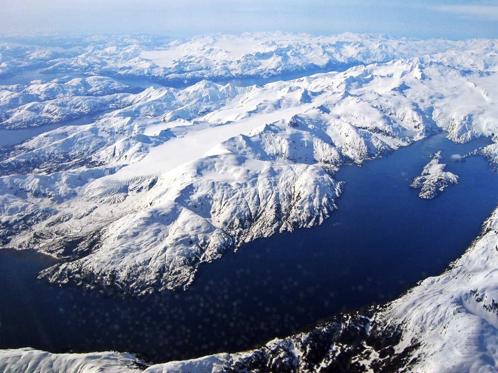
View from flight to Anchorage, Alaska
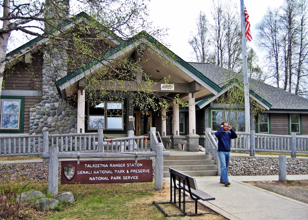
Talkeetna Ranger Station 
Talkeetna Air Taxi
Some groups fly to the glacier on the same day, but in our case the weather wasn’t cooperating, so we spent the night in Talkeetna.
Day 1 – Kahiltna Glacier to Camp 1
8 km (5 mi); Gain 365 m (1,200 ft)
The weather improved the next day, so we loaded our gear onto the Air Taxi planes and began our adventure. The planes were equipped with both wheels and skis to take off and land on either snow or tarmac.
From the plane we could see the incredible terrain we were about to enter. In all directions, countless white-topped granite mountains rose out of long, rugged glaciers. Towering above the peaks, we had our first view of the mighty Denali.

Loading our Talkeetna Air Taxi 
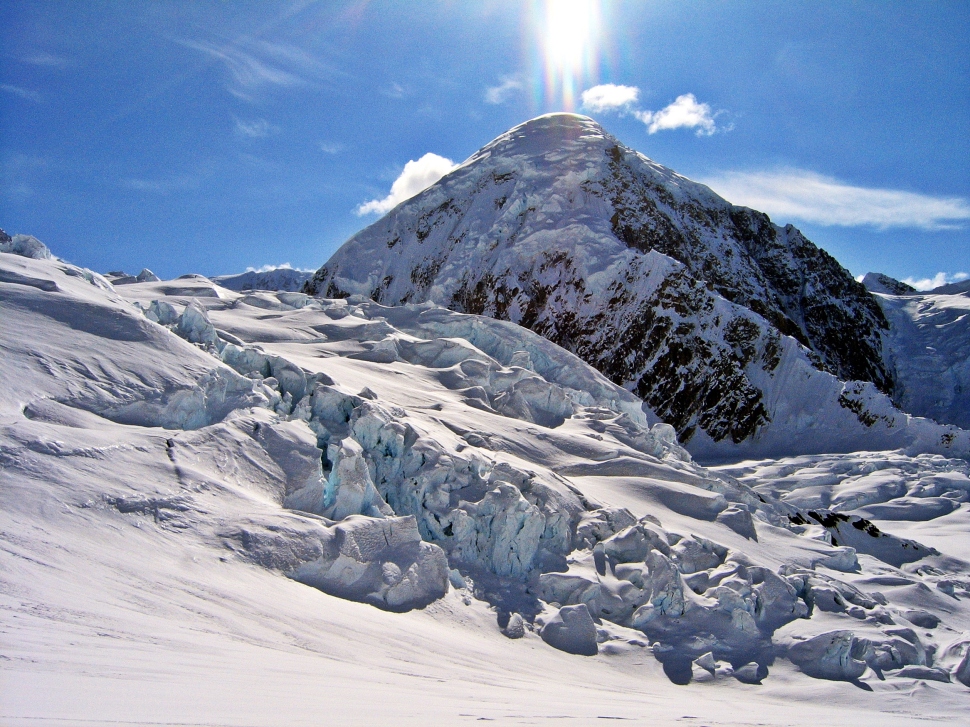
View of Denali from Talkeetna Air Taxi 
View of Denali from Talkeetna Air Taxi
Finally, Kahiltna Glacier came into view. It is a wide-open glacier that is perfect for a landing strip. The glacier runs north south between the Alaska giants of Mt. Foraker and Mt. Hunter. At the end of the glacier we could see our objective. Denali sat majestically, far ahead.
A few tents marked the airport and staff lodging on the SE fork of the glacier. After a gentle landing on the glacier we had work to do. We had to unload and organize our gear, but I had to take a minute to look around in awe at the stunning scenery.

Kahiltna Airport 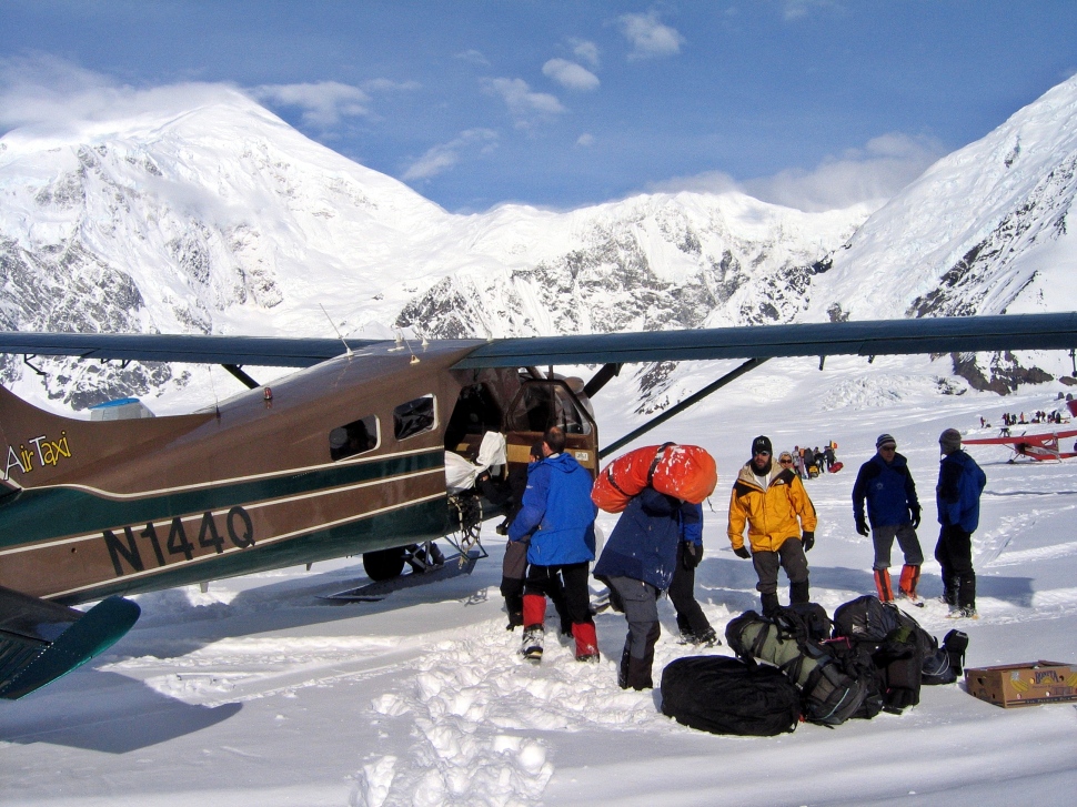
Kahiltna Airport 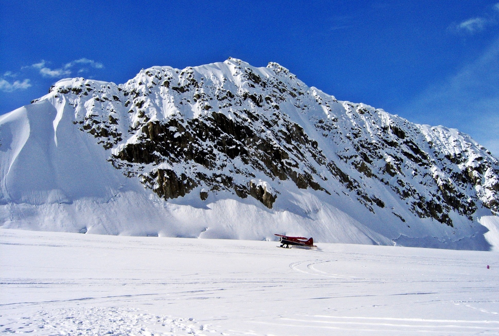
Kahiltna Airport 
Denali behind Kahiltna Airport 
Kahiltna Airport, Denali climb 
Kahiltna Airport 
Kahiltna Airport
The airport wasn’t our final goal for the day. Each climber had to carry their personal gear and their share of the communal camping equipment and food. We each had our personal backpack (at least 25 kg) and an expedition sled (25 kg). Leaving the airport, we first had to descend down Heartbreak Hill. It received its name because on the return hike to the airport, when you’re tired, you have to ascend the 175 m hill. Crossing the long Kahiltna Glacier we enjoyed the blue sky and white peaks that surrounded us.
The Kahiltna glacier has many large crevasses. Early in the climbing season many of the crevasses are covered with snow bridges, but late in the season, the crevasses are exposed. We were there at the end of May, which is early in the season, but to be safe, we were roped to a partner. Since the entire climb is on snow, climbers use either boots, snowshoes or skis as far as camp 3. After camp 3 we used crampons. My expedition was using either boots or snowshoes depending on the snow conditions. Travelling on the snow uses more energy and is slower than if we were on a hiking trail.
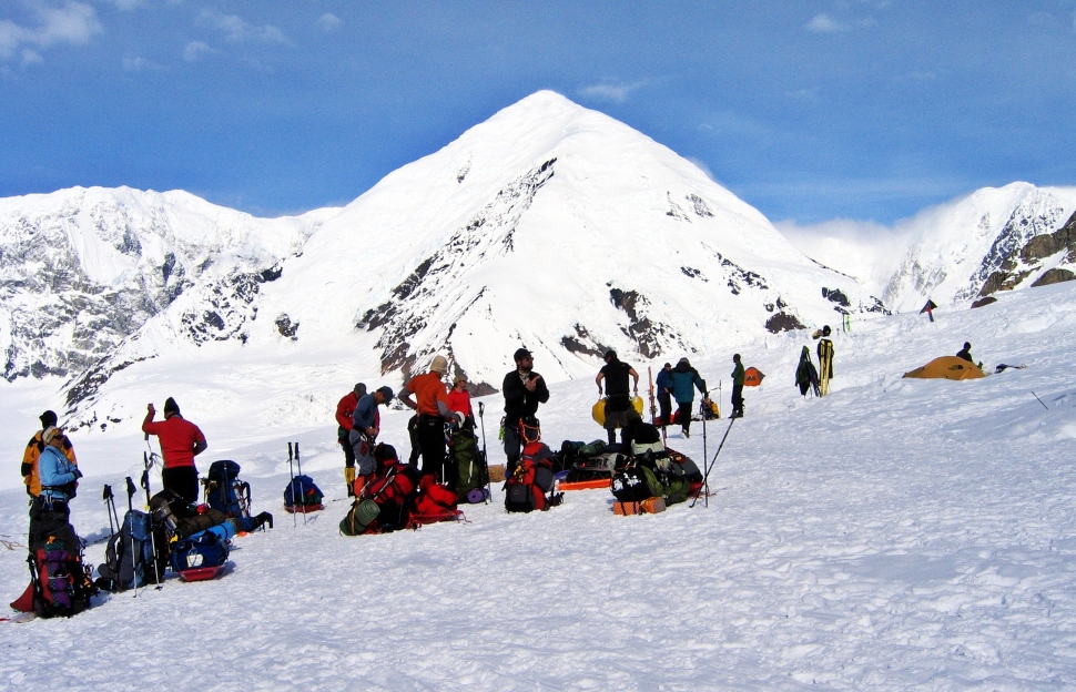
Loading our sleds, Kahiltna Airport 
On the way to Camp 1, Denali Climb 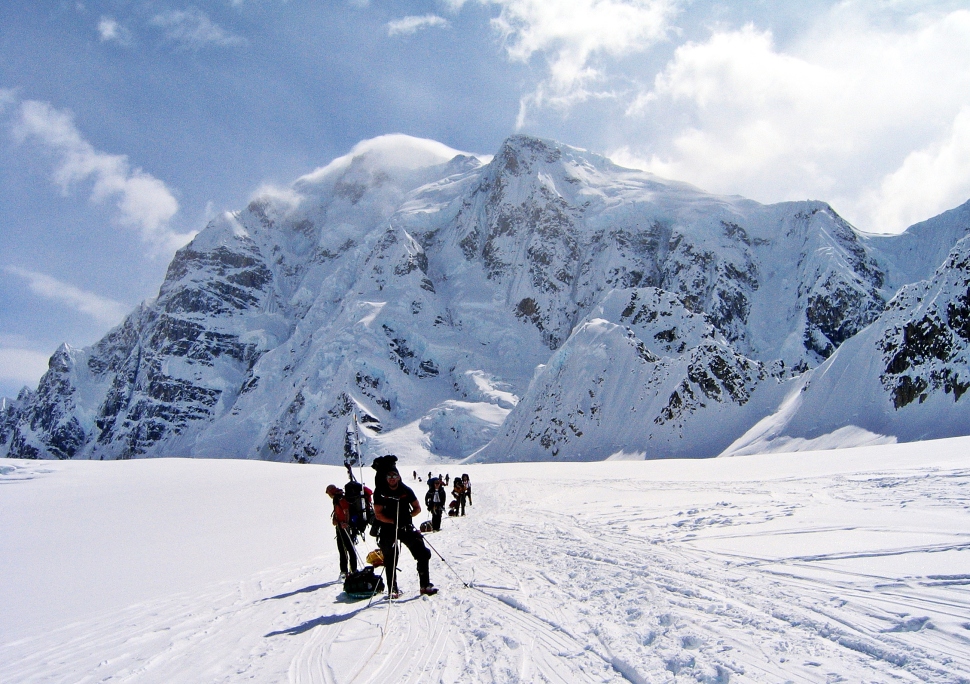
On the way to Camp 1, Denali Climb
After a few hours walking across the glacier, we reached the spot that would be our first camp at 2,375m (7,800 ft). We set up our tents below Ski Hill, near the junction with the NE fork of the Kahiltna Glacier. What a gorgeous campsite. We were surrounded by the tall snow-covered peaks of the Alaska Range. In late May in Alaska we had sun for most of the day. Even at 11 pm, it was very bright.

Camp 1, Denali Climb 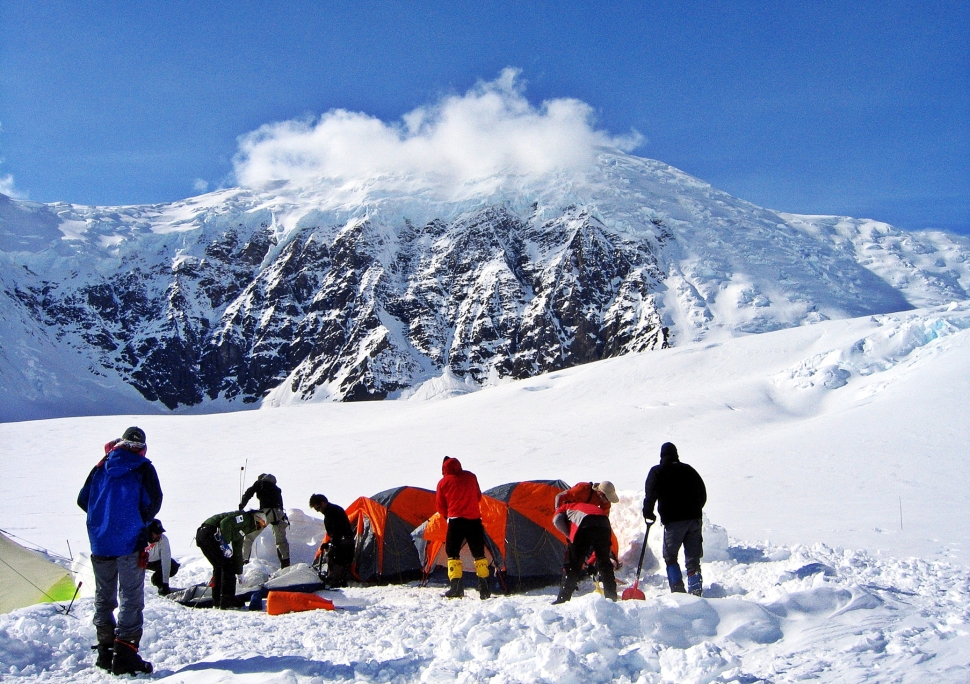
Camp 1, Denali Climb 
Camp 1, Denali Climb 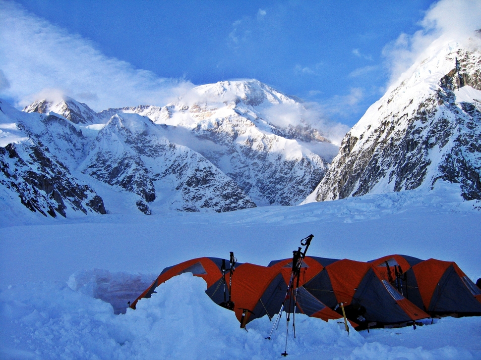
11:30 pm, Camp 1, Denali Climb
Day 2 – Camp 1 to Kahiltna Pass Cache
12 ½ km (8 mi) round trip; Gain – 670m (2,200 ft)
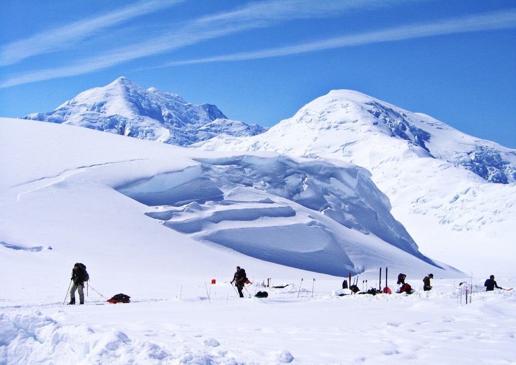
In high altitude expeditions like this, ensuring climbers become acclimatized is essential. As well, since there are no porters on Denali, the entire team must be involved in moving food and gear up the mountain. Throughout the expedition we followed the ‘climb high, sleep low’ rule. This means that one day is spent climbing higher up the mountain, bringing a load of gear. After depositing the cache, the team returns to the lower camp to sleep. Initially we moved a cache one day and then moved up to a higher camp the next day. As we got to higher altitudes, more rest time is needed before moving to a higher camp.
On Day 2 we carried loads on sleds which we pulled behind us. The climb to our first cache was a little more challenging than the previous day. We gained over 600 m of elevation climbing up Ski Hill to reach Kahiltna Pass 3,150 m. We were huffing and puffing, but the breathtaking mountain views took our minds off the hard work.
Climbing to Kahiltna Pass, Denali Climb 
Above Camp 1, Denali Climb 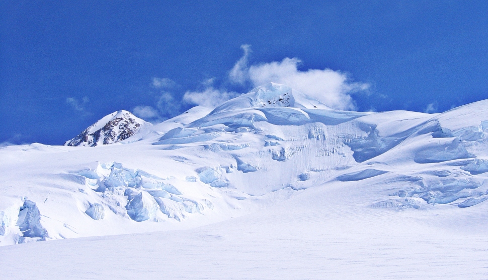
Climbing to Kahiltna Pass, Denali Climb 
Climbing to Kahiltna Pass Denali Climb
The caches had to be buried 2 feet deep and covered in snow to prevent ravens from ravaging the food and supplies. In the pictures you can see long skinny poles on some backpacks, there are used to mark the caches. These caches were used on the entire climb. After burying the cache, we headed back to camp which felt quite easy as it was downhill and we weren’t pulling a weighted sled.

Digging a cache at Kahiltna Pass, Denali Climb 
Digging a cache at Kahiltna Pass, Denali Climb 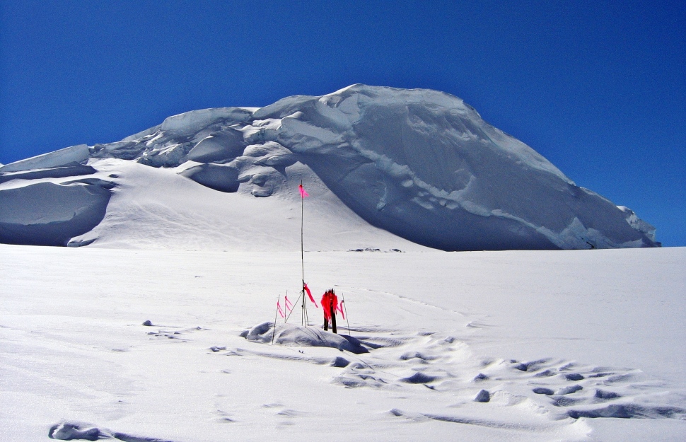
Cache at Kahiltna Pass, Denali Climb
After we returned to camp, we nestled in our sleeping bags for a rest. One of the American climbers decided that this type of expedition wasn’t for him and he would return to the airport the next day. It is a park rule that no one is allowed travel on their own on the glacier therefore, one of our guides had to go with him to the airport. The rule also applies to guides, so unfortunately, our guide had to wait at the airport for another group before he could return to our camp.
Day 3 – Camp 1 to Camp 2
7 ½ km (4 ¾ mi); Gain 1,036 m (3,400 ft)
Going with a guiding company has its pluses and minuses. Generally, the advantages outweigh the disadvantages. The guides have extensive high-altitude climbing experience and you can learn a lot from them. One of my guides was New Zealander Mike Roberts, at that time he already summited Everest twice and few other Himalayan giants. The biggest disadvantage of going with a guided group is that the ability of each group member varies significantly. In some cases, the guides will try to slow down the group to accommodate the weakest climbers. I was glad that Mike Roberts had a different approach. After few days of acclimatization, he divided the 8 team members into 3 groups. It turned out that Spanish climber Rosa Fernandez and I, were physically the strongest climbers and were teamed up together to climb the mountain. Rosa had already summited Everest, Cho Oyu, Gasherbrum, and Makalu (Himalayan peaks over 8 thousand meters). Denali was her last peak to complete the 7 summits.
We left Camp 1 retracing our steps back up Ski Hill, passing the cache we left the day before. From there we continued up to Camp 2 at 3,350 m (11,000 ft). We set up our tents in Peter’s Basin at the base of Motorcycle Hill in an incredibly beautiful spot. Weather on Denali is constantly changing, but we felt above the clouds as we watched them boil over a nearby ridge making a dramatic scene.
Camp 2, Denali Climb 
Camp 2, Denali Climb
Because of the fierce winds that are common on Denali, our tents needed to be protected. We surrounded the tents with walls made out of snow blocks. In the morning teams rushed to leave before other groups so they would arrive at the next camp before the others. Everyone was trying to ensure they could get the walls left behind from previous expeditions. If you were late, you may have to build your entire fortification. We were always early enough that we found good spots with walls already built. They often required maintenance, but at least we didn’t have to start from scratch

Snow wall around tent with Motorcycle Hill behind, Camp 2, Denali Climb 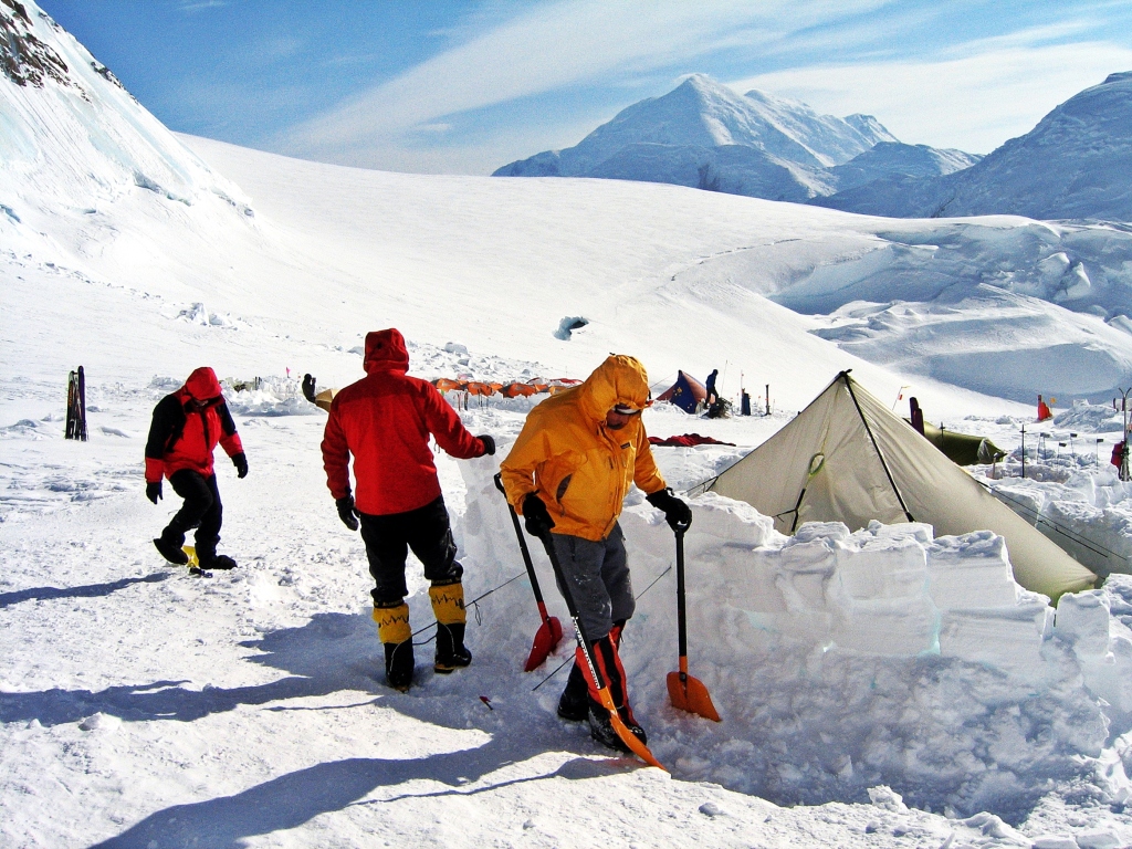
Snow wall maintenance, Camp 2, Denali Climb 
Snow walls, Camp 2, Denali Climb
Day 4 – Camp 2 to Kahiltna Pass Cache
2 ½ km (1 ½ mi) round trip; Gain 365 m (1,200 ft)
Day 4 was an active rest day as we hiked back down to pick up the cache we left near Kahiltna Pass. It allowed one more day to further acclimatize before moving higher on the mountain. At camp we enjoyed the amazing views for Mt. Foraker (5,304 m). It dominated the skyline for much of the climb.
Later we learned that while we were climbing Denali, two North American women went missing on Mount Foraker. They were considered deceased after an extensive search could not find them. It’s an awful reminder of how dangerous this sport is.

Lenticular clouds over Mt. Foraker, Camp 2, Denali Climb 
Camp 2 below Foraker and Kahiltna Dome, Denali Climb
Day 5 – Camp 2 to Windy Corner Cache
6 ½ km (4 mi); Gain – 700 m (2,300 ft)
We had another day of moving gear up the mountain. It was a tough, steep climb, gaining over 700 meters in less than 5 km. We were all wearing crampons for the steep ascent. First, we had to ascend the steep 300 m high Motorcycle Hill. The name of this hill has a funny origin as it has nothing to do with mountaineering. The name refers to the hills of the same grade that motorcycle racers ascend in some competitions. Looking behind as we climbed Motorcycle Hill, were amazing views across to Mount Foraker and the Alaska Range. The blue sky against these incredible white peaks was overwhelming.

At the top of Motorcycle Hill, Denali Climb 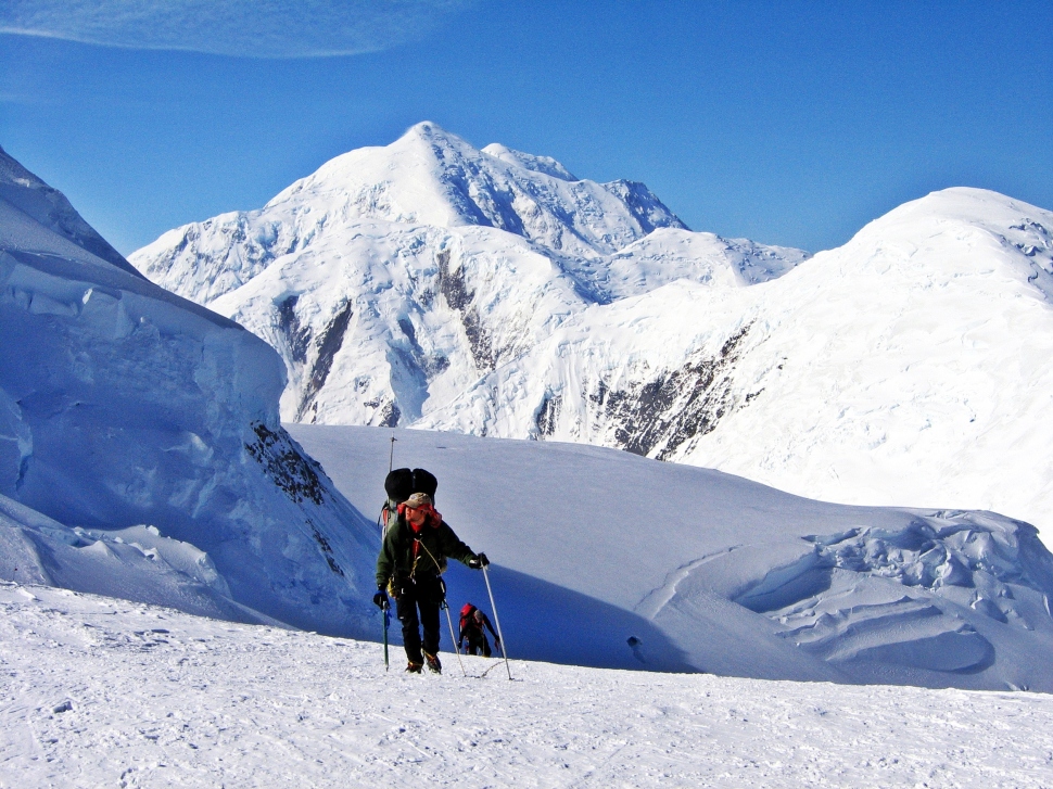
At the top of Motorcycle Hill, Denali Climb
After Motorcycle Hill, we had to ascend Squirrel Hill before the route flattened out. Apparently in the 1990s a squirrel was found in this region, surviving on the climbers’ caches. At the top of Squirrel Hill, we rounded what’s known as Windy Corner where we had views of Denali’s West Buttress. It’s an impressive rocky ridge, but still a long way away. We could see how steep it is and therefore what we were in for in a few days’ time.
We deposited our cache near Windy Corner and luckily the corner didn’t live up to its name. On the way back to camp we saw lenticular clouds over Mt. Foraker. Mike told us these meant a storm was coming.
Looking to Squirrel Hill, Denali Climb 
At the top of Squirrel Hill, Denali Climb 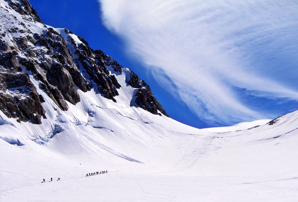
Climbing to Windy Corner, Denali Climb 
Climbing to Windy Corner with Denali’s West Buttress ahead 
Lenticular cloud over Mt. Foraker, Denali Climb 
Above Camp 2, Denali Climb
Day 6 – Camp 2 to Camp 3
6 ½ km (2 ½ mi); Gain – 914 m (3,200 ft)
After leaving a cache yesterday, it was time to move up to Camp 3. It was a long, hard hike gaining almost 1,000 m. Our camp was located about an hour beyond Windy Corner in the Genet Basin. Shortly after passing Windy Corner we had to cross an area known for frequent rock fall. It was important to get through this area as quickly as we could, but moving quickly at 4000 m elevation is difficult.
Camp 3 (4,330m (14,200 ft)) is the highest point that rescue helicopters can land. There is a semi-permanent camp set up with a medical tent and toilet. Elsewhere on the mountain we had to collect our waste in biodegradable bags that can then be deposited into crevasses far from camp.

Snow block walls, Camp 3, Denali Climb 
Snow block walls, Camp 3, Denali Climb 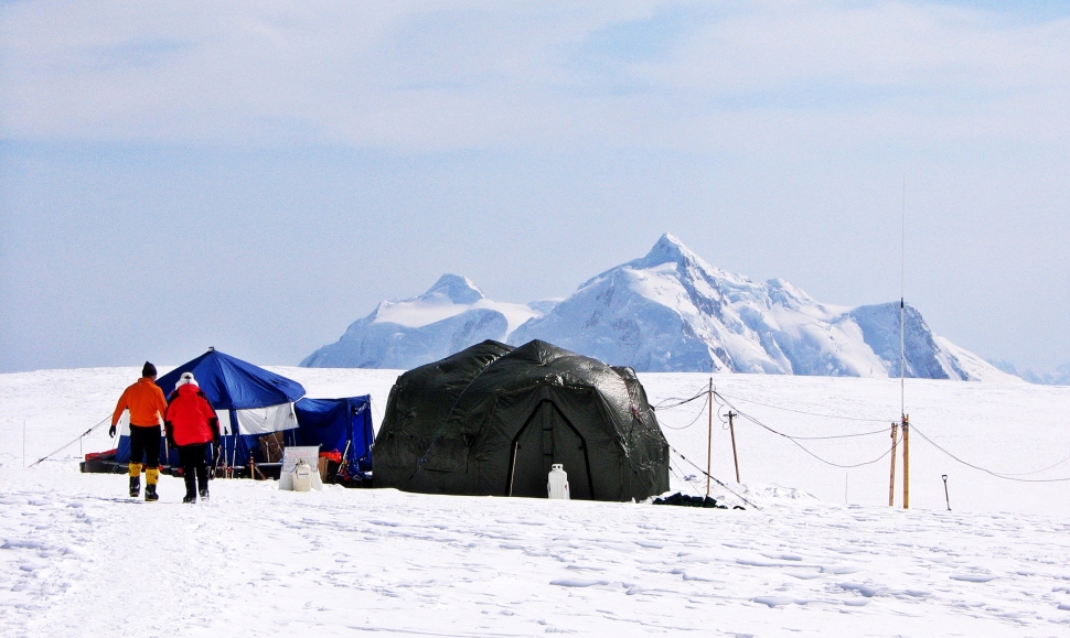
Medical tent, Camp 3, Denali Climb 
Clouds coming in, Camp 3, Denali Climb 
Clouds, Camp 3, Denali Climb 
Toilet with a view, Camp 3, Denali climb
Day 7 – Storm at Camp 3
I guess our guide Mike knows how to read the clouds. The plan was to retrieve our cache from Windy Corner, but as is often the case on Denali, a fierce storm blew in. The wind whipped for the entire day. We had to keep reinforcing our protective walls and clean snow off our tents so they would not collapse. My tent felt crammed with 3 men sleeping head to toe. We don’t usually spend much time in our tents, but because of the storm we were stuck together for 24 hours. At times the storm was so bad, we couldn’t even go outside to the outhouse. Instead we had to use pee bottles inside of our tent. It wasn’t the most pleasant of experiences.

Storm, Camp 3, Denali Climb 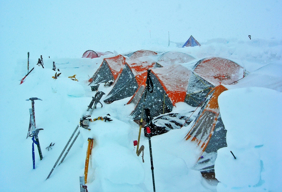
Storm at Camp 3, Denali climb 
Storm, Camp 3, Denali climb 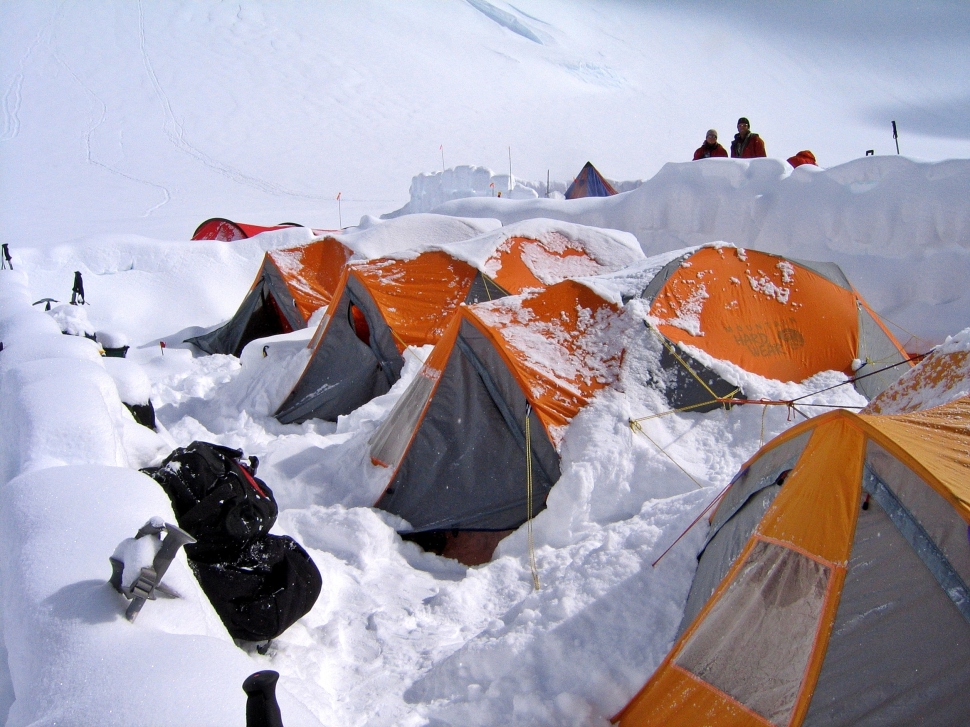
Storm at Camp 3, Denali climb
Day 8 – Camp 3 to Windy Corner Cache
1 ½ km (1 mi) round trip; Gain – 213 m (700 ft)
We had another active rest day to retrieve our cache we left two days earlier at Windy Corner. When we returned, the Danish woman in our group was suffering from altitude sickness and had to be evacuated by helicopter. Another party came down from a higher camp and required a medical evacuation. It was becoming more apparent, how dangerous this climb can be.

Helicopter rescue, Camp 3, Denali Climb
Day 9 – Camp 3 to Headwall Cache
3.8 km (2.4 mi) round trip; Gain – 670 m (2,200 ft)
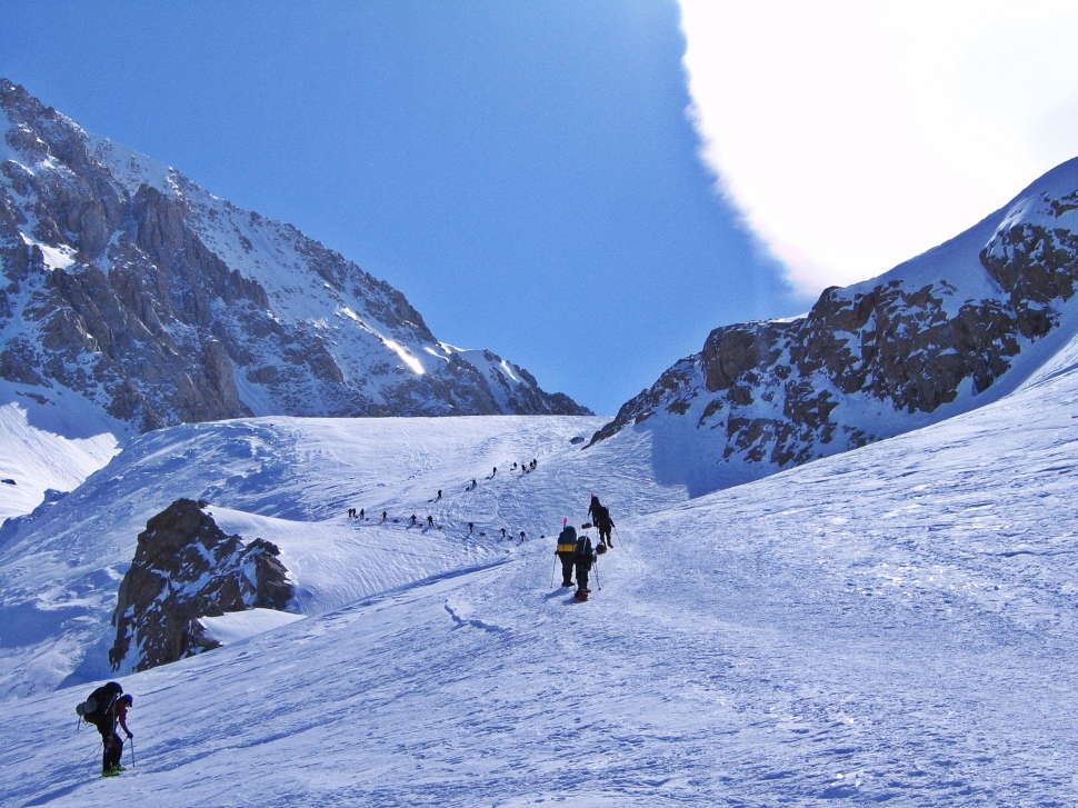
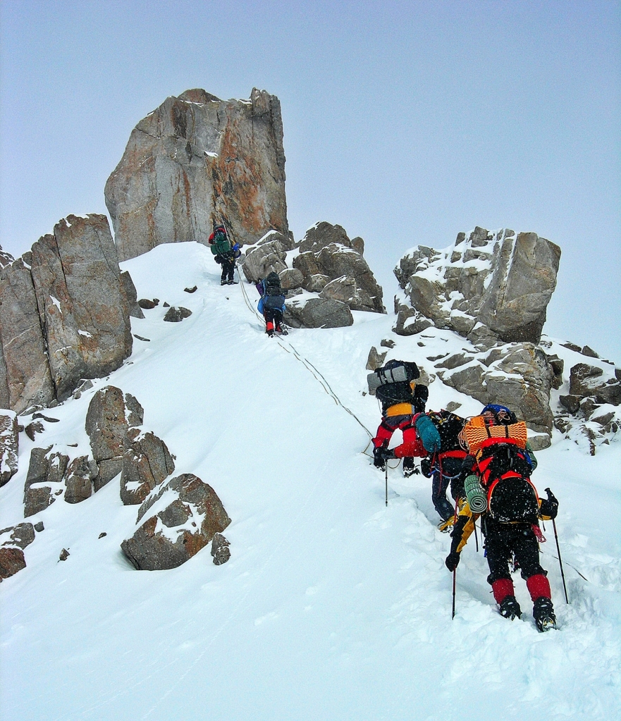
We were elated to wake up to a clear sky so we could take a cache higher up the mountain. First, we ascended a gentle snow slope to reach the base of the West Buttress. From there we had to climb up a steep 800 m high headwall using fixed ropes. The angle of the slope is 50° with sections that are even steeper. Another challenge is scaling two bergschrunds. A bergschrund is a large crevasse found at the head of a glacier between the moving glacial ice and the non-moving mountain ice. Fixed ropes help to increase the safety of the climb.

View of head wall from Windy Corner, Denali Climb 
One of the bergschrunds, Denali climb 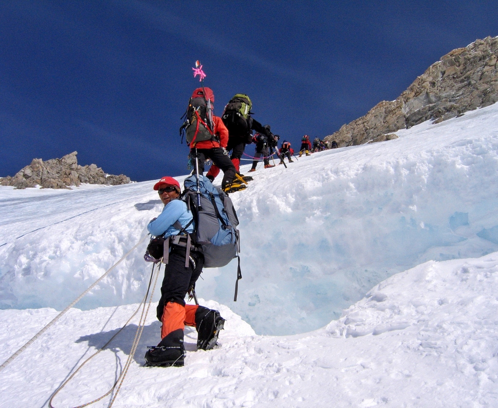
One of the bergschrunds, Denali climb 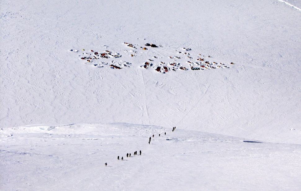
Camp 3 from above, Denali climb 
Camp 3 from above, Denali climb
We carried heavy packs up this headwall since it would be impossible to pull sleds. At high altitude it was a difficult day. Finally arriving on the ridge where we would leave our cache we were rewarded with incredible views of the Kahiltna Glacier between the mountains of Hunter and Foraker.

Kahiltna Glacier between Mt. Hunter and Mt. Foraker
Day 10 – Camp 3 Rest Day
Today we had a rest day at Camp 3. Since the weather was nice we walked to a nearby rock cliff called ‘The Edge of the World’. The other side of the rock has a shear drop of 1,800 m. It’s a great spot to enjoy the view.

‘The Edge of the World’, Camp 3, Denali climb 
Mt. Hunter from Camp 3, Denali Climb 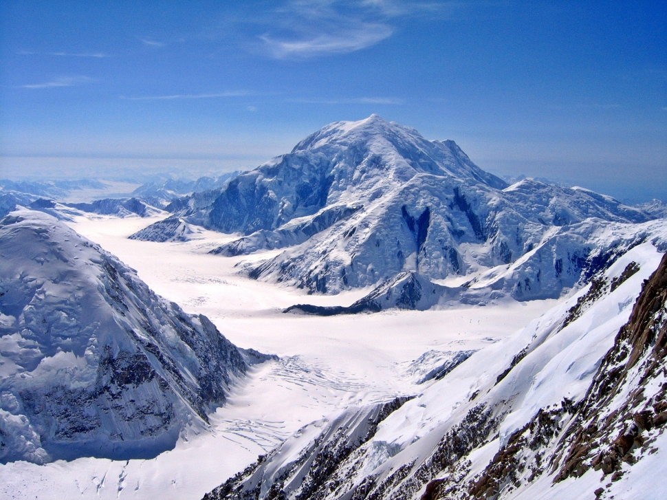
Mt. Foraker from Camp 3, Denali Climb
Day 11 – Camp 3 to High Camp
3 km (2 miles); Gain – 914 m (3,000 ft)
The summit is getting closer, but still feels so far away. We were finally able to leave camp 3 and move to high camp. We again had to climb the fixed lines up the headwall and over the two bergschrunds to attain the ridge above. From the top of the headwall, the route follows a narrow ridge offering some of the most spectacular views. On one side we can see Peter’s Basin and on the other we can see Camp 3 and the Kahiltna Glacier. The ridge can be icy or rocky depending on the year. Luckily for us we were walking on snow. The last stage to reach High Camp was another steep section with fixed ropes around an interesting rock feature called Washburn’s Thumb.
Washburn’s Thumb, Denali climb 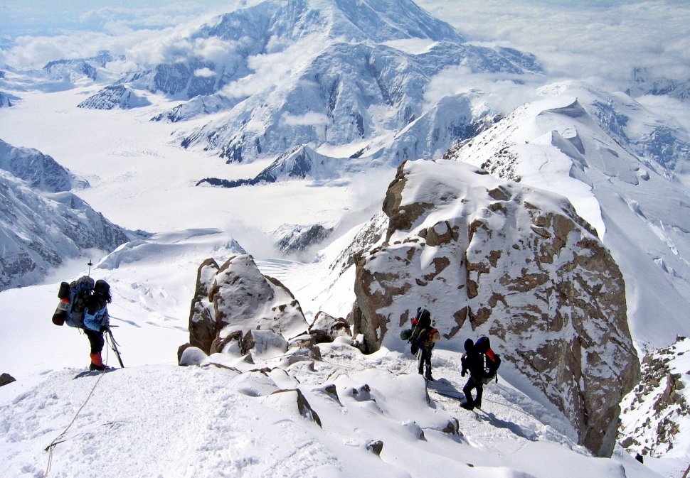
Washburn’s Thumb, Denali climb 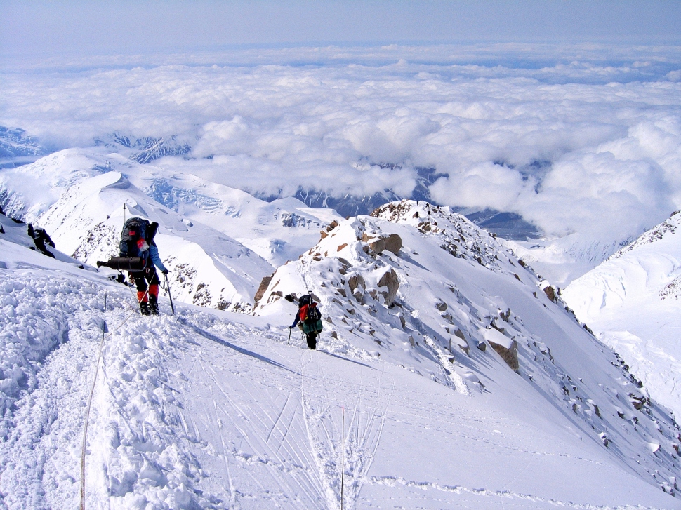
Ridge below Camp 4, Denali climb 
Camp 4 with Denali Pass above, Denali climb
High camp (5,245 m (7200 ft)) is a desolate place. It frequently has high winds and low temperatures. Combine that with the high elevation and it is exceedingly difficult to do anything. We mostly rested, mentally preparing for the next day and took turns to reinforce the snow walls protecting our tent.
Day 12 – Camp 4 to Summit and return
8 km (5 mi) round trip; Gain – 914 m (3,000 ft); Climbing time – 9 hours
On a peak like Denali it is important to be patient and wait for good weather. We were prepared to wait a couple of days at Camp 4. Luckily when we woke on the first morning, we had clear skies and calm winds so our plan to make a summit bid was a go. It was the 1st of June in Alaska where there is close to 24 hours of daylight, therefore, we were not as rushed for an early morning summit bid as on most climbs.
From camp, we crossed the glacier for a short distance and then climbed up over 300 m to reach Denali Pass (5,550 m). After the pass we went under the large rock feature called Zebra Rocks. This feature meant we were getting closer. After crossing an easy open area called Football Field we hiked up Pig Hill and reached Summit Ridge.

Climbing Denali Pass, Denali climb 
Below Denali Pass 
Above Camp 4 (left), Denali climb 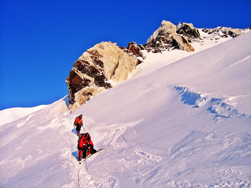
Zebra rocks, Denali climb
Summit Ridge is a long, narrow spine. Standing below it I could see most of its length. It’s easy to understand why the weather must be good as there is no room for error along this thin ridge. It was a long, slow climb along it, but the views are incredible. We were looking down at the impressive Mt. Hunter, Mt. Foraker and the rest of the Alaska Range. One step after another, I was slowly approaching the summit. Luckily, it was sunny but not too cold. When I was moving, I was actually quite hot.

Summit Ridge, Denali climb 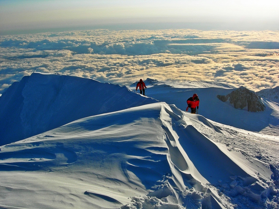
Summit Ridge, Denali climb 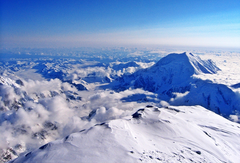
View from Summit Ridge, Denali Climb
Finally, after 12 days, of hard work, I had reached the top of North America! The summit is roughly the size of a single car garage and from it, I felt as if I could see the entire continent. There were spectacular snow-white peaks poking through the boiling ocean of cloud. It doesn’t matter which direction I looked, the other huge mountains of Alaska were far below.

Denali Summit 
View from Denali Summit 
View from Denali Summit 
View of Mt. Hunter from Denali Summit
Returning to high camp, having accomplished another of the Seven Summits, I was jubilant. Each step was easier than the last, each breath came with more ease. My quest to conquer all seven mountains was one step closer. In fact, other than the 2 climbers who left early, we all summited that day so it was a great success.
We arrived back to high camp at 11:30 pm and the midnight sun was barely off the horizon.

Midnight sun, Camp 4, Denali climb
Day 13 and 14 – Return to Kahiltna Airport
After a good sleep, and a breakfast treat of toasted bagels, we retraced our past few days’ trails all the way down to camp 1. On a ridge below high camp we left a cache of unused gear and food for the next Mountain Trip team that would begin soon after we were done. We still had a lot of gear to carry down, so although it was downhill, it was still a strain.
On the second day we continued from Camp 1 down to Kahiltna Airport, having to scale the aptly named Heartbreak Hill.

Ridge below Camp 4, Denali climb 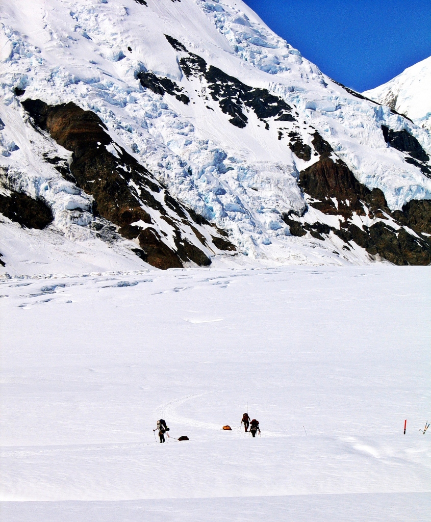
Going up Heartbreak Hill, Denali climb
At the airport we could finally celebrate. We shared a bottle of whiskey that someone from our team had cached there 14 days earlier. There were a few other expeditions waiting for a plane too and its first come first serve. We happily relaxed, waiting for our flight.

Celebrating at Kahiltna Airport, Denali climb
Here’s a short video of the trip.
Preparing for the trip
Fitness is an important component to achieve success on a big mountain climb like Denali. I had to prepare myself accordingly. For 6 months leading up to the climb I spent 5 to 6 hours per week in the gym lifting weights and doing cardio. Even more important, I went backcountry ski touring in the mountains for at least 10 hours every weekend. I’m lucky to live close to the Canadian Rockies.
Do I need a guide and a permit?
You are not required to take a guide, but unless you are extremely experienced in mountaineering, it is highly recommended that you use a guiding company. Permits are required and are usually included in the guiding fees. In addition each climber must attend an orientation meeting with a park ranger.
When to climb
Climbing season on Denali is short. Expeditions operate in May and June.
Note – Richard completed this climb a few years ago, not in 2020.
Here are links to stories from Richard’s other summits. Aconcagua (Argentina), Vinson Massif (Antarctica), Carstenz Pyramid (Indonesia)
Coming Next: Day hikes from Calgary
For extra pictures from the US click here. For pictures from other blogs go to Gallery at monkeystale.ca
To read about more of our adventures go to Destinations.
If you like what you read, please comment or share (with credit) using the links below.

Wow and congrats. My son climbed Denali, I was so proud of him. You had “better” weather than his group in spite of their summiting on and around the summer solstice.
LikeLiked by 1 person
Thanks Michael! Congrats to your son, is he doing the Seven Summits?
LikeLiked by 1 person
No…he climbed the Matterhorn last year on his 40th birthday. We hope that was it.
LikeLiked by 1 person
Hahaha!!
LikeLike
Congratulations and great to read this post! Well done.
LikeLiked by 1 person
Thank you so much!
LikeLike
Yikes! I feel exhausted having read this! What a great hike and climb! Wonderful post!
LikeLiked by 1 person
Thanks Colin, it was exhausting but also exhilarating!
LikeLiked by 1 person
I’ll bet 😉
LikeLike
Doesn’t sound like anything for the faint-hearted!
LikeLiked by 1 person
No, you have to enjoy a bit of suffering on these climbs. Richard does, Maggie doesn’t 😊
LikeLiked by 1 person
Getting to a mountain peak is certainly exhilarating, and accomplishing something after a great deal of effort is very rewarding. Still, I hope you don’t put yourselves in too much danger on such endeavors; we want to keep reading your posts!
LikeLiked by 1 person
Haha, Safety is always first!
LikeLiked by 1 person
Spectacular achievement and scenery. Congratulations on completing this adventure safely and thanks for carrying us mere mortals along with you. Allan
LikeLiked by 1 person
Thanks Allan, it was a great adventure and the scenery was unbelievable.
LikeLiked by 1 person
This is an wonderful post worthy of National Geographic! Amazing photos. About 20 years ago on a family trip to Alaska, my son and i took a sightseeing flight from Talkeetna with Talkeetna Air Taxi that circled Denali and landed on a glacier. I don’t think the glacier was Kahiltna but one of the other glaciers around Denali. I believe we followed the Kahitna glacier on the return to Talkeetna. The scenery around Denali and the Alaska range was magnificent.
In 2018 I visited Everest Base Camp Tibet at 17,000′. Denali is taller than Everest when measured from the base to the summit.
LikeLiked by 2 people
Thank you, it’s a gorgeous mountain range glad you also got to see it. We were also at EBC in Tibet and Nepal. The starting elevation is what sets Everest apart. Watch for an upcoming post on Richard’s Everest climb.
LikeLiked by 1 person
woooowwwww
LikeLiked by 1 person
Grazie!!
LikeLike
Wow, such a fantastic accomplishment! Really enjoyed the description and photos. Which summit is next?
LikeLiked by 1 person
Thanks!! Richard has actually completed the Seven Summits, we’re just slowly rolling out the stories. Not sure which we’ll post next – Kilimanjaro, Elbrus, Everest are left.
LikeLiked by 1 person
looking forward to whichever one it is. All we ever managed was a partial Annapurna trek so we’ll be happy to climb through your eyes 🙂
LikeLiked by 1 person
What a fantastic achievement and equally fascinating account! Great pictures create absolute thrill. Congratulations Richard
LikeLiked by 1 person
Thank you so much!!
LikeLike
Wow, what an amazing experience and personal achievement! I can only imagine what it feels like to see the surrounding peaks and landscape from the top of the Mount McKinley! I’m currently reading Seven Summits by Dick Bass and Frank Wells, so it was interesting to read your experience. Thanks for sharing such a fascinating read and have a good day 😀 Aiva
LikeLiked by 1 person
Thanks Aiva, Good timing on our post then! We have already posted about 3 of the other 7 and will post the last 3 in the coming months if you’re interested. We haven’t read Dick Bass’ book, but we probably should.
LikeLiked by 1 person
As always, I look forward to your amazing mountain climbing stories! 😊
LikeLiked by 1 person
What a read! All the intensity of the expedition is evident in the words, despite the beauty of the photos, I could guess the difficulty and the effort. Congratulations for this new accomplishment and a great thank you for sharing it a little.
LikeLiked by 1 person
Thank you for reading! Glad you enjoyed the adventure. It was fun for me (Maggie) to have Richard recount it for me too!
LikeLiked by 1 person
It reminded me of my readings of Roger Frison-Roche, without the drama of accidents of course, but that same physical and moral intensity of being in an inhospitable place where anything can happen.
LikeLiked by 1 person
Oh wow! Thanks for the compliment!!
LikeLiked by 1 person
I always love a good summit summary! Congratulations on your achievement on Denali. The photos were amazing, and the narrative was gripping, especially for a mountain rat like me (even though I’ve never climbed any technical or super snowy routes)!
LikeLiked by 1 person
Thank you!! Glad you came along on the expedition!!
LikeLike
Congratulations Richard! I enjoyed climbing with you from the comfort of my sea level home. Your photos are incredible. I was surprised to read about the crafty ravens…hard to believe that they hang out at such reaches. The cool-looking lenticular clouds are new to me too. And that toilet is awesome.
LikeLiked by 1 person
Thanks Caroline! The clouds in Alaska are very different most other places I’ve seen. Best toilet with a view!
LikeLiked by 1 person
Incredible climbs…love reading these blogs! I had no idea that Denali is higher than Everest from base to summit as someone posted here. Can’t even imagine the challenges that one faces with these summits!
LikeLike
That is simply AMAZING! I am in awe of the scenery and equally in awe of what you have achieved. Absolutely outstanding! Mel
LikeLiked by 1 person
Thank you Mel!!
LikeLiked by 1 person
Wow! Well done! I’m impressed that you could enjoy the scenery, even way up high. Usually when I get tired from a hike or climb, I stop seeing the beauty all around me and just complain and moan. It’s fun to climb the Seven Summits with you.
LikeLiked by 1 person
Haha! It’s hard to not to notice this scenery. Once you get used to the suffering day after day, it’s not so bad 😊
LikeLiked by 1 person
Amazing! Congratulations, and thanks for sharing all the details and photos!
LikeLiked by 1 person
Thanks Diana!
LikeLiked by 1 person
Congrats Richard!!!! It was a great read. I grew up in the Alps, trekking was a great part of my life but, unlike my brother, I never harboured any alpinism dreams. So I wanted to ask you, if possible, if you can explain what is the drive that spurs you to do this? I don’t mean to sound judgemental, I actually find it really great and commendable that you go through this effort and expense and risk to achieve your goal: I’m interested in understanding what made you go, one day, “Yes let’s do it!”
Fabrizio
LikeLiked by 1 person
Thank you Fabrizio! It’s hard to explain what the drive is exactly. I doubt most people truly understand their own passions. For me, I have always loved the mountains, adventure and to challenge myself physically and mentally. Climbing in a foreign country and getting to their highest point provides both adventure and challenges. The rewards for me are truling intrinsic; proving to myself that I have the ability and the fortitude. Or maybe it is as Hillary said when asked why he climbed Everest ‘Because it is there.’ Richard
LikeLiked by 1 person
Thats quite the hike…something I couldn’t do. Congratulations 👏
LikeLiked by 1 person
Thank you!
LikeLike
Love these reads guys. The seven summits has always been a dream on mine and the more I read about inspiring stories like these the more I feel it will one day be reality.
LikeLiked by 1 person
Thanks! It was a long journey to complete them, but well worth it in the end. If you have mountaineering experience, which I think you do, they are more about timing and fitness and definitely achievable.
LikeLike
Lenticular clouds … I did not learn of that type in school. They failed – those creeps. I’ve seen those clouds and didn’t know what I was looking at (well, the technicality of it), thanks for teaching it to me.
: )
LikeLiked by 1 person
The clouds really add to the view in addition to predicting the weather. I guess they’re fairly common in the mountains around Denali. Thanks for reading!
LikeLike
yes, and that is so interesting. Pleasure
LikeLike
It’s so beautiful
LikeLiked by 1 person
Thanks, yes Denali park has so many incredible views.
LikeLike