
Once considered the best multi-day backpacking trek in the world, Annapurna Circuit Trek has changed in the last few years. The trek used to be 240 km, following ancient trade routes between remote Hindu and Buddhist villages. A new road has made all but 34 km of it accessible by jeep.
The Nepalese government began building a road in 2005 to provide access to remote mountain villages. Before the road, locals were completely cut off. They had to walk for a day to the next village; several days to a larger centre. Construction took several years due to the difficult terrain in the steep valleys. In 2014 the road was completed and now covers all but 34 km in the centre of the route where it crosses over a high mountain pass.
There are pros and cons for the road. It has meant fewer tourists stopping at the small villages that once catered to their needs with shops, restaurants and hotels. But the villagers have better access to the cities for health care, fresh food and special needs.
In 2011, when we did this trek, the road barely affected the first half of the route, but was a nuisance in parts of the western side. Seven years later we completed two treks on either side of Annapurna Circuit and used the road on both sides.
In this post we’ll recount our trek of the circuit in 2011 and try to explain the differences we saw in 2018, seven years later. For us it’s a little sad because it is honestly one of the most picturesque treks in the world. Not only does the trek pass the huge massifs of the Himalayas, but walking though the small villages was a huge part of its charm. The map below shows the route that we trekked. The road now runs from Besisahar to Manang on the east and Muktinath to just passed Tatopani on the west. Apparently new trails are being built so you can hike away from the road, but there are many sections where trekkers have to walk on the road.

Map of Annapurna Circuit and Sanctuary
Kathmandu to Besisahar
In 2011 we took a long bus ride from Kathmandu, getting off in dusty town of Dumre (416 m). The 185 km drive took almost 7 hours. From there we found a jeep that would take us on the rough road to Besisahar (760 m). The 41 km trip took another couple of hours. Besisahar is an even dustier town with a few modest guest houses, but at that time was the usual starting place for the trek.

Rice fields on the drive to Dumre 
Main street, Besisahar
Day 1 – Besisahar to Bahundanda
Distance – 17 km; Elevation Gain – 554 m
Admittedly, this wasn’t the most interesting part of the trek, and nowadays everyone drives right by. In 2011 you could take a jeep to Bhulbhule village, about half way to Bahundanda. We wanted to walk so we began on the gravel road outside Besisahar. After not too long though we were able to get off the road and on to the trail.

Yellow flower, Nepal 
Red and yellow flower, Nepal
The hiking trail is an old trade route following the Marsyangdi River Valley, passing between small villages. At the lower elevations the villages are Hindu, higher up they are Buddhist. It was interesting to see the changes in the villages as we walked higher and higher. On the first day the locals are mostly farmers who we saw working their fields and tending to their animals.

Farm outside Besisahar 
Goats, Annapurna Circuit Trek
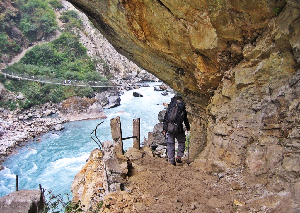
The trail crossed the Marsyangdi River a few times on suspension bridges in various states of disrepair. The rickety bridges were strung between tall mountains on either side of the deep valley. At times the bridges seemed frighteningly high.
Outside the village of Bhulbhule is a magnificent 60m high waterfall. It was the first of many tall waterfalls we’d see.

Suspension bridge, Khudi, Annapurna Circuit Trek 
Bhulbhule waterfall, Annapurna Circuit Trek
From this point the road was being built in stages. In some areas we walked on what would soon be a road but for us was a widened pathway. Most of the time we walked on narrow trails up and down the mountain ridges.
It was cloudy and although there aren’t many spectacular views in this area, we should have been able to see Mt. Manaslu. Unfortunately for us, it was hiding behind the clouds. After a final climb up steep switchbacks, we arrived at the hilltop town of Bahundanda (1,314 m). The new road is on the other side of the river so apparently businesses in Bahundanda have suffered.

Village of Ngadi, Annapurna Circuit Trek 
Wooden bridge, Annapurna Circuit Trek 
Village on Annapurna Circuit Trek 
Annapurna Circuit Trek
Day 2 – Bahundanda to Tal
Distance – 17 km; Elevation Gain – 316 m
After Bahundanda the mountain sides were filled with green rice terraces. It was more picturesque than we expected with small farming villages filling in the spaces between.

Rice fields, Annapurna Circuit Trek 
Village, Annapurna Circuit Trek 
Village, Annapurna Circuit Trek
Although the absolute elevation gain on this section of the hike isn’t large, that doesn’t mean the trail is flat. We had a lot of elevation gain and loss during the day. The trail went up and down hills. It descended to bridges and then climbed back up on the other side. Even though it was a tough walk, the spectacular waterfalls that we saw made up for the work. Some of the trail we hiked on became the new road. I wouldn’t want to miss these incredible scenes by driving quickly by.
The higher we climbed, rice terraces were replaced by thick jungle. Villages had dramatic settings, built on steep mountain ridges. Most of the villages on the trek have guesthouses which serve as restaurants and hotels. As we passed through most were hoping we would stop for lunch or stay the night.

Kani, Annapurna Circuit Trek 
Syange village and waterfall, Annapurna Trek 
Syange village, Annapurna Trek 
Village, Annapurna Circuit Trek 
Annapurna Circuit Trek
Before the village of Chamje, there is a gorgeous tiered waterfall that makes a spectacular crash in the middle. As we approached the village an excited group of Nepalis were running down the steep, narrow trail toward us. They were carrying a pregnant woman who was in distress, using a door as a make-shift stretcher. She was having complications with her pregnancy so villagers were carrying her all the way to Bhulbhule which was as far as an ambulance could drive. We passed through Bhulbhule the day before so they had a long way to go. Seeing this made us realize the importance of the road to the locals.

Chamje Waterfall, Annapurna Circuit Trek 
Chamje, Annapurna Circuit Trek
After Chamje a long suspension bridge was crowded with mules. The trail wasn’t busy with trekkers, but there were many porters and mules taking supplies to the villages higher up the valley. This was the only way those villages received supplies.

Mules on suspension bridge, Annapurna Circuit Trek 
Following a porter, Annapurna Circuit Trek
The trail took us through a forest of bamboo and poinsettia. It was November when we were there and the poinsettia were in full bloom. It was gorgeous! I had only ever seen them in small pots at Christmas.

Poinsettia, Annapurna Circuit Trek
Tal, which means lake, is a small village on the flats of a dry lake. After passing through so many villages precariously hanging on hillsides it seemed odd to find one on flat ground, and at 1,700 m. On the end of Tal is yet another lovely waterfall.

Tal, Annapurna Circuit Trek 
Tal waterfall, Annapurna Circuit Trek
Day 3 – Tal to Chame
Distance – 23 km; Elevation Gain – 930 m
After leaving Tal, the valley narrowed again with tight walls on either side of the river. The trail was often cut out of the rock, leaving little room for error. After a few river crossings we arrived at the Tibetan Buddhist region in Annapurna. Entry to Dharapani is marked by a large kani which is an arch-like gateway.
Not long after the kani, the trail goes through the middle of a rushing waterfall. In 2018 we entered this region on foot from Dudh Khola Valley after hiking the Manaslu Circuit. We hired a jeep in Dharapani that took us all the way to Besisahar and then Pokhara. We went though this same waterfall, except in 2018, we were in a jeep!
Driving on the road, we couldn’t recognize any of the villages that in 2011 we had walked through. The picturesque waterfalls, trees and flowers were just a blur. In the picture below you can see the road being built beside the bridge. This became the road that we later drove on in a Jeep.
Narrow trail, Annapurna Circuit Trek 
Dharapani kani, Annapurna Circuit Trek 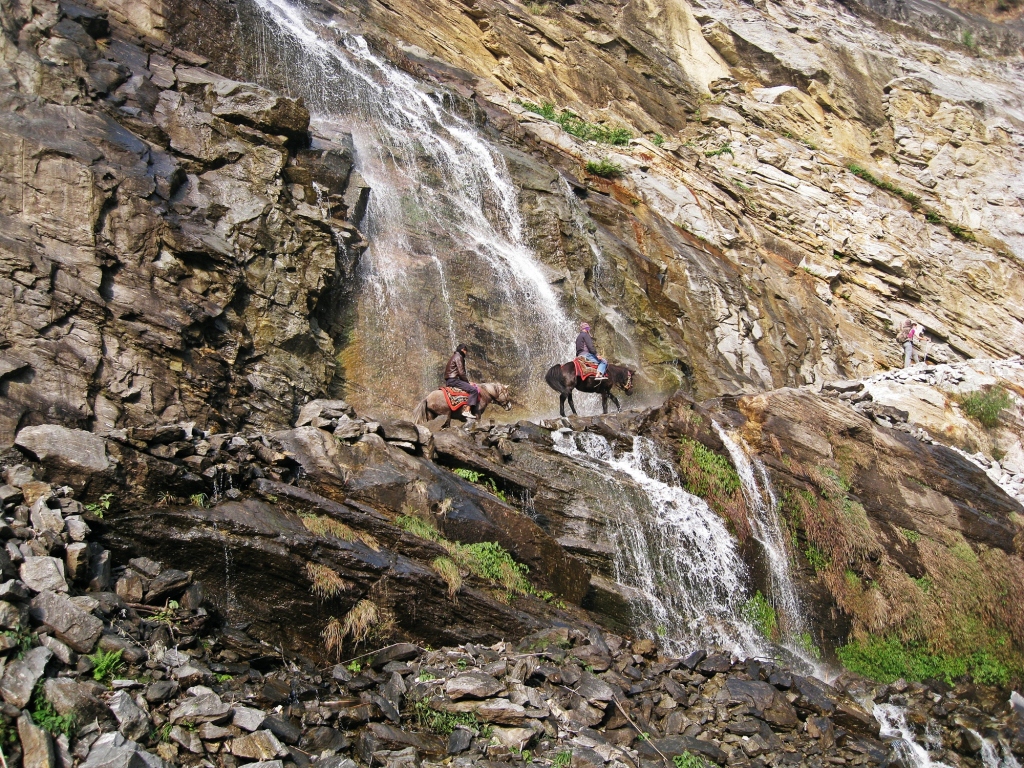
Trail though a waterfall, Annapurna Circuit Trek 
Road construction on the left, suspension bridge over the Marsyangdi River, Annapurna Circuit Trek
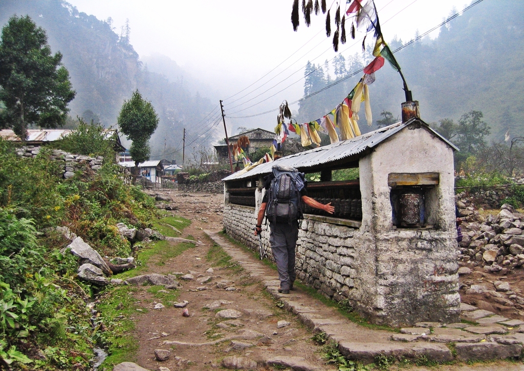
We entered our first Buddhist village and saw the first of many chortens, mani walls, prayer wheels and prayer flags that we would see over the next several days. The mantra ‘Om mani pad me hum’ is written in Sanskrit on these sacred objects. A prayer is made by spinning a wheel, passing a mani wall on your right side or when prayer flags flap in the wind.
These villages are very remote and we were reminded how tough their lives are when we saw them butchering a buffalo on the ground beside the trail.
Buddhist mani wall, Bagarchhap, Annapurna Circuit Trek 
Kani, Annapurna Circuit Trek 
Buddhist chorten, Annapurna Circuit Trek 
Nepalese woman, Annapurna Circuit Trek 
Butchering a buffalo in the yard, Annapurna Circuit Trek 
Village, Annapurna Circuit Trek
The trail then took us through a lovely walnut forest. The huge trees with large canopies were a change from the bamboo and jungle lower down. As we walked, we heard crashing in the trees and were lucky to see black faced langurs jumping between branches.

Walnut forest, Annapurna Circuit Trek 
Black faced langurs, Annapurna Circuit Trek
Finally, after a lot of climbing we arrived at a mani wall before the village of Chame. Tibetan Buddhists believe that walking clockwise around a mani stone is akin to saying a prayer. Some times we had to go out of our way to ensure we always kept the mani stone on our right side.
The entrance kani to Chame is gorgeous. A white horse standing in front of the elaborate white and gold kani added to its charm. It appears that this kani was not destroyed when building the road. Plenty of other Buddhist structures that we saw in 2011 though were damaged during the construction and new ones were built to replace them.
Since the road was built, many people begin their trek in Chame (2,630 m). They arrive by jeep and have missed all of the waterfalls and villages that we passed over the last two days.

Buddhist mani stone, Chame, Annapurna Circuit Trek 
Mani Stone, Chame, Annapurna Circuit Trek 
Buddhist kani, Chame, Annapurna Circuit Trek 
Buddhist prayer wheel, Chame, Annapurna Circuit Trek
Day 4 – Chame to Pisang
Distance – 14.5 km; Elevation Gain – 560 m
The hike to Pisang is a tough day on a rugged trail with many river crossings on wooden and suspension bridges. River crossings usually mean that you have to descend from the trail to get close to the valley bottom and then reclimb on the other side of the river. The new road allows a much easier and faster walk, but misses out on most of the views. Parts of the old trekking route can still be used, but only for about half of the day.

Buddhist chortens, Chame, Annapurna Circuit Trek 
Buddhist chorten, Annapurna Circuit Trek 
Wooden bridge over Marsyangdi River, Annapurna Circuit Trek
Above the village of Pisang (3,190 m) is the fascinating old village of Upper Pisang. The old stone buildings cling to the side of the mountain while narrow alleys crisscross their way between. The walls have interesting architecture with goat horns embedded between the stones. Flat roofs are covered in rocks that act to hold down the wooden shingles.
At the top of the village is a Tibetan Buddhist gompa (monastery). The colourful eaves sitting on top of white-washed walls are typical in Tibetan Buddhism.

View of Upper Pisang, Annapurna Circuit Trek 
Upper Pisang, Annapurna Circuit Trek 
Prayer wheels, Upper Pisang, Annapurna Circuit Trek 
Buddhist prayer wheels, Pisang, Annapurna Circuit Route 
Upper Pisang, Annapurna Circuit Trek 
Upper Pisang, Annapurna Circuit Trek 
Upper Pisang, Annapurna Circuit Trek 
Horns in building wall, Upper Pisang, Annapurna Circuit Trek 
Roofs, Upper Pisang, Annapurna Circuit Trek 
Buddhist gompa, Upper Pisang
In Pisang we saw the likely source of the goat horns. Some of the goats had the funniest look because their horns didn’t match. See if you can spot some below.

Goat, Upper Pisang, Annapurna Circuit Route 
Goats, Pisang, Annapurna Circuit Route
Day 5 – Pisang to Manang
Distance 15.7 km; Elevation Gain – 350 m
After our typical guesthouse breakfast of Tibetan bread we were back on the trail. The route to Manang can follow the new road for a shorter day, but it by-passes a lot of wonderful old villages. We don’t suggest taking it.
Finally, we had clear skies and gorgeous views of snow-capped Annapurna II. There’s a tough switchback climbing 540 m, but it ends at the interesting the village of Ghyaru (3,730 m). This village of flat-roofed stone homes has a wonderful setting in front of the Annapurna Range.

Tibetan breakfast in guest house, Pisang, Annapurna Circuit Trek 
Chortens and porters, Annapurna Circuit Trek 
Annapurna II, Annapurna Circuit Trek 
Ghyaru, Annapurna Circuit Trek 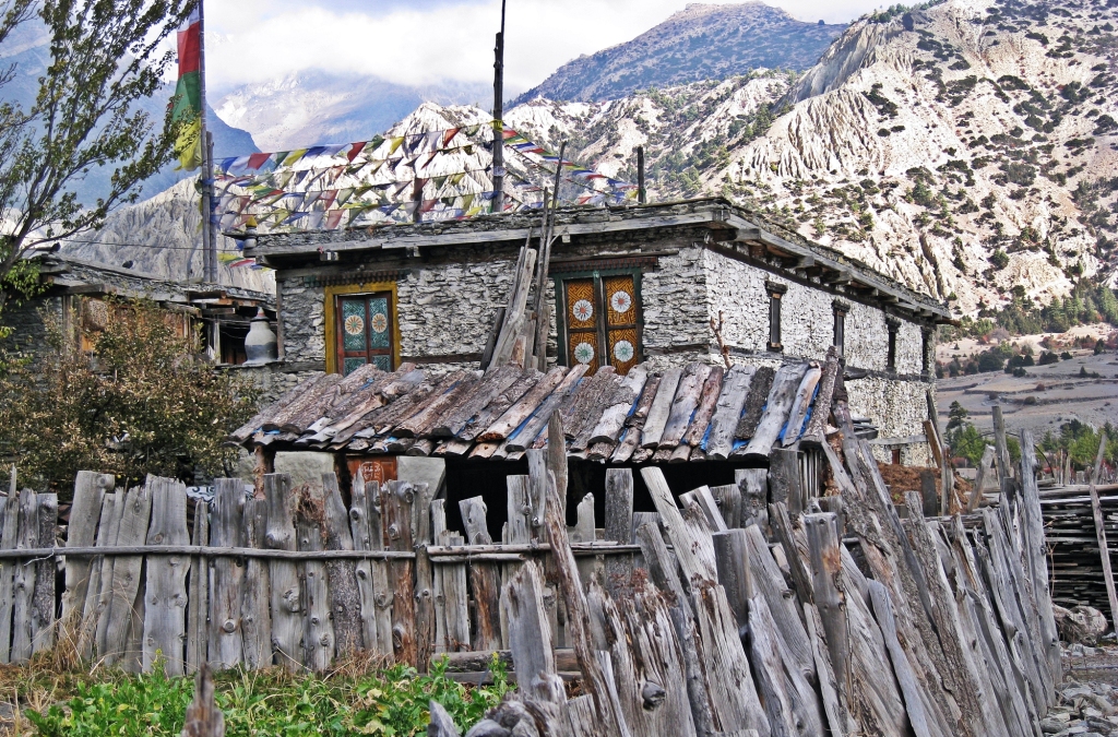
Ghyaru, Annapurna Circuit Trek 
Ghyaru, Annapurna Circuit Trek 
Buddhist prayer wheel, Annapurna Circuit Route
At almost 4,000 m, the vegetation is sparser and consists mostly of evergreens. We passed through another stone village, Ngawal. Its tall white chorten contrasted the grey stone buildings. We thought that these three stone villages would be the most interesting on the trek. But we were wrong.

Annapurna II, Annapurna Circuit Trek 
Buddhist chorten, Annapurna Circuit Trek 
Ngawal, Annapurna Circuit Trek
By far the most interesting village in the region is Braga (also spelled Bryaga or Byraka). From a distance it looks like matchbook houses piled one on top of the other. One house’s roof is the patio of the one above. This may sound like a metropolitan city, but these stone homes are very rustic. We wandered up and down the narrow winding passageways between the small homes. Many were drying apples on their patio. Behind the village pillar rock formations gave additional interest to this unusual village.

Braga, Annapurna Circuit Trek 
Braga, Annapurna Circuit Trek 
Drying apples, Braga, Annapurna Circuit Trek 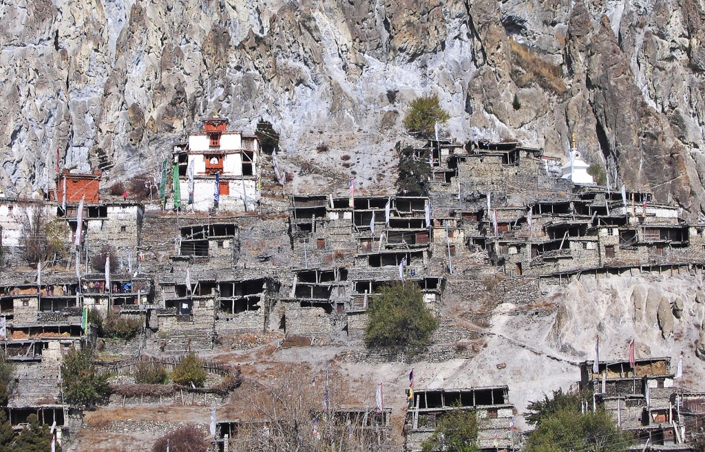
Braga, Annapurna Circuit Trek 
Buddhist mani wall, Braga, Annapurna Circuit Trek
At the top of the village is a 600 year old Buddhist gompa (monastery). It doesn’t have the flare of the newer gompa in Upper Pisang, but we loved the old two-story, white-washed plain style. Inside were statues of Buddha, Guru Rinpoche and festival masks, all typical in Tibetan Buddhism.
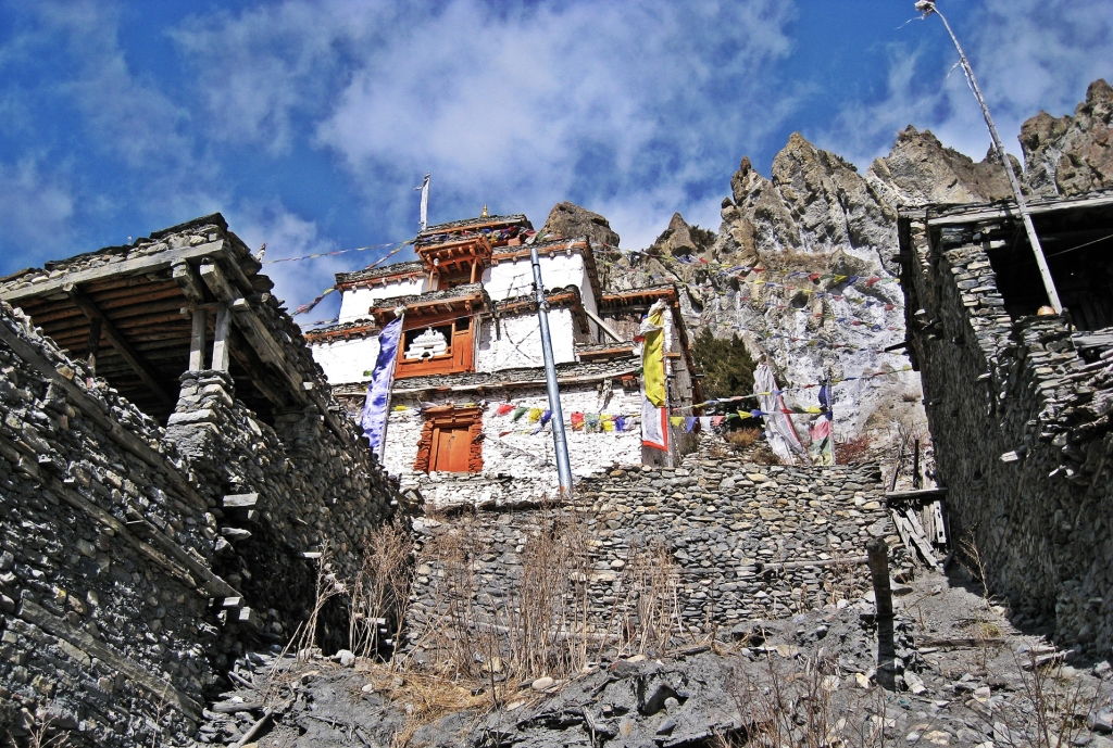
Monastery, Braga, Annapurna Circuit Trek 
Monastery, Braga, Annapurna Circuit Trek 
Masks, Braga Gompa, Annapurna Circuit Trek 
Guru Rinpoche, Braga Gompa, Annapurna Circuit Trek
From Braga the last 3 km to Manang is an easy walk but arriving in Manang (3,540 m) is a shock. Even before the road was built the tourist part of the town was filled with ‘German’ bakeries, restaurants coffee shops and hotels. Manang is very busy. On the trail, trekkers are spread out as they stay at the different villages along the way. In Manang however, that changes. Everyone spends at least two nights in Manang, so we could see the large amounts of people that were on the trail.
Outside of this tourist area though Manang has the stone, flat roofed homes similar to other villages in the area.

Manang, Annapurna Circuit Trek 
Manang and Annapurna, Annapurna Circuit Trek 
Manang, Annapurna Circuit Trek 
Manang, Annapurna Circuit Trek 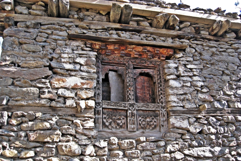
Manang, Annapurna Circuit Trek 
Manang, Annapurna Circuit Trek 
Temple inside our guest house, Manang, Annapurna Circuit Trek
Day 6 – Manang
Manang is set in a wide valley below the beautiful snow-capped Annapurna Range. At an elevation of 3,540 m, it is necessary to have an active rest day to acclimatize before moving higher. We wanted to get a better look at the mountains so we hiked up to a ridge overlooking Manang.
On the ridge Budhhist chortens added a unique aspect to the view of the Himalayan giants. It’s a spectacular spot where you can see Annapurna II, III, IV, Gangapurna and Tarke Kang.


Annapurna Range, Manang, Annapurna Circuit Trek 
Yaks in front of Annapurna Range, Manang, Annapurna Circuit Trek 
Annapurna Range, Manang 
Manang, Annapurna Circuit Trek 
Annapurna Range, Manang 
Chortens in front of Annapurna II and IV 
Annapurna II and IV
In a cave above the chortens we found the small Praken Gompa. We received a blessing from the Lama. He prayed for us to have a safe journey over Thorong La.

Monk, Praken Gompa, Annapurna Circuit Trek 
Monk, Getting a blessing, Praken Gompa, Annapurna Circuit Trek
After being blessed by a Buddhist monk during the day, we met a Jesuit priest at dinner who said he would pray for us. It made us wonder if this upcoming mountain pass was going to be more difficult than we expected. Thorong La is the high point of the trek and at 5,416 m (17,769 ft), it is one of the highest passes in the world. We still had 2 more days of trekking before we see if it’s really that difficult. That story to come in part II.
Driving vs walking summary
Sometimes the new road follows the old hiking trail and sometimes it crosses new territory. Where the old trail still exists you can often follow it, although it is more challenging than the new road. The government realized how the road has affected the trekking industry and is building new hiking trails. It appears that if you hike the entire route as we did, over 50% of it is now on the road.
You can start trekking anywhere between Besisahar and Manang. Buses can only go as far as Bhulbhule, from there you have to go by private or share-jeep. It may be difficult though to find a seat on a jeep anywhere further than Besisahar. It sounds like most people begin trekking in Chame, but some take a jeep all the way to Manang. Beginning a trek at 3,500 m without acclimatizing is very dangerous and not recommended.
Here’s a short video from our trip.
Coming Next: Trekking the Annapurna Circuit Part II – Thorong La
For extra pictures from Nepal click here. For pictures from other blogs go to Gallery at monkeystale.ca
To read about more of our adventures go to Destinations.
If you like what you read, please comment or share (with credit) using the links below.

Nothing ever stays the same, once it is discovered. Good to see it before the major changes, but you can certainly understand how the road will improve the lives of those who live in such a remote area. Thanks for sharing. Allan
LikeLiked by 2 people
The road has completely changed the lives of the villagers, and I think mostly for the better. I’m glad we saw it when we did. Thanks for reading! Maggie
LikeLiked by 2 people
Another one of your unique adventures. I suppose you learn about the lives of people in different parts of the world through your travels, and I have a feeling that this trip in particular must have been very revealing. Such a beautiful place!
LikeLiked by 2 people
We really did learn a lot about how little we actually need to be happy. The Nepalese are very kind, compassionate people even without any modern amenities. But the road really changed their quality of life.
LikeLiked by 2 people
What a great lesson to come away with!
LikeLiked by 2 people
Thanks for taking us back! The one thing that struck me the most while trekking in that area was the deformity of the porters feet. Some of them had their ankle bones pushed so low that it was almost under their feet. I can’t help but wonder if the new roads have any impact on their health. Your photos are stunning! Looking forward to reading about the rest of the hike.
LikeLiked by 1 person
The porters have hard lives don’t they. We still did see a few porters on the road, but mostly now they work on their farms since jeeps take supplies up the valley. I have a funny story about the porters feet when we go to Annapurna base camp in the snow!
LikeLiked by 1 person
Can’t wait!
LikeLike
You are so lucky! Have you ever read Arlene Blum’s book about the all-female expedition up Annapurna? It’s really great! I also recommend A Woman’s Place is at The Top, which is Annie Smith’s biography. The downside of that book is that there is some stuff about her racist attitude though
LikeLiked by 1 person
No I haven’t read it, I’ll look for it. Thanks for the recommendation!
LikeLiked by 1 person
You’re welcome!
LikeLike
What an adventure and to be able to repeat it for comparison. This sure is a remote part of the world that takes some doing just to get there. It looks like you were there in the summer and one can only imagine the winter conditions the locals have to endure to live.
As usual stellar story and photography. The photo of you with Annapurna in the background is magnificent. You guys should write a book about this !
Cheers!
LikeLiked by 1 person
Thanks! It’s such a beautiful area of Nepal, we look for other reasons to get us there. It’s mostly rainy or dry season, although higher up they would have snow in the winter. The pass has had a few accidents during snow storms. It’s a tough life for sure. Maggie
LikeLike
Such an amazing circuit you did, I’ve heard so much about and definitely the landscape is remarkable! One needs to hire porters, or can do the circuit by himself? It looks like you can find accommodation in every village you passed by.
Your photos are stunning, thank you for transporting us in another word, in another time..
LikeLiked by 1 person
Thanks Christie, It is an incredibly beautiful trek, especially when you get higher up the valley. You don’t need a guide or a porter. It’s very easy to do on your own, but most people we saw had porters, we didn’t. Every village beginning in Besisahar has guesthouses. They all usually charge the same, which is a free bed if you eat there and their menus are all the same. The difference is usually cleanliness, so always look inside first. I’ll put more info on the last post of this trip. Maggie
LikeLiked by 1 person
What a wonderful adventure both for the hiking and for the villages you would have passed through along the way. What a fascinating way of life these people have had without direct access to roads for so long. You’ve captured beautiful photos to share!
LikeLiked by 1 person
Thanks Linda, it’s really amazing how they lived without something as simple as a road for so long! Seeing their way of life was as good as the views! Maggie
LikeLiked by 1 person
Wonderful! Thanks for that. We should have been flying to Nepal in a couple of weeks to hike to Everest Base Camp, but that will have to remain in our dreams for a while longer yet. Thanks for the little bit of escapism. Mel
LikeLiked by 1 person
Hopefully you can go in the next season. It’s actually prettier in spring because the rhododendrons are in bloom. We did the 3 passes on the way to and from EBC, if you can you should do at least one or two of the passes. We did a post about it, here’s the link for your research. It’s 3 separate posts, plus a separate one with trek details, there’s a link to it at the end of part 3. https://monkeystale.ca/2018/05/06/everest-3-passes-trek-part-3/
LikeLiked by 1 person
I doubt that we will be able to go anywhere in 2021. Our borders are still closed and Aussies are not allowed to leave the country. In the meantime, I will keep dreaming. Thanks for the links.
LikeLiked by 1 person
As usual, great photos and what an amazing adventure! I always learn so much from your posts about the local area and culture as well, which I enjoy. The most surprising fact I’ve learned from this one is that poinsettias grow on trees! I had no idea. I also didn’t know they grew in Nepal. The more you know…
LikeLiked by 1 person
Haha! I know, I had no ideas a poinsettia could be so big! I was shocked when I saw them. I laughed when I saw them today in the supermarket, in pots of course. 😊 Maggie
LikeLiked by 1 person
I am repeating, but your photos make a great report on the lives of these people. We may like them to stay the same, but if a little progress is going to make their lives easier, we should be delighted for them.
LikeLiked by 1 person
Exactly, it’s hard to be upset by the road when you think of how much easier things will be for them. But, on the other hand tourism was a large revenue source for the villages lower down and now they don’t have that. Overall though, it’s better for them all, as would be electricity. Thanks for your comments. Maggie
LikeLiked by 1 person
wonderful! I love Nepal so much! thanks.
love love love…
LikeLiked by 1 person
Grazie! We love Nepal and the Nepalese too 🙂
LikeLiked by 1 person
How much I miss the Himalayan countries after reading this. I’ve only been to Nepal and Bhutan, but I’d love to visit Tibet, Sikkim, and other places in this region one day because it’s such a fascinating corner of the world. The culture is so rich and colorful, the landscape majestic, and the food surprisingly good. Speaking of the new road, it’s always difficult to choose which one is actually better. Should we keep this kind of place the way it has been for generations? Or should we embrace modernity which will make the local people’s lives a little more comfortable? There is a middle path somewhere, one that doesn’t take away a place’s uniqueness and charm, but gives its residents a better way of living. This middle path, however, is often tricky to find.
LikeLiked by 1 person
Thanks Bama, that’s exactly right. Most have an improved quality of life with the road, but some have lost a revenue source. I really hope it doesn’t lose its charm, though it’s like to change. You should also add Ladakh, India to your list of Himalayan places to visit. It’s likely more Tibetan than Tibet is now, and Mustang in Nepal.
LikeLiked by 1 person
Nice to see pictures of this part of the trek. We hiked the other way and only made it to Muktinath, but then I was carry my daughter who was 3 1/2 years old at the time. We read that is was better not to take a small child to a higher altitude, since you could not know whether the child was simply cranky or had altitude sickness.
We did see Chinese already building roads at that time (1988)
LikeLiked by 1 person
We’re a few years younger in the pictures though 🙂 When you went the villages on the Jomsom side were likely similar to what we saw on the Manang side or in Manaslu in the 2000s. The Chinese are building everywhere, scary to see what the end results will be for these poor countries. Maggie
LikeLike
“Pave paradise put up a parking lot.” Well, in this case, a road. Looks like such a beautiful area and a great place to go on a multi-day hiking trek. Glad the government is building new hiking trails.
LikeLiked by 1 person
Now I’ll have that stuck in my head all day 🙂 I’m curious to read reports of how the new trails are. Most of the posts I read are still taking the road as far as they can – too bad, but their loss. Maggie
LikeLiked by 1 person
Wow..Wow..wow…Awesome pictures!!! What an amazing adventure! Annapurna looks stunning!!
LikeLiked by 1 person
Thanks! Yes the scenery in this part of Nepal is incredible. Thanks for reading! Maggie
LikeLiked by 1 person
What an amazing cultural and athletic experience! Oh, that poor pregnant woman. I hope she and the baby made it! You’re pictures are fantastic.
LikeLiked by 1 person
Thanks, ya, seeing that woman being brought down on a door was a real eye-opener. We can’t even imagine how difficult their lives are.
LikeLiked by 1 person
Wow what a place and what an adventure. Those villages look absolutely amazing. Love the look of those bridges, they look fun!
LikeLiked by 1 person
This part of Nepal is amazing. Fantastic views and interesting villages. The bridges are often fun, but the ones with the holes, are a little scary especially if its filled with mules:)
LikeLiked by 1 person
this is a brilliant kind of trek, so varied and through different villages meeting the locals. just brilliant! your photos are STUNNING too! Thanks for sharing!
LikeLiked by 1 person
Thanks Andy, the Annapurna range is a very special place. We love seeing how the people love in such remote locations under the beautiful Himalayas. Maggie
LikeLike
Lovely photos. My lap top is struggling to upload all of them so I’ll give it a couple hours so I can see them all. What an amazing trek!
LikeLiked by 1 person
Thanks Katelon, Let me know if they don’t open. I hope we’re not keeping the files too large.
LikeLiked by 1 person
very detailed post would love to do this one day
LikeLiked by 1 person
Thank you, It’s a beautiful area and well worth a visit if you can 🙂
LikeLike
Wonderful reportage
Your photos are amazing!
LikeLiked by 1 person
Thank you so much! It’s an incredibly beautiful area. Maggie
LikeLiked by 1 person
🤗😘
LikeLike
You guys are lucky to have had this experience in 2011and then repeat it again after the new road was built. It would be a shame to miss out on those gorgeous waterfalls and interesting villages. What strikes me as much as the majestic beauty is your description of how different and basic life is in these parts—carrying the pregnant woman on the door, wow! Really interesting analysis of the changes. It’s good to hear that new trails are being built away from the road.
LikeLiked by 1 person
We love Nepal for its beauty and the amazing people. Even though they really have nothing they are warm and compassionate. Their homes are fascinating, how they adapt to the landscape. I feel for them now having lost their main revenue source with the road, and I’m not sure how well the trails are promoted but hopefully it will improve. Even after being there twice, I would go again!
LikeLiked by 1 person
Enjoyed this immensely. You took me to an area that I had little knowledge of. The photos are great!
LikeLiked by 1 person
Thanks Roxanne, it’s amazing how different people’s lives are around the world isn’t it? Thanks for reading! Maggie
LikeLike
I’m so happy to hear that new hiking paths are being built to route hikers off the new road (which, I totally understand, is also critical to the locals’ well-being). I had pushed off an Annapurna Circuit hike because I’d been spoiled by the Everest Base Camp trek that is more out in nature (although that, too, is/was becoming a bit over-run!), but if I do get back to Nepal, I’d like to try something new. I saw you mentioned Ladakh in another comment – THAT is top of the list for me once the world opens up again!
LikeLiked by 1 person
We loved Ladakh too! When you start planning, we did a few posts on Ladakh you can read. Also look at Manaslu which is the mountain range beside Annapurna. The road only goes for 1/2 of the first day and then it’s all hiking. It’s not as scenic as Everest but you can end hiking the last couple of days on the best part of Annapurna. We also did a post on Manaslu. Hope you get there one day 🙂
LikeLiked by 1 person
Can’t believe that I missed this wonderful post! As ever, a really enjoyable read!! Great photoas and I particularly love the photos of Manang! 🙂
LikeLiked by 1 person
Thanks, the views above Manang are truly breathtaking.
LikeLiked by 1 person
Yes, your pics captured some of that scale and beauty!!
LikeLiked by 1 person
Wow!!! Thank you for sharing , it’s wonderful! I’m going to save this post for future reference, because I want to go there !🌸
LikeLiked by 1 person
That’s great. The views from Manang are some of the best anywhere in the world. I hope you get to go one day! Maggie
LikeLiked by 1 person
Thank you Maggie , me too!❤️
LikeLike
Definitely an adventure but well worth it .We haven’t been to that part of Nepal….maybe a bit scary hiking on that mesh bridge.
LikeLiked by 1 person
The bridges are even more scary when there is a pack of miles on it too😊
LikeLike
Really fortunate to be able to visit the same place twice. The differences am sure made you upset. Making to roads in such ecologically sensitive areas does come at a cost but again the lives of some people will remain miserable without it. Amazing pictures. Surely you have had a great adventure both the times.
LikeLiked by 1 person
It’s difficult to see the changes in such a pristine area. I understand it makes their lives a lot easier, but also takes away some income. It sounds like the government is trying to help them regain the tourists in the lower valleys. It’s an amazing area regardless.
LikeLiked by 1 person
What an amazing journey! I so admire the ability to truly backpack long distances. I never did it when I was young and now sadly I wouldn’t be able to handle the weight in my back. I imagine it to be a very liberating way to travel though! Thank you for the beautiful images and sharing your views!
LikeLiked by 1 person
It’s the ony way to get to see a lot of these amazing mountains and villages. We hike a lot at home so even though we’re not young, we’re more used to it. But you live in the mountains now so…. maybe!
LikeLiked by 1 person
Working my way up. Told Paolo I needed a buttpack and I’d be good!
LikeLiked by 1 person