
The air was getting thinner as we slowly climbed the steep trail toward Thorong La. After 9 days of walking, the highest point on the Annapurna Circuit was within our reach.

Map of Annapurna Circuit and Sanctuary
Day 7 – Manang to Letdar
Distance – 11 ½ km; Elevation Gain – 660 m
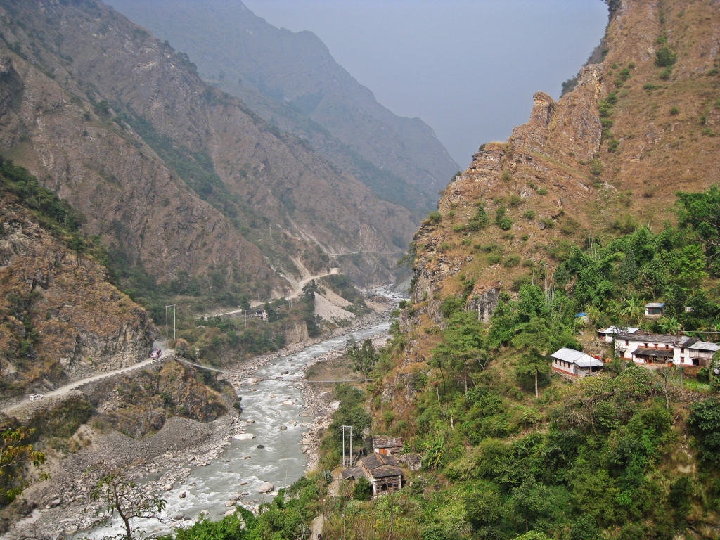
We spent the first five days walking up the Marsyangdi River Valley, passing small villages and spectacular waterfalls to reach Manang (Part I). After a rest day we were ready to move. Between Manang to Muktinath there are no roads. For those trekking since the new road was built, this may be their first time walking on a trail.
It begins as a steep climb taking you quickly above the hills. At this elevation hiking is more difficult. Our breathing and heart rates were faster. We had to make sure we were drinking enough water to keep hydrated and avoid high altitude sickness. After the climb the trail flattens a bit making it easier to enjoy some of the best views of the entire trek. The impressive white peaks of Gangapurna and Annapurna III dominate the scene.

Hiking above Manang, Annapurna Circuit Trek 
Looking back toward Manang, Annapurna Circuit Trek
The vegetation is sparser at this elevation with mostly scrub juniper and alpine grass. As we neared the guesthouses of Yak Kharka we saw a herd of yaks grazing on the hillsides. It was if they had to prove the name to be accurate.
The trek is now at a high elevation so some people take a slower approach to the pass and stay in Yak Kharka ( 4,018 m). We wanted to get a little higher so we continued up the valley.

Gangapurna and Annapurna III, Annapurna Circuit Trek 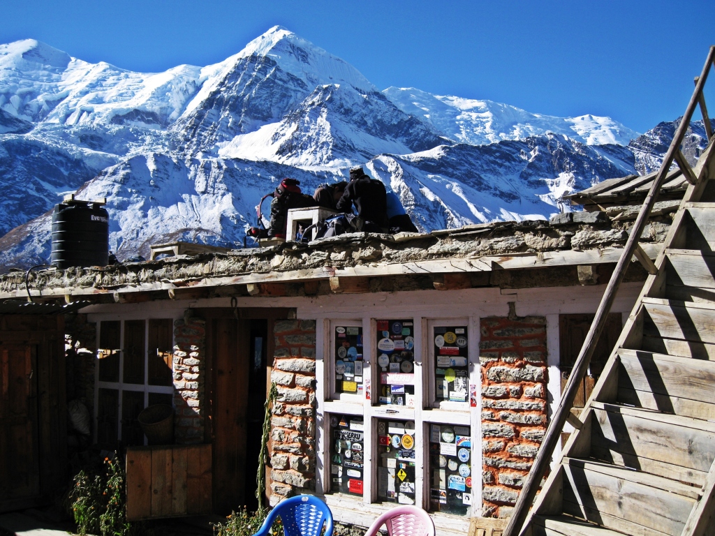
Yak Kharka, Annapurna Circuit Trek 
Yak in front of Gangapurna and Annapurna III, Annapurna Circuit Trek
Above Yak Kharka the scenery continues to improve with unimpeded views of the mountains. We passed a few shy blue sheep grazing on the hills. The breathtaking views continued all the way to Letdar.
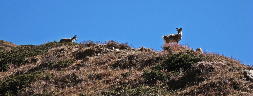
Blue sheep, Annapurna Circuit Trek 
Gangapurna and Annapurna III, Annapurna Circuit Trek
Letdar (4,200 m) is 180 m higher than Yak Kharka. At this elevation even a small increase in elevation makes a noticeable difference. The higher you get, the lower pressure of oxygen makes everything more difficult including sleeping.
Guesthouses are more expensive between Manang and Muktinath because they are only accessible by foot. There are no villages, instead there are groupings of guest houses for tourists. Meals and rooms are more basic and cleaning doesn’t seem to have a high importance.
Day 8 – Letdar to Thorong High Camp
Distance – 6 ½ km; Elevation Gain – 680 m
From Letdar the trail continues to climb along the side of the Jarang Khola Valley. The vegetation is even sparser and the land is very dry. There’s not as much rain on this side of the Annapurna Range. Heavy clouds need to dump their moisture as rain and snow on the other side in order to get over the tall mountains.
The first guesthouses are located in Thorong Phedi (4,450 m). Many stay overnight here, but we wanted to get higher so we continued on to High Camp.

Gangapurna and Annapurna III, Annapurna Circuit Trek 
Above Letdar, Annapurna Circuit Trek 
Above Letdar, Annapurna Circuit Trek 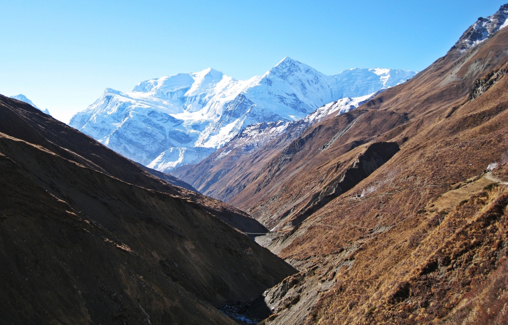
Looking back to Gangapurna and Annapurna III, Annapurna Circuit Trek 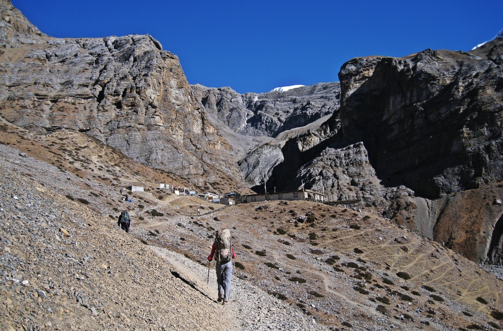
Thorong Phedi, Annapurna Circuit Trek
The walk to High Camp is very steep ascending 430 m in one kilometer. At almost 5,000 m elevation, it’s a tough grind to reach Thorong High Camp (4,880 m). It’s a desolate place with almost no vegetation.
Staying at this high elevation is not comfortable and if your body is slow to acclimatize it’s better to stay lower down the valley. The disadvantage of staying lower in Thorong Phedi, is that you have to climb an extra 430 m in the morning on the way to the pass. Some people travel very slow, spending a night Thorong Pedi and the next night at High Camp before going up to the pass.

Above Thorong Phedi, Annapurna Circuit Trek 
Looking back above on the trail to High Camp, Annapurna Circuit Trek 
High Camp, Annapurna Circuit Trek 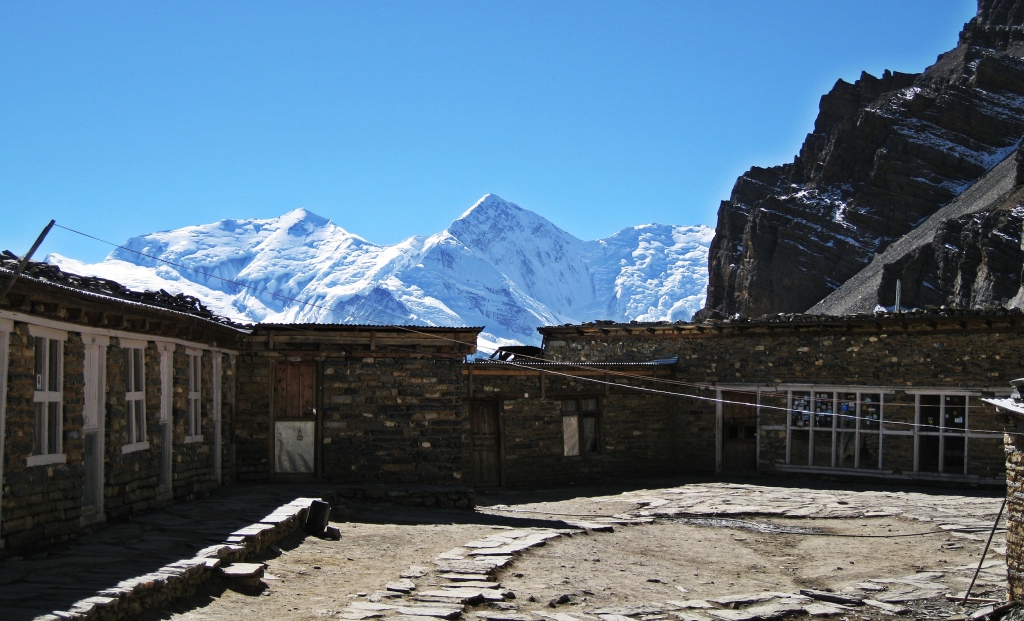
High Camp, Annapurna Circuit Trek
There’s a viewpoint not far from High Camp that looks toward the valley we had just climbed. High above are the stunning white peaks of Annapurna III and Gangapurna.
That night the guest house was completely full. Some people were turned away and had to stay at a teahouse 200 m higher. We had to share our small room with two other people. One was a female guide who snored loudly all night. Between the snoring and the usual difficulty sleeping at high altitude, we didn’t get much sleep.

Chulu West from High Camp viewpoint, Annapurna Circuit Trek 
Annapurna III and Gangapurna, High Camp viewpoint 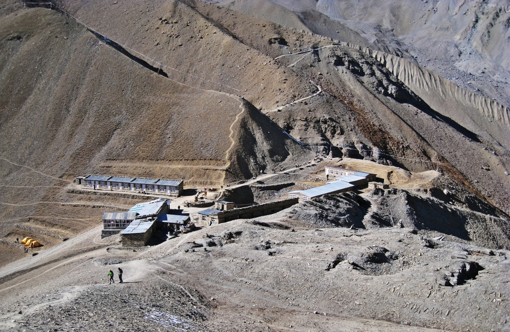
High Camp, Annapurna Circuit Trek
Day 9 – Thorong High Camp to Muktinath via Thorong La
Distance – 4 km to pass, 10 km to Muktinath; Elevation gain – 536 m, Elevation Loss – 1,616 m
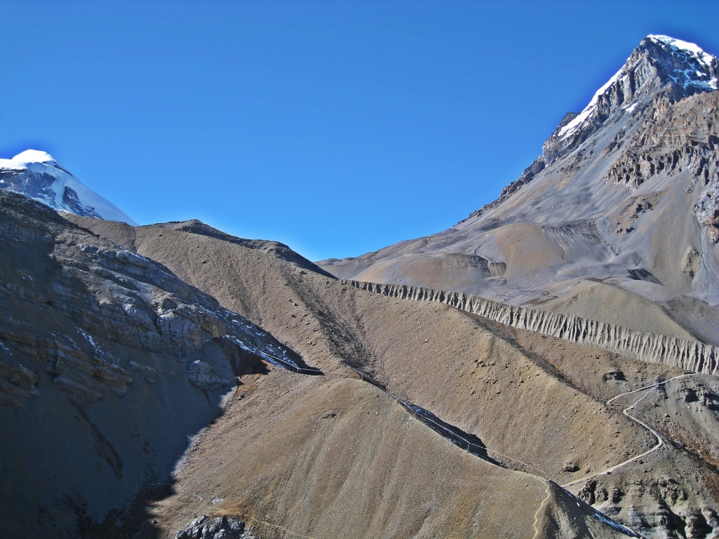
The trail to Thorong La (pass) is a grind. It’s a short distance but the constant climb up the moraine gains over 500 m in just 4 km. Local people have used this trail for hundreds of years to bring herds of sheep and yaks in and out of Manang.
There have been storms in this area and deadly accidents. The worst was in 2014 when a massive snowstorm hit the area. Many hikers were stranded at the pass in whiteout conditions. At least 43 people died. The pass is not to be taken lightly. We left early in the morning under clear skies so we were confident that it would be safe.
Most other trekkers on the route had porters to carry their packs for the entire trek, but we carried our own. When we saw porters on the trail these past few days we wondered if they were annoyed with us since we were not hiring them. Part way up to the pass, after passing several other trekkers, a porter smiled at us and said ‘I watch you, you’re strong’ and gave us the thumbs up. So, I guess they weren’t angry with us.
Trail above High Camp, Annapurna Circuit Trek
Roughly halfway up the trail we passed a small teahouse. Some trekkers were forced to stay here overnight because High Camp was full. At over 5,000 m, they would have had an awful night.

Teahouse below Thorong La, Annapurna Circuit Trek 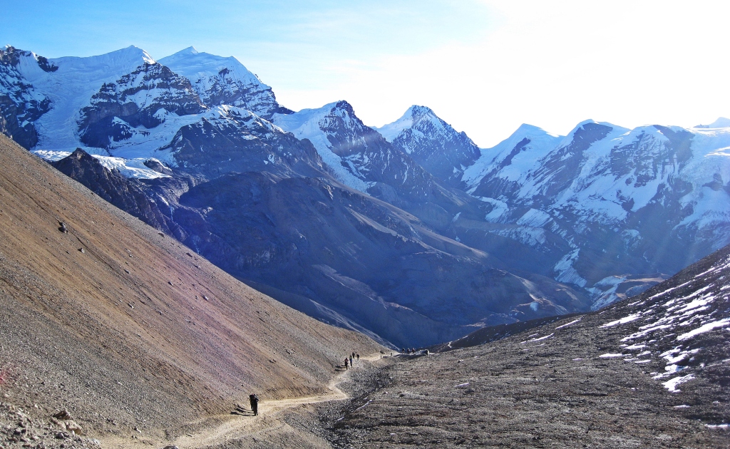
Looking back on the way to Thorong La, Annapurna Circuit Trek
The trail to the pass is deceiving. There are many false summits, fooling you into thinking you’re close, only to be disappointed to see another ridge. We renamed it ‘Deception Pass’. Slowly, slowly, one foot in front of the other, we made our way up the moraine to Thorong La (5,416 m). It was windy and cold, but we still had clear skies. The pass is decorated in prayer flags which flapped vigorously in the strong wind.
On the other side of the pass we could see the mountains in the Dhaulagiri Range and the Kali Gandaki Valley far below. Joining us at the pass were dozens of other trekkers and surprisingly, a Himalayan snow partridge.

Thorong La, Annapurna Circuit Trek 
Himalayan snow partridge, Thorong La
The descent from the pass is steep but with each step we inhaled more and more oxygen. We went down a lot faster than we climbed. The mighty Dhaulagiri (8,167 m) look spectacular, rising above the hills on the other side of the Kali Gandaki Valley. It’s the seventh highest mountain in the world. After not too long the important centre of Muktinath can be seen below.
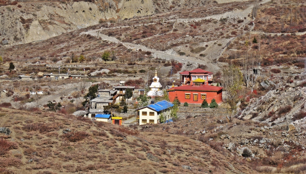
Muktinath translates to Nirvana and is important for both Buddhists and Hindus. The hillside above the town is covered in Buddhist prayer flags. Just beyond them are the golden roofs of Muktinath Temple. Hindus make pilgrimages to this important temple.

Looking back up to Thorong La 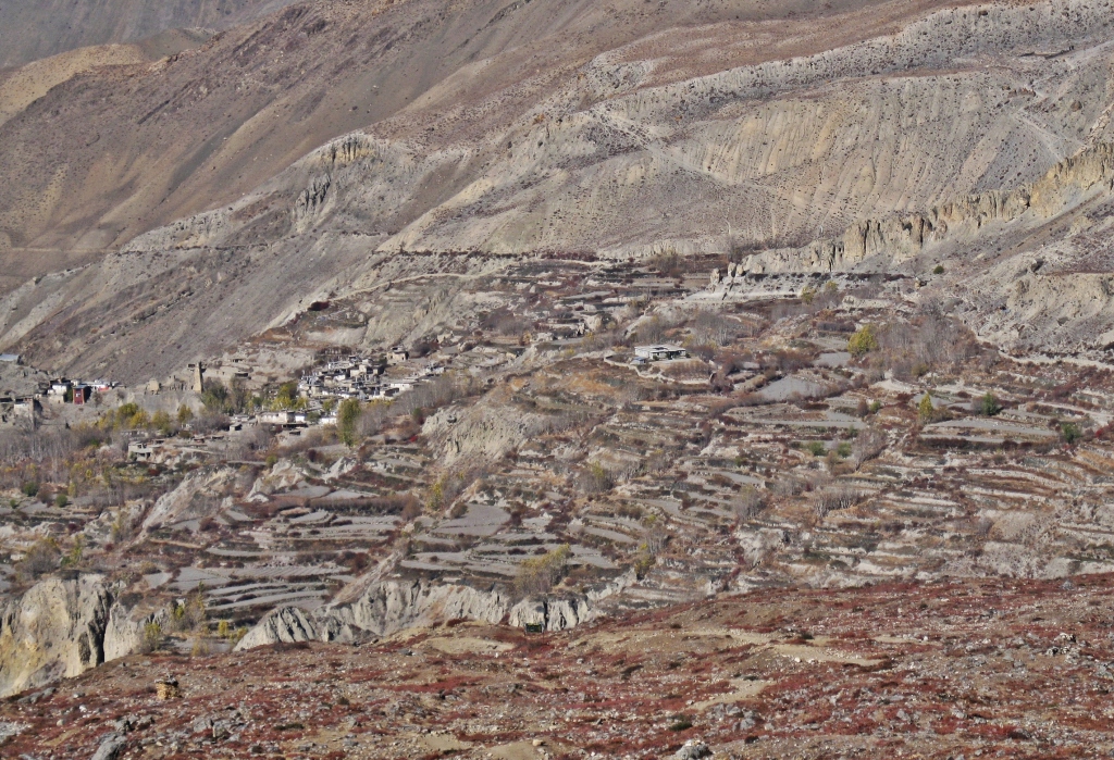
Muktinath, Annapurna Circuit Trek 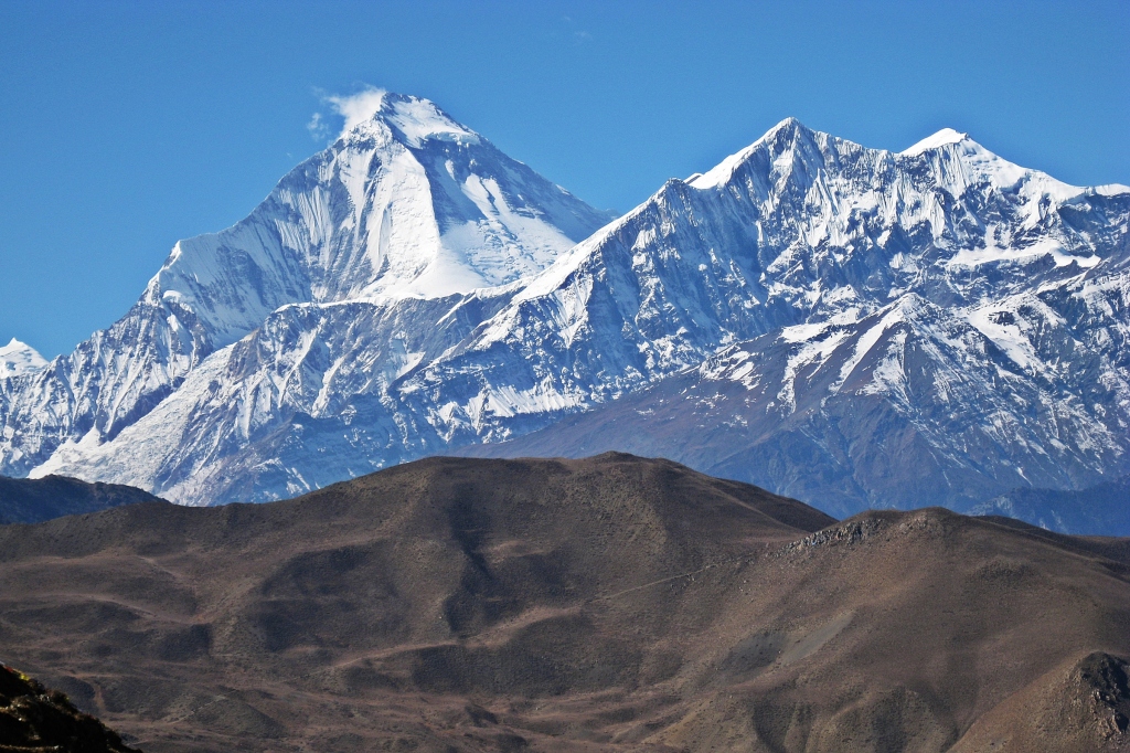
Dhaulagiri, Annapurna Circuit Trek 
Prayer flags above Muktinath 
Prayer flags and Buddhist gompa, Muktinath 
Shree Muktinath Temple 
Muktinath Temple, Annapurna Circuit Trek 
Downtown Muktinath, Annapurna Circuit Trek 
Muktinath, Annapurna Circuit Trek
It was still early in the day and we could see an interesting looking village on the other side of the river. After lunch we went for a walk to explore. The Buddhist village of Jhong has retained its authentic rustic charm. Ruins from an old fortress and a new monastery sit side by side on a hilltop in town. We walked between the flat-roofed stone homes on our way to the interesting site. A lady called out to us from her yard asking if we want apples. She picked 6 apples off her trees and sold them to us. It had been days since we had fresh fruit so this was a lovely surprise.
Jhong, Annapurna Circuit Trek 
Jhong, Annapurna Circuit Trek 
Jhong, Annapurna Circuit Trek 
Jhong, Annapurna Circuit Trek 
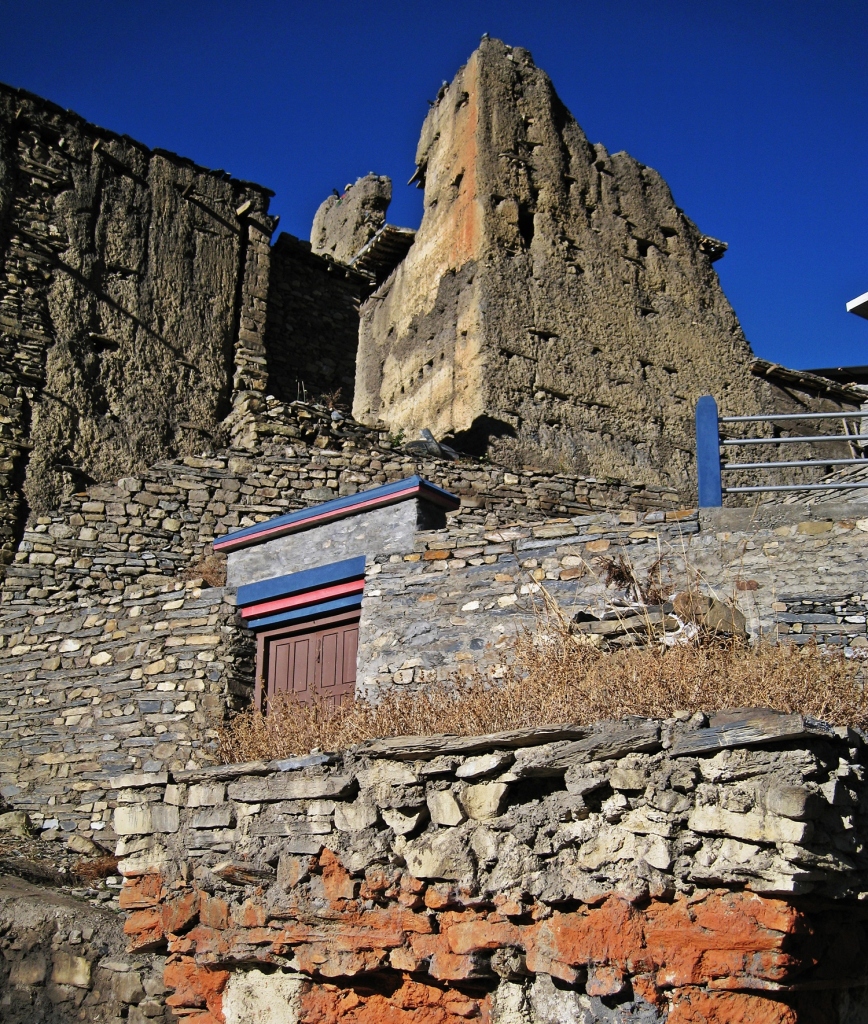
Fortress ruins, Annapurna Circuit Trek 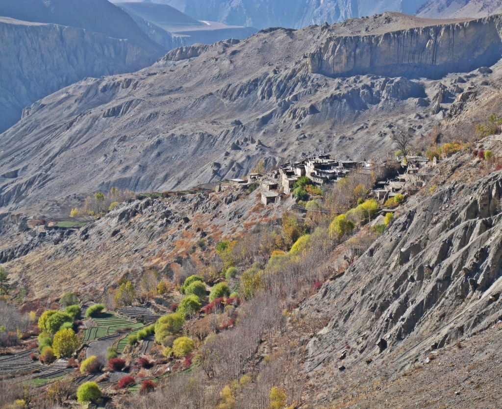
Near Jhong, Annapurna Circuit Trek 
Jhong gompa and fortress, Annapurna Circuit Trek 
Jhong gompa, Annapurna Circuit Trek
Day 10 – Muktinath to Marpha
Distance – 23.5 km; Elevation Loss – 1,145 m
Leaving Muktinath we had to follow the dusty road for a while. A short-cut trail allowed us to walk along the ridge above the Kali Gandaki Valley. In this section it is an arid valley dotted with villages on green oases. The trail took us above the village of Kagbeni which marks the beginning of the Upper Mustang region. During our 2018 trip to Upper Mustang we visited this fascinating old village. Today a paved road goes from Muktinath to Kagbeni.
Eventually the trail descended from the ridge to the Kali Gandaki River and led to the large centre of Jomsom (2,743 m). There’s an airport here so many people end their trek in Jomsom and fly back to Pokhara. Others will skip the next day and a half of the trek and take a bus to Tatopani.
Jharkot, Annapurna Circuit Trek 
Kagbeni, Mustang region 
Village along the Kali Gandaki, Annapurna Circuit Trek 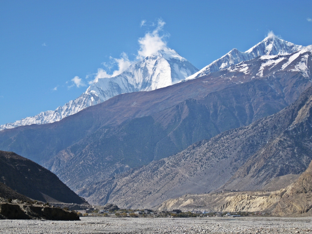
Dhaulagiri above Kali Gandaki, Annapurna Circuit Trek
From Jomsom we walked on the dusty road following the Kali Gandaki to Marpha (2,655 m). The village of Marpha was a welcome surprise. Even though it’s very close to the road, Marpha is a lovely village. We walked on flagstone paths, beside white buildings with red windows frames. The flat roofs were stacked with wood, an indication of wealth. For a remote village they have a modern approach to water drainage. Channels were built under the stone sidewalks that serve as pipes for rain and waste water.

Marpha, Annapurna Circuit Trek 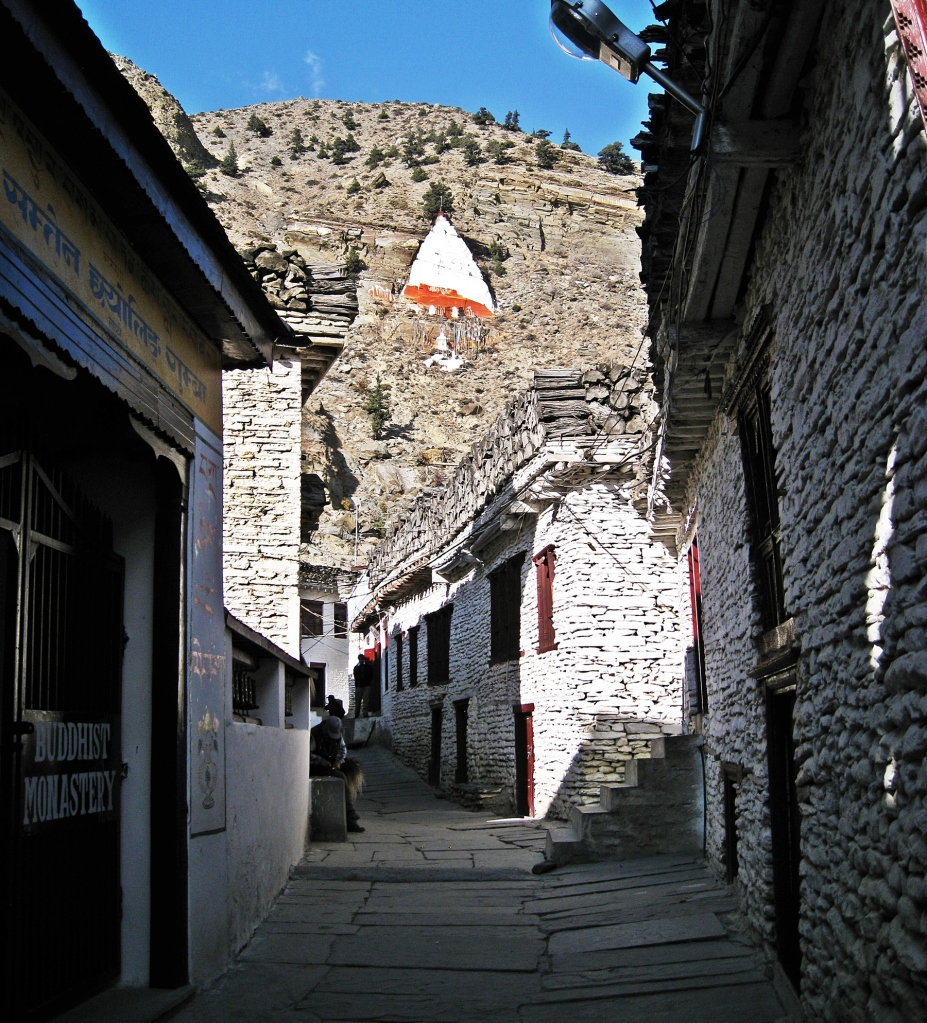
Rhisum Gompa above Marpha, Annapurna Circuit Trek 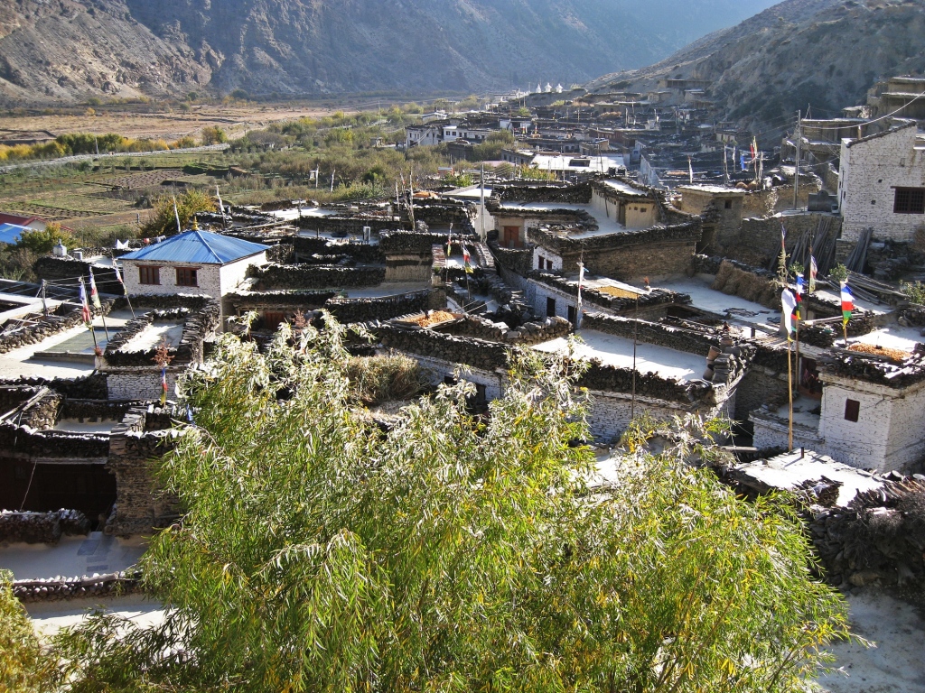
Marpha, Annapurna Circuit Trek 
Drying food on rooftop, Marpha
Above the village the fascinating triangle shaped Rhisum Gompa (monastery) is built into the side of the mountain. Today this monastery is only used on special occasions. In the centre of town is a more typical Tibetan Buddhist gompa with white walls and colourful gables under a flat roof.
Marpha is the apple capital of the region. We had more fresh apples along with apple pie and apple danishes.
In 2018 we drove this road between Jomson and Marpha. The road was busier, but since the town is not directly on the road it doesn’t appear to have been affected. We recognized the white triangle monastery on the hill above.

Rhisum Gompa above Marpha, Annapurna Circuit Trek 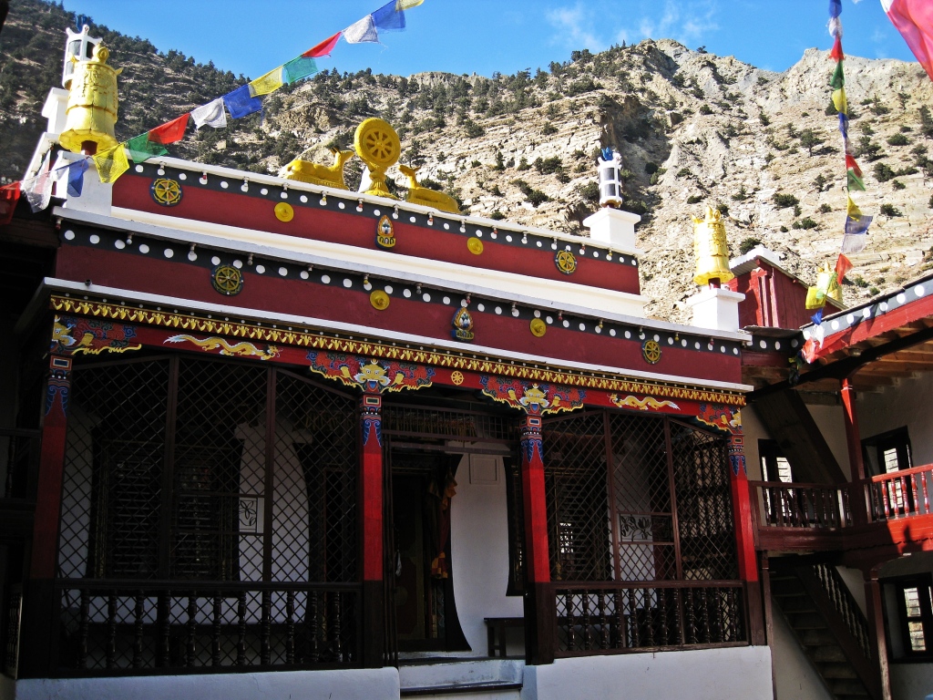
Marpha gompa, Annapurna Circuit Trek 
Rhisum Gompa, Marpha, Annapurna Circuit Trek
Day 11 – Marpha to Kalopani
Distance – 19.7 km, Elevation Loss – 140 m
We left Marpha traveling on the road for a while until we were able to walk on the trail. The next two days would be the most we would walk on the road for the entire trek. Before the cute village of Tukuche we were able to get off the road and onto the trail. It began raining soon after we passed Tukuche and continued all the way to our next stop in Kalopani (2, 530 m). We should have had views of Annapurna I and Dhaulagiri, but the mountains were covered in clouds.

Samba Gompa, Tukuche 
Tukuche, Annapurna Circuit Trek 
Tukuche, Annapurna Circuit Trek
Day 12 – Kalopani to Ghara
Distance 25 km; Elevation Loss – 1,340 to Tatopani, Elevation gain – 501 m to Ghara
We woke to another cloudy day in Kalopani and had to walk along the road again for part of the day. Right beside the road Rupse Chharhara waterfall drops down from 300 m above. Cars use a wooden bridge to cross it and during rainy season, water covers the bridge and road.
We lost a lot of elevation by the time we reached Tatopani at 1,190 m. The busy tourist centre is filled with colourful, flowering trees and lush vegetation. The name means hot water and there are a few thermal baths in the area. Many take the bus from Jomsom to Tatopani, missing the last day and a half that we just walked.

Rupse Chharhara waterfall, Annapurna Circuit Trek 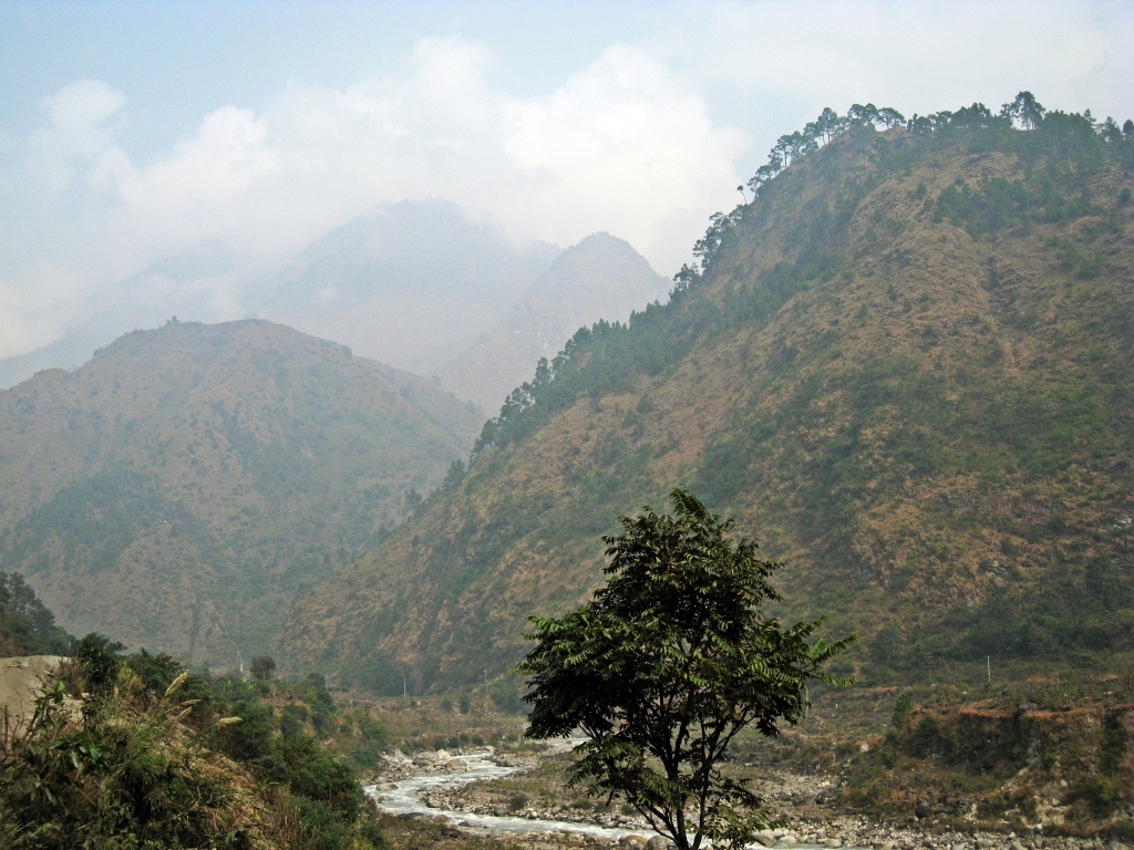
Annapurna Circuit Trek 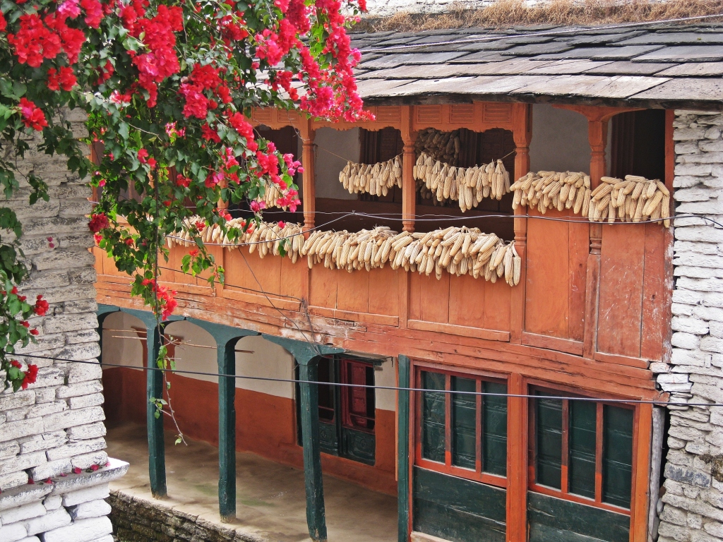
Tatapani, Annapurna Circuit Trek 
Bougainvillea, Tatapani, Annapurna Circuit Trek 
Annapurna Circuit Trek
In this area the Kali Gandaki is a narrow, steep valley and the road follows the deep contours of the mountain’s ridges. It is here that the Kali Gandaki is considered to be the deepest gorge in the world. It is bordered by the 8,000 m peaks of Annapurna and Dhaulagiri. When measuring from their peaks to the river far below, it becomes the deepest valley in the world. A long suspension bridge crosses this deep valley and takes us away from the road.
The usual finish for the Annapurna Circuit is Nayapul which is just beyond Tatopani. Instead though we wanted to also do the Annapurna Sanctuary Trek. We walked up the Ghar Khola Valley where we could eventually join it in Ghorepani. There are a lot of farming communities in this lush valley. The trail took us passed many terraced fields and into deep gorges. In one area the gorge was filled with boulders of marble. It was incredible. Many of the steps on the steep climb to Ghara (1,700 m) were made of marble. It would have looked great in our home, and here it was in its original environment.
Bridge crossing the deep Kali Gandaki, Annapurna Circuit Trek 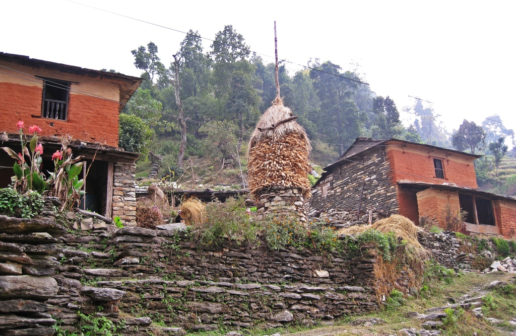
Annapurna Circuit Trek 
Annapurna Circuit Trek 
Annapurna Circuit Trek 
Ghara Medical Centre, Annapurna Circuit Trek
Day 13 Ghara to Ghorepani
Distance – 15 ½ km; Elevation Gain – 1,644 m
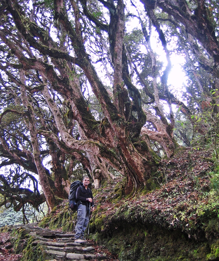
The trail continued to climb, passing farms on the way to Ghorepani. It was raining, making the 1,600 m of stone stairs very slippery. We barely looked around and didn’t take many pictures. Just before Ghorepani the trail goes through a dense forest of rhododendron and magnolia trees. It was November though so unfortunately none were in bloom.
Ghorepani is a very busy village as it is the base for the popular trek to the Poon Hill lookout. Trekkers often include Poon Hill when doing either the Annapurna Circuit or Annapurna Sanctuary treks. Many come to Ghorepani just for the short trek to Poon Hill. The village has many restaurants, coffee shops and guest houses to accommodate all of the tourists.
Forest before Ghorepani
Day 14 – Ghorepani to Poon Hill to Chhomrong
Distance – 3 ½ km to Poon Hill return, 17 ½ km to Chhomrong; Elevation Gain/Loss- 375 m to Poon Hill, Elevation Loss – 710 m to Chhomrong
We woke very early so that we could be on the top of Poon Hill (3,210 m) in time for sunrise. We planned to leave at 4:30 am, but at 3 am we were awakened by a lot of noise in the guesthouse. Other trekkers were getting ready to leave. We were worried that it would take longer than we planned so we got up and left for Poon Hill. There are over 3,000 stairs in the 1 ½ km, 376 m climb to reach the lookout. The steep trail was incredibly busy.
We shouldn’t have left so early because we were at the top of Poon Hill in the dark, long before sunrise.
Once the sun started to rise, the Annapurna Range began to show itself. Annapurna I (8,091 m), Annapurna South (7,219 m) and Machhapuchhare (6,993 m) were coming alive. It was our first glimpse of the fishtail pyramid of Machhapuchhare. It looked so small in comparison to the Annapurna giants. The beautiful alpenglow on these peaks showed us why this is such a popular hike.

Sunrise at Poon Hill 
Sunrise at Poon Hill 
Sunrise at Poon Hill
After watching the sunrise, we had a quick breakfast in Ghorepani and were back on the road. We spent the next few days hiking to Annapurna Sanctuary (coming soon in Part 3).
Coming Next: Annapurna Circuit Trek (Part 3) – Annapurna Sanctuary
For extra pictures from Nepal click here. For pictures from other blogs go to Gallery at monkeystale.ca
To read about more of our adventures go to Destinations.
If you like what you read, please comment or share (with credit) using the links below.

Impressive….what an adventure.
LikeLiked by 2 people
Thanks Michael, Nepal never ceases to amaze 🙂
LikeLiked by 1 person
An incredible journey!! A stunning trek and such captivating photos! Rhisum Gompa looks a special site!
LikeLiked by 1 person
Thanks Colin, Nepal has amazing mountains. The village of Marpha was such a cute town, and the view of that gompa will stay with me.
LikeLiked by 2 people
You are most welcome! Yes, Nepal was a place that I enjoyed visiting very much.
LikeLike
It never ceases to amaze me how adaptable humans are to live and work in such altitudes. Surely, we can adapt to the current normal and thrive. The sunset shots are stunning. Great post. Thanks for sharing. Allan
LikeLiked by 1 person
Thanks Allan, we took 3 days to cross the pass, but the locals would do it in a day, and likely several times a month. You’re right, our current situation isn’t so bad, I think we can wait it out in our comfortable, heated homes with cushy beds. Thanks for reading! Maggie
LikeLiked by 1 person
What an adventure this must have been, and that sunrise on Poon Hill looks like a dream!
LikeLiked by 1 person
It was an incredible trip. It had been raining for the previous two days so we were very lucky to have this sunrise. Thanks for reading! Maggie
LikeLiked by 1 person
The sunrise pictures at Poon Hill are breathtaking!!!
LikeLiked by 1 person
Thanks Stephanie, It’s an awesome view from Poon Hill. We wondered why so many people did this trek, but the sunrise showed us why:) Maggie
LikeLiked by 1 person
Stunning beauty ! Thanks for sharing those magnificent pictures 👏😊👍👍. For a long time I have planned to hike in the Himalayas. By now I have become too old ! Walking down steep hills is a problem and also fitness.
LikeLiked by 1 person
The Himalayas offer so may incredible views. Too bad you didn’t get there. You can take a mule on some of the routes, – mostly in India I think. Thanks for reading! Maggie
LikeLike
Beautiful post. I love the great photos. They are a story in themselves. You always take the reader along on the journey. I love that❤😊🙏
LikeLiked by 1 person
Thanks Suzette! Your’re right some of these scenes don’t even need an explanation. 🙂 Maggie
LikeLiked by 1 person
Thank you so much.🙏🌸
LikeLike
What an incredible journey you had! Mountain trekking is the most exciting adventure ever!
LikeLiked by 1 person
Thank you! This winter you can see some of the beauty of Canadian Rockies! Maggie
LikeLiked by 1 person
Can’t wait! I lived in Colorado a long time ago, and I love the Rockies! That should be nostalgic 😍😍
LikeLiked by 1 person
Wow those sunrise photos are spectacular! Worth getting up for no matter what the time!
LikeLiked by 1 person
It’s always so hard convincing yourself it will be worth it, but I’m glad we didn’t sleep through this one 🙂
LikeLiked by 1 person
I like to read your articles, it’s already a trip and the photos illustrate what you have to say. I particularly like the small villages and their simple functional architecture, not yet ‘improved’ with modern facilities.
LikeLiked by 1 person
Thank you, we try to enjoy the journey as much as the destination. The journey in this case was being able to see how people live in these small, traditional villages in remote locations. I really appreciate your kind words 🙂 Maggie
LikeLiked by 1 person
Stunning photos! Thanks for taking us along!
LikeLiked by 1 person
Thanks for coming along 🙂
LikeLiked by 1 person
Just stunning. Thanks for sharing, Mel
LikeLiked by 1 person
Thanks Mel, I’m glad the pictures showed just how beautiful this area is. Maggie
LikeLiked by 1 person
Amazing as always! Mostly I’m just still trying to comprehend that final bit of hiking up to high camp. I can’t imagine hiking something that steep where there is oxygen, let alone doing it at that elevation!
LikeLiked by 1 person
It’s a tough grind, but you could do it. Our bodies are remarkably adaptable. Besides, the scenery would distract you from the suffering 🙂 Maggie
LikeLiked by 1 person
What a stunning two part series of the Annapurna circuit. Will act as guide for many enthusiasts like us. Marvellous!!
LikeLiked by 1 person
Thank you, We love this region of Nepal, glad you enjoyed the trek!
LikeLike
While the landscape along the trek is undoubtedly spectacular, I’m really intrigued by Marpha. It’s so fascinating to see this interesting small village located at such a high altitude which doesn’t seem to be much affected by the construction of the new road. However, looking at that photo of Rhisum Gompa makes me shiver just thinking of what could happen if one or more of those wooden supports move. That alpenglow you saw from Poon Hill is breathtaking in every single way! So majestic and beautiful.
LikeLiked by 1 person
I think you should do this hike Bama, you’d love it. Marpha is really special. It’s so clean and organized, the people are very kind and the architecture is really pretty. We were excited to see it the second time we were in the area. Poon Hill is one of the most popular treks, and you can see why. We saw a few people hiking up after sunrise, not realizing what they just missed. Maggie
LikeLiked by 1 person
Enjoyed the post. These are amazing experiences!
LikeLiked by 1 person
Thank you, yes it’s a fascinating place, I’m glad we were able to visit. Maggie
LikeLike
Amazing trek, we would so like to see villages like this but I guess this is a step too far in trekking for us. Fabulous photos of such a fantastic adventure
LikeLiked by 1 person
Thanks! They certainly have a different way of life.
LikeLike
What an amazing journey! Looking at a few of the photos it looks like there is glass in the windows! I would imagine they make many of the building materials but I feel humbled by all they have to port in to create their villages, shrines, monasteries, etc. Do they have indoor plumbing or is do they have to use outhouses and carry water?
LikeLiked by 1 person
When these buildings were built or even when windows were added everything had to be brought on mule, yak porter, or you’re right, made themselves. Some places had outhouses, some had a modified version of indoor plumbing, often with a bucket of water to flush. Places are getting more modernized now since the roads are being built, but it’s no where near comfortable. Its a tough life.
LikeLiked by 1 person
You’ve had a complete plethora of landscape along your trek, it is mesmerizing!! How are you adapting so quick to the high altitude?
LikeLiked by 1 person
These treks in Nepal take you though al of the vegetation possible. From jungle to glacier moraine. It’s really incredible. We’re lucky because both of us acclimatize well, but it did take us 9 days of hiking to get to the pass. Now with the road, many people are taking less time to get to it and suffer from altitude sickness.
LikeLiked by 1 person
Looks exhausting but rewarding. Well done.
LikeLiked by 1 person
Thanks! It’s so beautiful you don’t notice the suffering too much 😊
LikeLiked by 1 person
such stunning scenery. you guys are amazing!
LikeLiked by 1 person
No Nepal is amazing 😊😄
LikeLike
Hi Maggie,
Your adventures continue to amazing and delight me! You are a true world traveler. I have been interested in this circuit for a while, so thank you so very much for your detailed descriptions and photos. It is a true preview. Were you solo the whole time? No problem staying healthy with food and water?
Alisen
LikeLiked by 1 person
Thanks Alisen, the views on this part of the trip are unbelievable, you’d love it. We didn’t have a guide and it was no problem. It’s very easy to navigate. Food was fine in the guesthouses, just tasteless at times but no health issues. We did get sick on the Everest Base Camp trip though. We know the exact meal, so you do have to watch. Our water purifier broke mid-way on the trip so we had to buy water. A few communities sell filtered water, or boiled water from guesthouses and everywhere sells bottled. I think the filtered water availability is increasing. But if you have a good filtration/UV/drops system, you should be fine. Our next post to basecamp will have more details on guesthouses, permits etc.
LikeLike
Oh good! I look forward to reading about that. I have friends that go every other year. They hire a guide, which I think they do to help the local economy. I’d be interested in local customs, tipping, etc.
Thanks so much, Alisen
LikeLiked by 1 person
Wow.. I have no words!!! Amazing post, yet again! Thanks!
LikeLiked by 1 person
Thank you, Nepal has so many stunning views!
LikeLike
Incredible scenery! You guys are machines hiking at 5000m and carrying your own stuff! I’m glad that the porter acknowledged your strength. Thanks for the inclusion of the map. It helps me put the trek in perspective. How did this compare to your treks in the Everest region? Do you have a preference?
LikeLiked by 1 person
The good thing is that the packs aren’t too heavy because we don’t have camping equipment, but still more than a day pack. We couldn’t believe the luggage (suitcases with wheels!) that people brought for the porters to carry. I’m actually thinking of comparing Everest and Annapurna, maybe at the end of Part 3 or a post on its own. Everest by far has better views. We did the 3 passes trek so we got off the highway trekking route for most of it. The main trail to Everest base camp is incredibly busy, making it less enjoyable, but few people do the 3 passes. It was Richard’s 2nd time at Everest and he was still stunned by the views. It was really special for me to visit it with Richard and hear his summiting stories while looking at it, so I maybe a bit biased. The villages though on Annapurna are more interesting. Even the small out of the way villages on the Everest trek look like all of the others. Both have a lot of Buddhist influence which we love. So it depends what you want – mountains or villages.
LikeLiked by 1 person
Suitcases with wheels, seriously!!!! Thank you for your thoughts on Everest vs Annapurna. That sounds like a special trip seeing Everest through your “first-time” eyes and Richard being equally stunned by the views on his second trip. I may have mentioned that my son (maybe with me) is interested in doing a Nepal trek when he graduates next year.
LikeLiked by 1 person
I’m going to do a post next week on the differences, with pictures for comparison. It’s a tough decision because they both are so amazing. But Everest is our favourite – just by a little.
LikeLike
It has been a long time since I last did a high altitude trek in the Himalayas. I’m not sure if I will attempt again. Till then your post is my escape to this stunning part of this planet!
LikeLiked by 1 person
Thanks Arv, there are plenty not far from you in HP! We love the Himalayas, glad we gave you an escape.
LikeLiked by 1 person
I know. I have delibrately chosen to stay away from the multiple day hikes and restricted to the few hours hikes in Aravalis owing to injuries. I’m better but I need more mental courage to make the transition. I need to test myself first though. Someday….
LikeLiked by 1 person
Reading about the slog up to the pass (with those big packs, no less!) and sleeping at high elevations brought back both good and bad memories. When one is in the thick of it, it can feel so impossible and exhausting, but the minute it’s done, the feeling of accomplishment and awe is so great! Even my memories of some pretty gnarly accommodations are fond! I can’t wait to get back into the Himalayas and sure hope it’s sometime soon (by which I probably mean 2022 if we are lucky).
LikeLiked by 1 person
Exactly, the elation from success can over ride all of the suffering! Looking back at this trip, I’d love to go back and do it again now. The Himalayas are always calling us, hope you get there again soon- ish. Maggie
LikeLiked by 1 person
I am in awe] by the Nepalese Himalayas! Seeing those stunningly soaring mountain peaks and the way people still live in isolated communities must be an incredible experience. This is a challenging trip, but the sense of accomplishment most likely can leave even the most seasoned trekker with some unforgettable memories. Thanks for sharing and have a good day. Aiva
LikeLiked by 1 person
Thanks Aiva, we love the Himalayas for the views and for the people. It’s still amazing to see how the thrive in these remote villages. Maggie
LikeLiked by 1 person
The landscape looks so unique. You’ve have had such an amazing treat. Nepal Himalayas are astounding.
LikeLiked by 1 person
We love the Himalayas and Nepal has some of the best views. I’m sure we’ll return to them again some day. Thanks for reading, and all of your comments! Maggie
LikeLiked by 1 person
What an awesome adventure !! I find the trip fascinating and the wonderful photographs. A big hug Maggie and Richard 🌼🤗😊
LikeLiked by 1 person
Thank you! It was an amazing hike with such beautiful mountain views. Thanks for reading! Maggie
LikeLiked by 1 person