
This three-day hike travels around Highwood Range on quiet trails with jaw-dropping views of untouched landscapes in the Kananaskis backcountry. The almost circular route begins at Picklejar Creek, travels up Misty Ridge to Rickert’s Pass, heads down Sheep River Provincial Park and then exits beyond Picklejar Lakes. It’s a backpacking trip in the Canadian Rockies you won’t easily forget.
Day 1 – Picklejar Creek Day Use Area to Sheep River
Distance – Approximately 14 km (8.7 miles)
Elevation Gain – 808 m (2,650 ft)
Access – Picklejar Creek Day Use Area, Highway 40
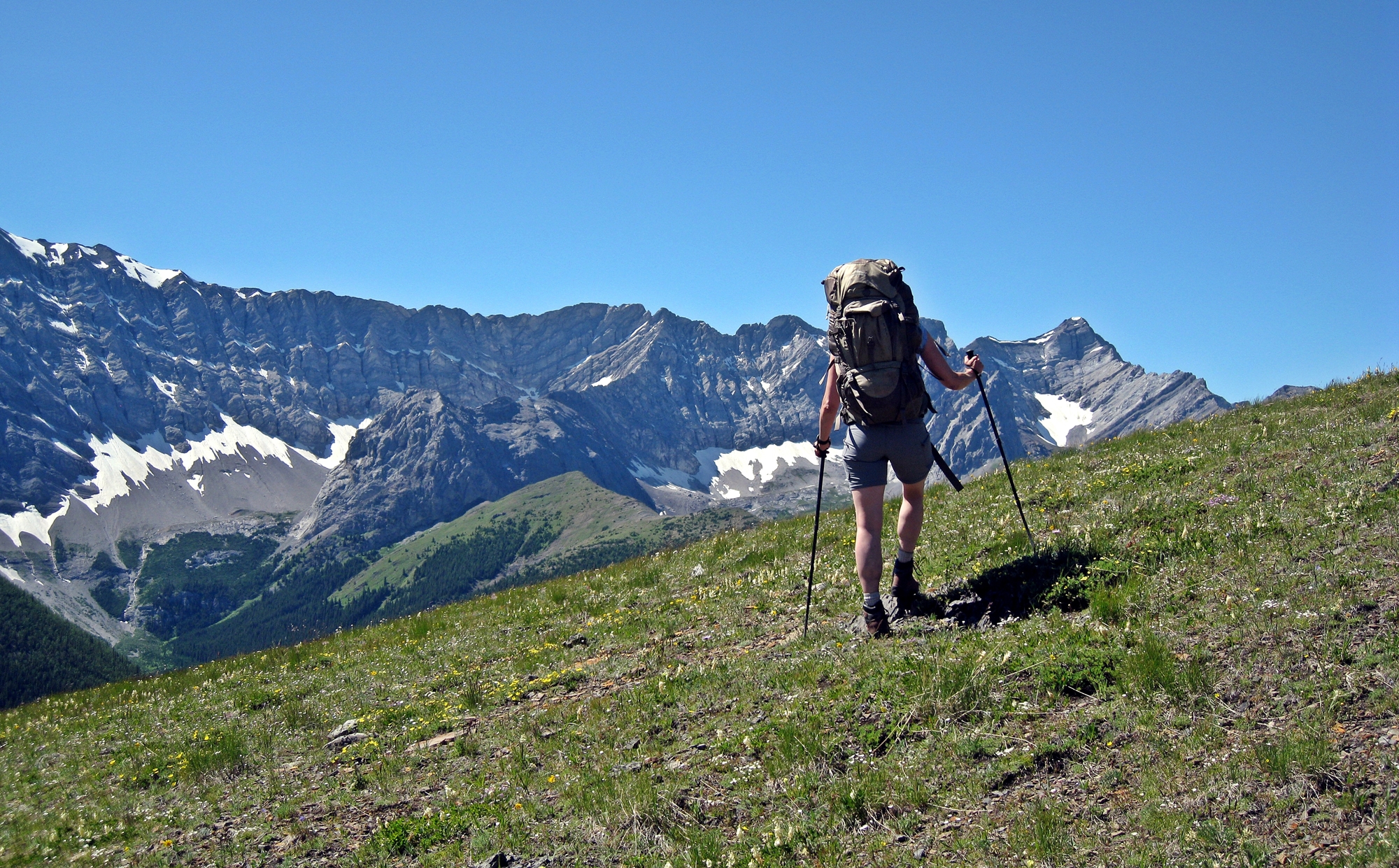
Leaving the Picklejar Creek Parking Lot the trail initially follows the small Picklejar Creek through a dense pine forest. It doesn’t take long though before the trail begins to climb and reaches a wide open slope. The trail is faint in this area but if you keep heading in the same direction you will soon reach the intersection between Picklejar Creek, Mist Ridge and Mist Creek trails. You can take Mist Creek but it spends a lot of time in the treed valley. Instead, we recommend continuing straight ahead on the long, open Mist Ridge trail.
From the long ridge walk you have unimpeded views of the surrounding rugged peaks. Mist Mountain is on one side and Highwood Peak on the other with the colourful Gibraltar Mountain further ahead. The undulating grassy ridge has a few false summits as it slowly makes its way to Rickert’s Pass.


Getting down to Sheep River on the opposite side of the pass is a bit more challenging. The steep descent on loose gravel is tiring and can be slippery. Hiking poles will help save your knees in this section. The trail though is well defined and easy to find.
Once you reach the valley below the walking is much easier. There’s a horse camp near the base of the pass with plenty of flat spots for your tent and running water in a nearby stream. Don’t take water from Sheep River as it is used by the horses.
The first time we attempted this hike was on Labour Day weekend, the first weekend in September. It had rained a little during the day and in the evening the temperature dropped quite a bit. When we woke in the morning, the ground was covered in a foot of fresh snow! Since we didn’t know the trail, we decided the safest thing to do was turn around and head back to the car. The next year we went on August Long weekend, the first weekend in August. The weather was perfect.
Note: part of the trail along Sheep River does pass through private land but it is our understanding that backpackers are allowed entry. There are also reports that this area sustained damage in the 2013 floods, so the terrain may be more difficult.


Day 2 – Sheep River to Junction Creek
Distance – 11 km (6.8 miles)
Elevation Gain – Negligible
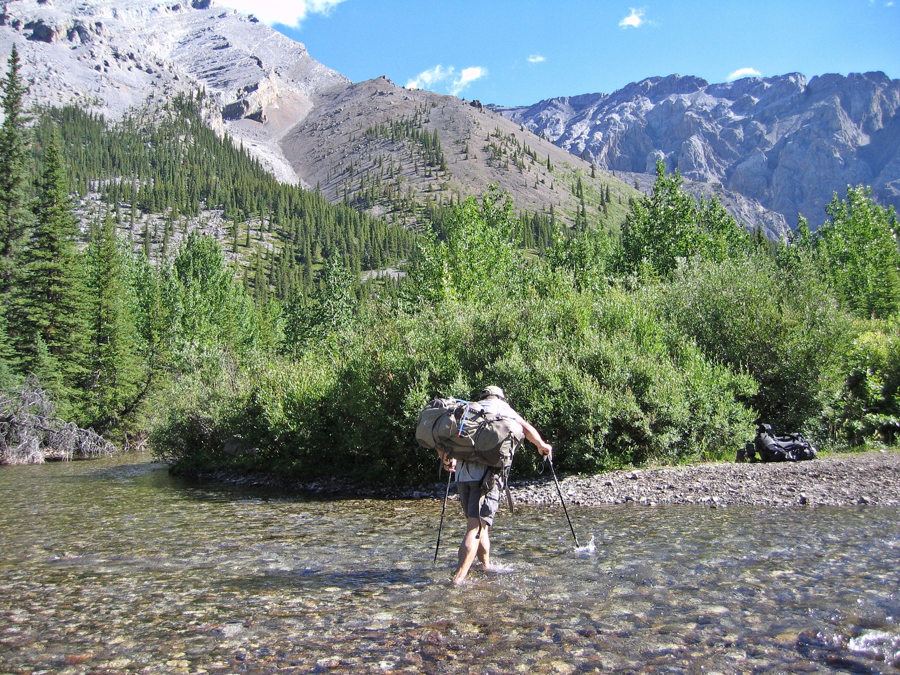
The route today is not the most scenic as it follows Sheep River along its course until it meets Junction Creek. Much of the trail is a wide horse trail with a few spots where you need to ford the river. Some sections may still not have been repaired since damage from the 2013 floods so route finding may be more difficult.

Just before reaching the confluence of Sheep River and Junction Creek you will pass the Junction Creek Day Use Area. You’re likely to see picnickers here which seems strange because until then the area felt very remote. There is road access to this part of Sheep River Provincial Park. Don’t worry though, most don’t travel much beyond the picnic area.
At the confluence turn south to follow Junction Creek on another horse trail. Continue for about 3 km and camp where you can find a flat area close to fresh running water along Junction Creek.

Day 3 – Junction Creek to Lantern Day Use Area
Distance – 8 km (5 miles)
Elevation Gain – 500m (1600 ft)
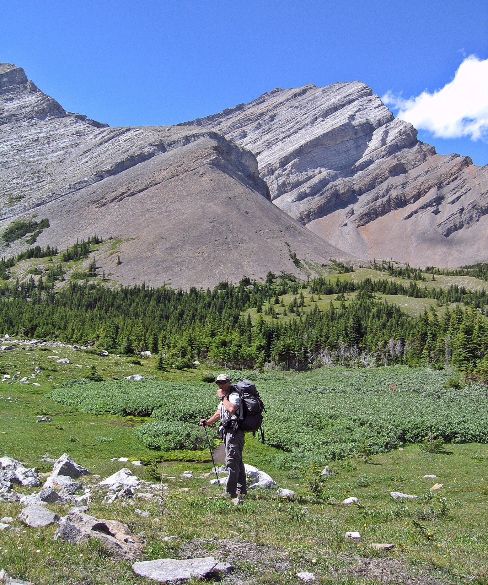
As you hike beside Junction Creek the rugged peaks of Highwood Range begin to show themselves over head. Continue to follow the creek south. After a kilometer watch for a faint trail on your right. We mistakenly missed this trail and continued going straight. The result for us was climbing up a ridge of loose scree. From there we could see the trail in the green valley below. We could have turned back, but instead we descended down the opposite side of the crumbling scree slope. It added another 300 m elevation gain to our hike, but at least we had gorgeous views.


Once we reached the valley below we found a faint trail and followed it to yet another steep scree ascent and descent, but this one lead to the pretty Picklejar Lakes.
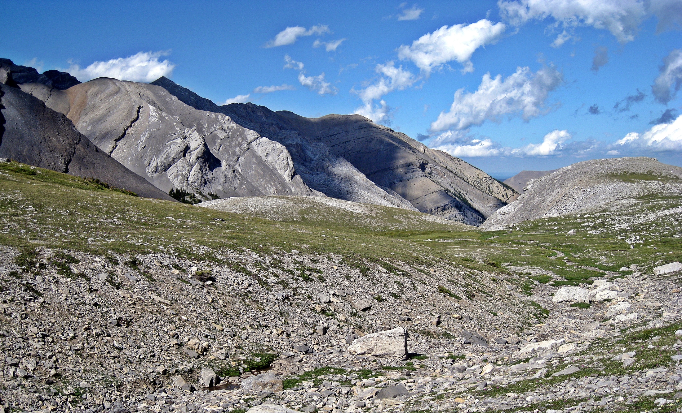


These four mountain lakes are bordered by the rugged cliffs of Highwood Range. They have a gorgeous setting.


From the lakes there is a well defined trail that climbs up and down open hills to take you to Lantern Day Use Area on Highway 40. Then you have an unappealing 1½ km plod beside the road to Picklejar Creek Day Use Area where you left your car.

Note: This part of Kananaskis is closed between Dec 1 and June 15th every year.
Tips For Backpacking in Kananaskis
• Expect sudden changes in weather. Bring a rain jacket, an extra sweater, gloves and a toque for one-day or multi-day hikes.
• Hiking poles are useful in many areas and can help save your knees when going down steep descents.
• Water taken from streams will need to be treated, filtered or boiled
• Fires are not allowed at most backcountry campsites so you will need to bring your own stove.
• Bring bear spray and/or bear bangers and educate yourself on wildlife safety.
• You will need to purchase a Kananaskis Conservation Pass.
For more hikes in the Canadian Rockies look under Treks.
Coming Next: Sailing in BC’s Gulf Islands and Howe Sound
For extra pictures from Canada click here. For pictures from other blogs go to Gallery at monkeystale.ca
To read some of out other treks click here. To read more of our adventures from around the world go to Destinations.
If you like what you read, please comment or share (with credit) using the links below.

More beautiful scenery in the back country Maggie. Thanks for sharing your hike. Allan
LikeLiked by 1 person
Thanks Allan, so much backcountry to see here!! Maggie
LikeLiked by 1 person
This trek looks like one I might be able to do with a friend. I like the names of the lakes and river, too.
LikeLiked by 2 people
It’s not as extreme as some we’ve done, but yet it’s not as popular because you have to drive a little further. One story is the name Picklejar is because there used to be so many fish in them you could catch them by dipping a pickle jar into the lake! Funny that they made it one word 🙂 Maggie
LikeLiked by 1 person
To drive a few extra miles adds to the appeal in my opinion.
LikeLiked by 1 person
Our’s too 😊
LikeLiked by 1 person
One of the things I like about hiking is green meadows and trees. I have hiked through the bare mountains but they are never fun. Overall, I feel a trail that offers meadows, forests, mountains, snow, and a waterfall is a great experience.
LikeLiked by 1 person
Yes it’s nice to have the colours of the trees, grass and lakes. In our province, Alberta, the tree line is low, but there’s usually a nice contrast with a green base and grey rocky snow capped tops. You should come hiking in western Canada Arv, You’d love it 🙂 Maggie
LikeLike
Totally gorgeous!
LikeLiked by 1 person
Thank you 🙂 Maggie
LikeLike
It takes a real hiker (or maybe it’s a clever hiker) to decide when to turn around (as you’ve done when you woke up to snow on your first attempt) … like they always say, the trail will be there tomorrow as well (or next year). Wow, once again, how lovely are those lakes! Your pictures of the high mountain peaks are always a joy to watch, thanks for sharing.
LikeLiked by 1 person
It was a difficult decision, thinking the snow would soon melt and it would be fine, but as soon as we started climbing higher, back up the pass, the snow was deeper and deeper so we knew we’d never make it the other way. It’s always tough to turn around, but as we proved, the trail was still there 🙂 Maggie
LikeLiked by 1 person
Beautiful. If I was younger and not so attached to sleeping in a comfy bed, I think I would have liked to do this.
LikeLiked by 1 person
Haha! You can take the day hike to the lakes then 🙂 Maggie
LikeLiked by 1 person
That would work!
LikeLiked by 1 person
I love the different kinds of terrains. Such beautiful photos!
I have a question – isn’t the water available in the streams pure and unadulterated? I would imagine at such locations the water available would be untouched.
LikeLiked by 1 person
Good question and maybe I should talk about that in a post. The problem is that animals walk through, drink from or pee/poop in the streams. Giardia is a concern here when drinking water from the streams without purifying. It’s not chemical contamination, but parasites. Thanks for asking 🙂 Maggie
LikeLike
This trek sounds so fun…including the names..
LikeLiked by 1 person
It was fun! Especially on a sunny weekend. Thanks for reading Suzette!! Maggie
LikeLike
Always a delightful journey 😊
LikeLike
I love that name picklejar! I don’t know why but names that have to do with pickles make me laugh! You should have seen my reaction in London everytime someone mentioned the Gherkin building
LikeLiked by 1 person
It is a funny name, and I kept spelling it wrong when typing this. There are four of them, so say that fast four times and you’ll be on the floor laughing 🙂 Maggie
LikeLiked by 1 person
Don’t. Just don’t 😂😂
LikeLike
Two great pictures in particular here – the view of the lake from above and the one of you sitting on the mighty scree slope. Both great shots. Sounds like a nicely varied trail too – you even get a bit of boring roadway just for variety!!
LikeLiked by 1 person
Thank you, I guess all of the hikes can’t be challenging all of the time 🙂
LikeLiked by 1 person
Epic views! The forests, mountain peaks, lakes, rivers and fantastic names – elements of a great hike. The shot on the Scree Slope is amazing.
LikeLiked by 1 person
Thanks Leighton, In the end we were glad we missed the turn off and ended up on that scree slope for those views. At the time though, with full packs, it was not as fun! Thanks for your comments 😉 Maggie
LikeLiked by 1 person
Your pictures are gorgeous. Climbing up and down all that loose scree sounds exhausting, but at least the views along the way are beautiful. I can see why you’d recommend hiking poles.
LikeLiked by 1 person
It is tiring but once at the top the views make it worthwhile. Next trip west you should come to Alberta!
LikeLiked by 1 person
We are actually planning to head back west at the end of June to hit up a bunch of the national parks in the Rockies 🙂
LikeLiked by 1 person
Let me know if you have any questions or suggestions. M
LikeLike
Let me know if you have any questions or suggestions. Actually there will still be snow up high in June. Most higher peaks and passes are snow covered until well after July long so don’t plan any big elevation hikes.
LikeLike
Good to know. I will definitely take you up on your offer for suggestions and recommendations for day hikes in Glacier, Mount Revelstoke, Kootenay and Yoho National Parks 🙂
LikeLike
Won’t be long now and there will be so many hikes opening up again. Nothing beats those views! Seeing your photos makes me realize that the mountains are calling 🙂
LikeLiked by 1 person
Pretty soon!! The skis are already in storage, ready for hiking!
LikeLiked by 1 person
Oh my; what an amazing experience! Thanks for sharing it with us.
LikeLiked by 1 person
Thank you!
LikeLiked by 1 person
The Canadian Rockies bear significant resemblance to the Colorado Rockies. 😊
This circuit looks absolutely beautiful and your beautiful photos make me long for the high country. For various reasons, we haven’t done a backpacking trip for too many years and likely won’t be able to do a long trek like this one, but we hope to be able to fit in a few shorter ones at some point.
Knowing how tired and sore feet get during these trips, crossing Sheep Creek and soaking one’s feet in the cold water must have been very refreshing.
LikeLiked by 1 person
The ceek did feel good but I wish it were later in day! The Rockies here are quite a bit lower than in Colorado but otherwise are quite similar. Thanks for your comments Tanja! M
LikeLiked by 1 person
Those mountains are just so spectacular! I love how rugged and tilted they are.
LikeLiked by 2 people
So many are tilted in this area and have great grooves and lines. Thanks for reading Diana! Maggie
LikeLiked by 1 person
I will never tire of the vistas you show us!
LikeLiked by 3 people
Thanks Chris!! Maggie
LikeLike
Oh wow, Picklejar Lakes look so beautiful…well, so does all of it! I’m not sure I’d manage to keep my footing on the scree, but what an amazingly rewarding walk 🙂
LikeLiked by 2 people
I just love the striations in the rock, especially the curved ones in the first picture and the curvy ones at Picklejar Lakes (love the name). In the picture of Richard fording the stream, he appears to have his pack on in a horizontal fashion. Is this because he was anticipating high water?
LikeLiked by 3 people
Hmmm, I think he was being very chivalrous and carried my backpack across. 😊
LikeLiked by 1 person
What a gentleman! 🙂
LikeLiked by 1 person
The Picklejar Lake with the Highwood Range setting is absolutely gorgeous. Also the green patches on the barren Highwood Range is an excellent contrast making it more scenic.
LikeLiked by 2 people
It is a great hike that gets you out of the trees and into different and perry terrain. Thanks for your comments! Maggie
LikeLiked by 1 person
Wishing I was here hiking instead of at my desk at work today! What incredible views of these beautiful mountains! 🙂
LikeLiked by 2 people
Haha, there’s a bit too much snow here to hike yet, but can’t wait to get out there again. Thanks for your comments. Maggie
LikeLiked by 1 person
So beautiful, the striations in the rock and the little lakes. The scree slope looks a little slidey. Had to smile at the warning about the water in Sheep River. Do you know the derivation of the Picklejar name?
LikeLiked by 2 people
One story about the name is that there used to be so many fish in the lake that you could easily catch them by dipping a pickle jar in the water. It would come out full of fish. That’s certainly not the case now but some people hike to it with a rod and reel so there must be fish in it.
LikeLiked by 1 person
I love that story! 😄
LikeLiked by 1 person
Can’t you picture the early explorers with hemp ropes and burlap sacks making up that name 🙂
LikeLiked by 1 person
It’s great scenery, Maggie! Love that shot of you perched on the scree slope. A well deserved sit down! Have a great week!
LikeLiked by 2 people
Thanks Jo, It was a seat with a view!
LikeLike
The mountains look majestic, the weather nice, the water crystal clear, the trees lush. What is there not to love? These kinds of photos always brighten up my mood. On a side note, I’ve noticed that some of my blogging friends have started traveling abroad again. I wonder if you have planned something similar in the near future.
LikeLiked by 3 people
Thanks Bama, we’re not sure when and where we’ll travel next. The government restrictions for getting back in to Canada were just reduced so we’re finally thinking about it. We had wanted to go to Poland where Richard is from, but with the war I’m not sure that’s the best idea. One country we really want to go to soon is Pakistan to hike to K2 basecamp, but I don’t think it’s a good time to go there yet. Next in my list is Bolivia and actually the Yukon in northern Canada. So in other words we have no idea but at least we’re starting to look. How about you? Any plans to travel?
LikeLiked by 1 person
This war really is the last thing everyone needs right now. Travel planning-wise, we’re very much in the same situation. I’ve been looking up destinations closer from home (somewhere in Southeast Asia), but nothing has been finalized so far. The fact that now I can start planning to travel again really brings so much hope and joy.
LikeLike
Wonderful scenery and hike!
Think you’ve changed your blog site design (since I visited last)? Looks fabulous! I’m working full time so it’s hard to keep up with all my favourite blogs. 😦
LikeLiked by 2 people
Thank you, I did change the design, glad you like it 😊 Maggie
LikeLiked by 1 person
Yes, it’s very clean. I’m thinking of changing mine but I always add so much CSS but then WP changes the platform and the CSS doesn’t work anymore. 😦
Did it take you long to do?
LikeLike
It wasn’t difficult but it only changed going forward. I went back and reformatted some of the old posts to the new layout but haven’t done them all. I don’t do CSS so don’t know how it’s affected.
LikeLike
WOW! Another stunner.
LikeLiked by 1 person
Gorgeous hike! Thanks for sharing the pics & info, Maggie! 🌞
LikeLiked by 1 person
Thank you Lisa! Maggie
LikeLiked by 1 person
I’ve spent some time in this area, although not on this exact hike. You’ve brought back some wonderful memories!
LikeLiked by 1 person
Great! Glad we were able to bring those memories back of our beautiful province!! Maggie
LikeLiked by 1 person
Your photographs are brilliant, really showing the scale and size of those mountains against you! 💛🌲
LikeLiked by 1 person
Thanks Cherryl!
LikeLike