
The 8-day circuit trek in Peru’s Cordillera Huayhuash is known for its high mountain passes and jaw-dropping views. We certainly found that to be true in our first two days of walking. (Part 1) The next two days would prove to be no less spectacular.
Day 4 – Huayhuash to Cuyoc Pampa
Trekking Time – 5 hr 40 min (plus breaks); Elevation Gain – 633 m (2,077 ft) & 550m (1,805 ft); Elevation Loss – 350 m (1,148 ft) & 708 m (2,323 ft)
We stepped outside of our tent in the morning to see the early rays from the sun bring the surrounding mountains to life. We experienced a lot of cloud cover on the first few days on the trail so this view was a nice change.
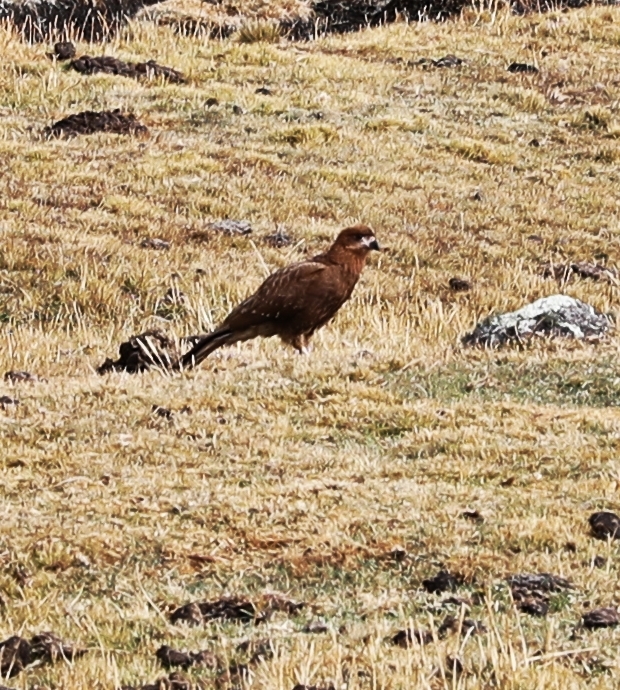
The clear sky didn’t last long though. Clouds rolled in before we began trekking. Instead of taking the common route to visit the thermal baths, we took an alternate trail and hiked over Paso del Trapecio. The trail from Huayhuash Camp brought us up another steep climb, passing flowering bushes and around the side of a grassy hill. On the way we saw a couple of brown Andean eagles sitting on the dry grass.


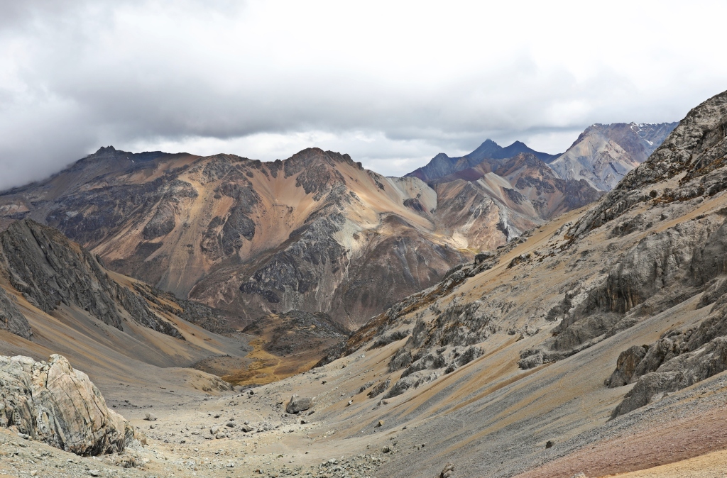
As we got higher, the clouds started to boil around the mountains and the ground was covered in a fresh layer of snow. The final approach is on rough, rocky terrain that added even more texture to ominous scene.


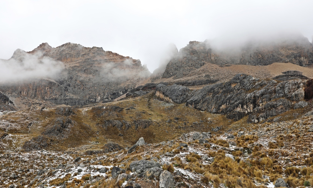
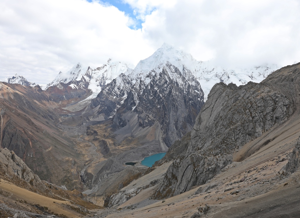
Trapecio Glacier started showing itself to us from below. As we got closer we could see its wild side, filled with large seracs and cervices. Paso del Trapecio (5,050 m/16,570 ft) is a long ridge that allows a 360° view of the mountain ranges. On one side is Trapecio and its glacier and on the other is the rocky Cuyoc Mountain standing above stunning turquoise glacier tarns. We stayed awhile to enjoy the scenery.

The descent from the pass was initially quite steep, but then meandered its way through an open field filled with large boulders. Hardy plants grew next to the trail in the most uninhabitable places. The rocky landscape led into another grassy slope across from the towering Cuyoc. From this slope we could see our next campsite, far below. But that wasn’t our destination quite yet. Looking up was the long steep, scree slope that led to Santa Rosa Pass high above.


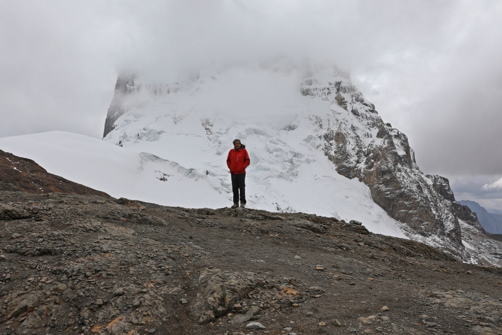
It started to snow as we began our ascent toward the pass. We wondered if it would be worth it or would the view be obscured by clouds and snow. Hiking up the long gully was a slog, but our persistence was more than rewarded. At the pass (5,200 m/ 17,060 ft), the snow had stopped and we looked across to see Serapo Mountain guarding the blue, glacier-fed Laguna Jurau. Even though the mountain tips were shrouded in clouds, the view was breathtaking.
Looking behind we saw a colourful string of mountains beside Cuyoc. The contrast between the view in front and behind made the pass even more impressive.

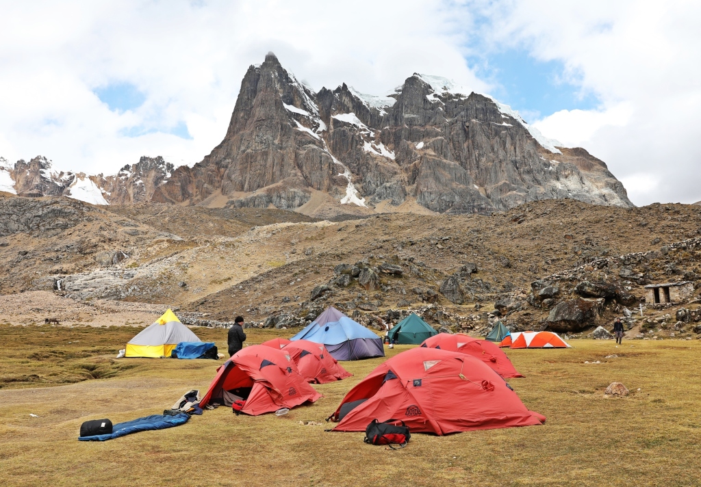
After spending time enjoying the vista we descended back down the same trail. We went all the way to the valley bottom to our next campsite, over 700 meters below. With such a gorgeous view from the lookout we didn’t expect a beautiful setting for our campsite, but that’s exactly what we got. Set below the magnificent rocky Cuyoc Mountain, we couldn’t have asked for a better end to our day (4,492 m/ 14,738 ft).
While sitting together in our dining tent each night, one or two of us would share a funny story of a mishap or adventure from their life. One trekker told a story that happened when he was a 14 year old boy living in a Christian commune. He was admittedly very naïve and believed it when another boy told him he may have been born with chlamydia. He immediately sent for a mail-order chlamydia test. The problem arose when the test was sent to the commune’s head office. The shock to his conservative parents when they opened the package was immense. They were bewildered at the possibility that he could have contracted chlamydia in the commune. He never took the test and wasn’t born with chlamydia. He was a great story teller, you can follow him on Instagram.
Day 5 – Cayoc Pampa to Huayllapa
Trekking Time – 5 hr, 36 min (plus breaks); Elevation Gain – 650 m (2,230 ft); Elevation Loss – 1,530 m (5,020 ft)
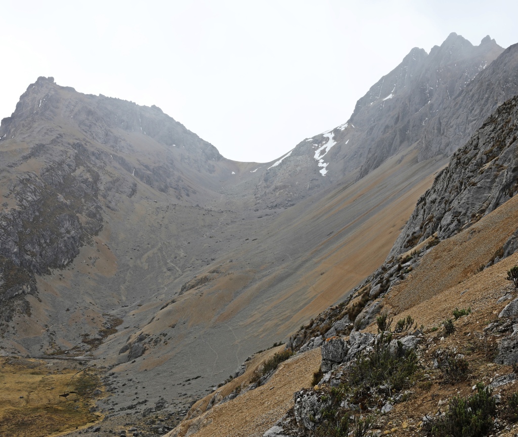
Immediately beside the gully leading to Santa Rosa Pass, is another drainage leading to Antonio Pass. This pass held one of our most anticipated views. After leaving camp we began to cross the ridge between the two gullies. Soon we could see the long drainage that led to the pass at the top.
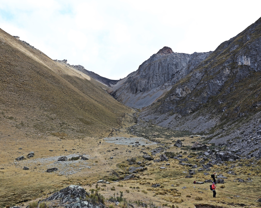
The trail was dusty and then rocky as it zig-zagged its way up the gully. Near the top it was covered in scree and the trail headed straight up the slope rather than taking an easier switchback approach.
We we were out of breath as we reach the pass and the view left us speechless. Laguna Jurau, that we saw from Santa Rosa Pass, was on the right, Serapo was in front and poking out from the left was Suila Grande. This mountain and its rugged glacier became famous in the book Touching the Void. The book tells the story of two British climbers who were on an expedition on Suila Grande. They ran into serious problems on their descent. The story is a gripping account of their journey. We highly recommend the book and movie.
On the side of Suila Grande a mountain range coloured in orange and gold added even more beauty to this gorgeous setting.


From the pass we could see what would have been the British climbers’ basecamp next to a glacier tarn on the moraine. Above it is a glacier so convoluted that it looks impassable. Looking up, long couloirs lead to the summit, one of which they climbed. The glacier and the couloir play a major role in the story. For mountaineers it is an awesome site.

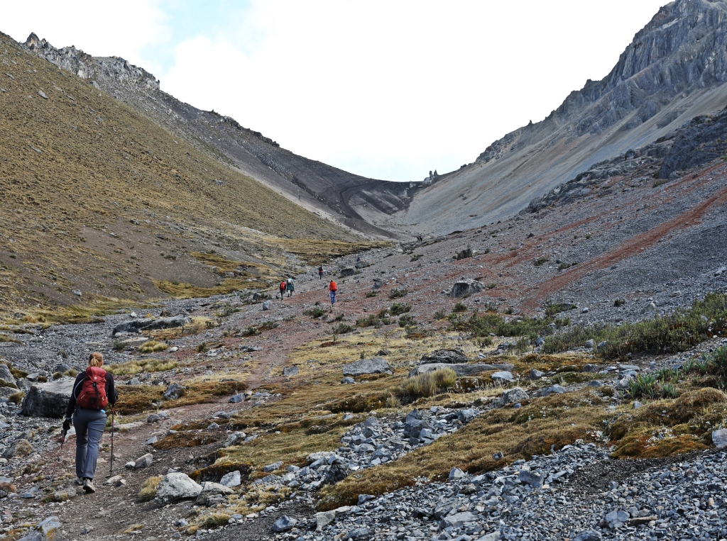
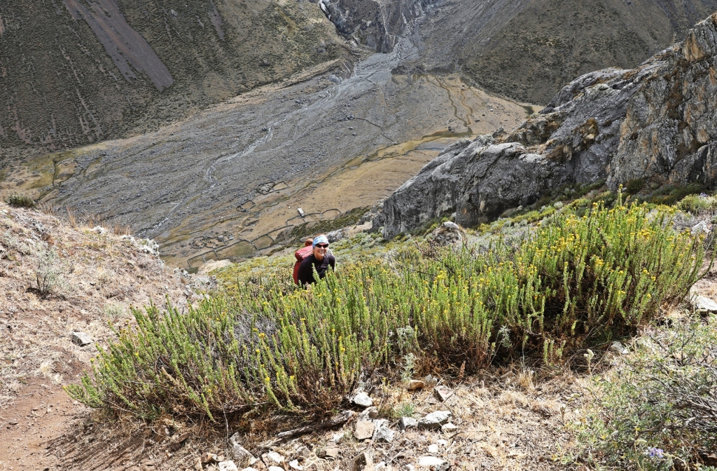
We had a big discussion with our guide the night before regarding how we should get down from the pass. Descending the other side was said to be dangerous. Because of this warning, some of our group retraced their steps back toward Cuyoc Pampa Camp before continuing to our next destination. We decided to join the remainder of our group and go down toward Suila Grande basecamp. The first 100 or so meters of this descent are quite sketchy as there is only a thin layer of scree on a very steep slope and no defined path. After that 100 m though, we found a good trail that was steep, but better maintained and quite manageable. As we descended, our angle of view of the mountains changed and they showed us their even more dramatic sides. We were very glad we decided to take this way down.
Once we were half way down we looked back up to the pass and could see the steepness of the trail. Being on such a sharp descent, it didn’t take long to reach the elevation where flowers and bushes could grow along the trail.


Once at the valley bottom we stopped for a snack and watched at least a dozen condors soar overhead. We had seen many condors on this trip, but usually only 2 or 3 at a time, not a dozen. It’s fascinating to watch them use the thermals to soar as they search of food.


The rest of the day felt quite long as we followed the river all the way down the valley. In one area we walked through a nice canyon with vertical walls on both sides. The lower we walked, the more the vegetation changed. Bushes became larger and more were covered in flowers. Tall eucalyptus trees began to fill in the landscape. This vegetation made it easy to realize that we had lost a lot of elevation. Finally we arrived at a lovely multi-tiered waterfall that made a great spot for a rest.
As we neared the town of Huayllapa, the trail travelled between stone fences. On one side were crops of wheat and potatoes, and on the other were corrals for cattle and sheep. The hills above were covered in terraces, filled with green crops. From the amount of farms, we could tell we were about to enter a much larger village than we had seen yet.


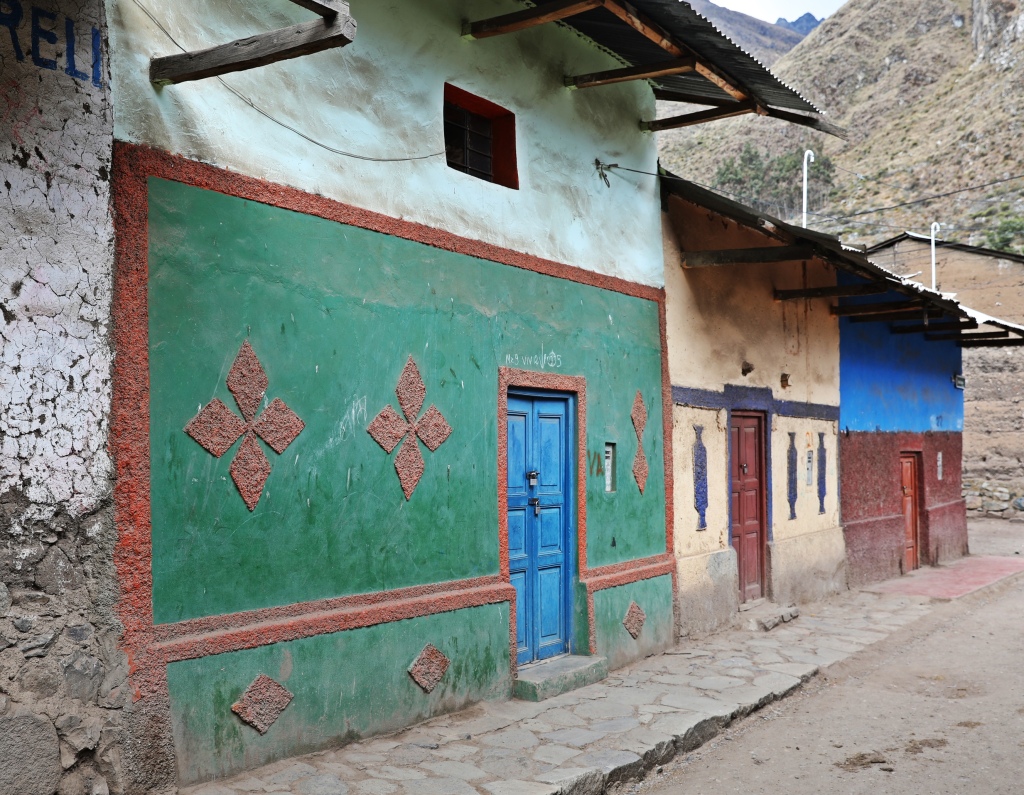
We had descended all the way to 3,490 m (11,463 ft) and the air felt very thick. The 100 or so rustic adobe brick homes in the town of Huayllapa reminded us of mountain villages in Nepal. Many of them added brightness to their brown brick walls with colourfully painted doors and windows. There are a few shops and a guesthouse, but as it was Sunday, the dusty streets were quiet. The only people we saw were a few quechua ladies in their traditional skirts and hats. We treated ourselves to Inca Kolas from the store and then strolled along the few streets in Huayllapa. The sweet drink really hit the spot.


Coming Next – Trekking in Peru’s Cordillera Huayhuash – Part 3
For pictures from other blogs go to Gallery at monkeystale.ca
To read about more of our adventures go to Destinations.
If you like what you read, please comment or share (with credit) using the links below

The colour of those lakes… just stunning!
LikeLiked by 1 person
I know they’re quite amazing colours! Maggie
LikeLiked by 1 person
Oh wow, this landscape looks out of this world… Thanks for sharing your adventure!
LikeLiked by 1 person
It is one of the most beautiful hikes we’ve done. You should consider it, you’d love it! Maggie
LikeLiked by 1 person
I have added it to my list after reading your stories. Looking forward to the next ones. Thank you!
LikeLiked by 1 person
The textures and roughness are more evident in this set of photographs than usual. The tactile appearance feels somewhat personal.
LikeLiked by 1 person
Thank you, I think the lighting was better, but also the landscape was much more varied. Glad the reality of the landscapes came through. Maggie (for Richard the photographer 😊)
LikeLiked by 1 person
I could just sit here and stare at these photos all day. It’s SO gorgeous. Seeing this in person must have been incredible.
LikeLiked by 2 people
It is almost unbelievable, and day after day we would be in awe at the views. When are you going?! 😊😊 Maggie
LikeLiked by 1 person
I would go tomorrow if I could! We have a couple other trips we are working on planning, so I’m not sure when we’ll get to Peru. But this has bumped it up higher on my list for sure!
LikeLiked by 1 person
A great read and, as ever, the photos are stunning! What a wonderful adventure you folks are having!!
LikeLiked by 1 person
Thanks Colin, the mountains in Peru are really spectacular 😊 Maggie
LikeLiked by 1 person
You are cvery welcome! 🙂 Yes, they looked stunning!!
LikeLike
Wow, incredible scenery and photos! The stark landscape makes every plant and flower shine so brightly! Thank you for sharing this beauty.
LikeLiked by 1 person
Yes there is so much to look at on this hike and it changes all the time. How the plants can thrive is beyond me! Maggie
LikeLiked by 1 person
What an absolutely wonderful trek! And great photos to see things and places I had never seen before!
LikeLiked by 1 person
Thanks! It is a gorgeous part of Peru. Maggie
LikeLiked by 1 person
Oh Maggie it is gorgeous
LikeLike
Every thing from the mountains to the resilient plants is beautiful. I a imagine that being there in person takes your breath away.
LikeLiked by 1 person
Yes, both the elevation and the beauty took our breath away 😊 Maggie
LikeLiked by 1 person
Amazing post! Such an interesting read and wonderful images❣️
LikeLiked by 1 person
Thank you Luisa!
LikeLiked by 1 person
You’re more than welcome ❤️❤️❤️
LikeLike
Wow… awesome clicks, Maggie!! Great read, thanks!!
LikeLiked by 1 person
Thanks Jyothi!
LikeLiked by 1 person
This was a incredible post Maggie, almost made me sit upright in excitement. Peru and the mountains- i really felt so much like the Himalayas and even the villages. Lovely.
LikeLiked by 1 person
Thank you, Cordillera Huayhuash reminded us a lot of the Himalayas too. The spectacular scenery, high mountain passes and you’re right, even the villages reminded us of Nepal. Maggie
LikeLike
Ya Maggie! Pray that I get to do it someday 🙂
LikeLike
Also the other day, i was going through your Gangotri Trek but the the link was not available! See when you get time.
LikeLiked by 1 person
Thanks for letting me know. I think I’ve corrected it now. I’m not sure what happens with WP, but it seems like some of the older links get dropped. I appreciate letting me know 🙂 Maggie
LikeLike
Ya..it happens. Gangotri is an important trek. Many pilgrims search for it on net. Pleasure Maggie !
LikeLike
I was literally drooling over your photos and those beautiful mountain views, it is no wonder that Peru’s Cordillera Huayhuash is considered to be the best alpine trek in the entire world. Thanks for sharing and have a good day 🙂 Aiva xx
LikeLiked by 1 person
Yes it’s hard to beat these views. Thanks for your thoughts Aiva, Maggie
LikeLiked by 1 person
A spectacular adventure. These mountains are so different than our own. I am with you on the steep descents. Sometimes, it is better not to look back up until you are all the way down. Glad you shared your adventure Maggie. Allan
LikeLiked by 1 person
Haha exactly! It actually didn’t seem that bad until we looked up!
LikeLiked by 1 person
Well done, you two! Colossal hiking. I would certainly need some colour if I lived in that village, but actually I can’t imagine living there.
LikeLiked by 1 person
No I couldn’t imagine it either. Their houses obviously don’t have heating or any modern conveniences! Tough life! Maggie
LikeLike
Stunning photos. What a beautiful trek – seems totally worth the effort. I hope I’m able to visit Peru some day.
LikeLiked by 1 person
It is worth it, hope you get there someday 😊
LikeLike
Another impressive trek, thank you for the post, it is good to read; it is refreshing.
LikeLiked by 1 person
Thanks so much, I appreciate your kind words. Maggie
LikeLiked by 1 person
Absolutely, incredibly wonderful – you guys have done a lot of fabulous treks but wow this looks one of the most stunning. I’m guessing you experienced some real changes in temperature (as well as oxygen levels) with those radical changes in elevation. Amazing experience.
LikeLiked by 1 person
That’s for sure, we were so glad we brought our down jackets and warm sleeping bags:) It was funny how warm it seemed when we went down to the town, but in reality it was over 3,000 m so still really high! Maggie
LikeLiked by 1 person
Wow what an awesome adventure and landscapes 😍
LikeLiked by 1 person
Thank you 🙂 Maggie
LikeLiked by 1 person
Is it possible for me to get altitude sickness while I read your account? I think it is. I was excited, exhilerated and exhausted, sliding around on scree. But the views kept me going. Thanks for this adventure. A great way to start a Winter’s morning.
LikeLiked by 1 person
You’re welcome, glad you didn’t suffer like we did 😊 Maggie
LikeLike
What a fabulous experience. Simply breath-taking. Mel
LikeLiked by 1 person
It was an awesome trek, difficult but amazing 😊
LikeLiked by 1 person
One of those ‘once in a lifetime’ experiences, no doubt.
LikeLiked by 1 person
Ha, yes, because I’ll never be able to do it again!
LikeLiked by 1 person
🙂
LikeLike
Wow, Huayhuash, amazing!!! Great photos.
LikeLiked by 1 person
Thanks, it’s one of the best treks we’ve done!!
LikeLike
The view at San Antonio Pass is awesome! Congratulations on bagging this trek.
LikeLiked by 1 person
Thanks it’s been on our list for a while and it certainly didn’t disappoint even with our high expectations. Maggie
LikeLike
Huayhuash is one of my biggest dream…it will be amazing…wonderful photos❤
LikeLiked by 1 person
Veronica, this is the hike for you! It’s one of the most beautiful ones we’ve done. Maggie
LikeLike
Oh yessssss 😍😍😍 I could only imagine Maggie❤
LikeLike
It amazes me how nature is never cluttered – and never boring, even when it plays with browns and beige.
LikeLiked by 1 person
That’s so true,the colours,, even the browns were very pretty
LikeLike
Stunning place and thanks for the virtual trek…much more comfortable from my sofa than what you had to do…(Suzanne)
LikeLiked by 1 person
Haha, glad you came along on the trek 😊 Maggie
LikeLike
Wow, you have so many stunning pictures of the turquoise water and snow capped mountains. I can sense that it’s definitely a challenging trek, but you must have enjoyed all these spectacular views!
LikeLiked by 1 person
The views more than made up for the struggles of going up and down the mountains at altitude 😊 Maggie
LikeLiked by 1 person
Beautiful photos. I can imagine the power and the energy within those mountains permeates all you experience there.
LikeLike
What a beautiful planet we live on. You captured this part very well.
LikeLiked by 1 person
It really is, isn’t it!
LikeLike
Two very rewarding, though challenging treks. The views of the lakes and colourful mountains are amazing, plus the eagles, condors and vegetation that grows on such high altitude and rocky terrain, are amazing. The little town of Huallyapa also captured my imagination.
LikeLiked by 1 person
The little town was cute, it reminded us of a Nepal mountain village. Every day on this trek provided us with something amazing. That’s pretty good for such a long hike. Thanks for giving your thoughts Leighton, Maggie
LikeLiked by 1 person
Looks amazing! I can’t get over the colors. Lovely post.
LikeLiked by 1 person
Neither could we 😊 Maggie
LikeLike
While I have heard of many places in S America for trekking but never came across Peru. The scenery is stunning with the rugged landscape.
LikeLiked by 1 person
Peru has some great multi-day hikes and this one provides some of the best views we’ve ever had. It’s a photographer’s dream. 😊 Maggie
LikeLiked by 1 person
Good to know. Thanks for the insights, Maggie. 🙂
LikeLike
Such a fabulous hike and a wonderful place to see. We loved seeing the mountains in Peru but the altitude was so high for me.
LikeLiked by 1 person
Thanks Anita
LikeLike
What a rugged landscape! The views are awe-inspiring. thank you for sharing your adventure with us, Maggie and Richard! ❤
LikeLiked by 1 person
Thanks Cheryl, it is a beautiful part of Peru 😊 Maggie
LikeLiked by 1 person
Wow this looks like challenging terrain but the views are absolutely gorgeous – I particularly like the ones across from Santa Rosa Pass
LikeLiked by 1 person
Santa Rosa and San Antonio beside it were out of this world gorgeous. Thanks for your input Hannah 😊 Maggie
LikeLike
Great pictures and wow, what a descent! The reward of the views must have been all the sweeter for the risk. And yay – Touching the Void is on Amazon Prime. It just went on the list! We love shows like that.
LikeLiked by 1 person
It’s a mountain film/documentary style so don’t expect a Hollywood movie, but I think the format is better for it. Let me know what you think of the movie!
LikeLiked by 1 person
No, that’s ok. We like them like that, and will do.
LikeLike
It’s too bad about all the cloud cover, but the scenery and views still look stunning. I love how colourful the landscape is. I’ve seen Touching the Void a few times. It’s so good.
LikeLiked by 1 person
I guess you can never have perfect weather in the mountains. 😊 It was really cool to see Suila Grande and the route they must have taken up and down.
LikeLiked by 1 person
You both are amazing! I always look up to people like you who seem to always be on the active side because that really is the best way to ensure good health in many years to come when you’ve reached your 70s, 80s, or even 90s.
LikeLike
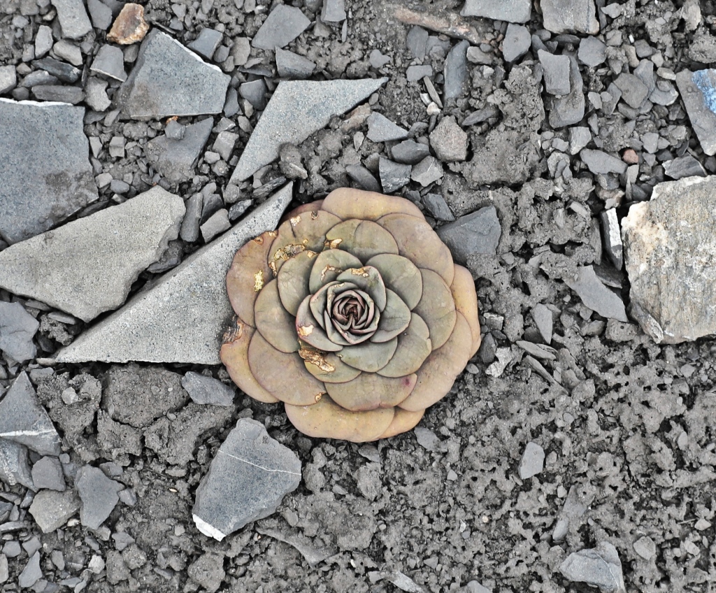
That leathery looking flower is amazing. I guess it must be a cactus, isn’t it?
LikeLike
Random observations:
Even before you mentioned a scary descent, I was eyeballing those scree slopes and shivering with nervousness.
I have read Touching the Void; seeing the place where it all happened would give me goosebumps.
I would have liked to see a photo of you WITH the two Incan women in Huallyapa! Quite a height difference, I would guess!
Gorgeous lakes and scenery; I am smitten with this trek.
LikeLiked by 1 person
Yes I was glad I had poles for the descent – and experience. It was a little surreal being so close to Suila Grande and imagining their epic journey. The ladies weren’t really too interested in us, I’m not sure they would have posed, but the height difference would have been quite funny. It really is one of the most scenic treks, even the dud day had views, you should do it!! Maggie
LikeLiked by 1 person
Great follow up to part 1. The Santa Rosa pass looks amazing. Must have been cool seeing the Andean eagle. Looked like a difficult and rewarding trek, thanks for sharing.
LikeLiked by 1 person
Thanks Erik, there are so few treks that have such gorgeous views every day. There were some tough days but you’re right, very rewarding. Thanks for giving us your thoughts, Maggie
LikeLike
Gorgeous photos, especially the Suila Grande part of the trek. I might have chosen the other way around, but your photos from the scree slope are a good reason to go that way. The blue of the lake just pops.
LikeLiked by 1 person
Even though the mountains were quite arid there were so many colours in the landscape. Yes we’re glad we went down that scree slope 😊 Maggie
LikeLiked by 1 person