
With its unique location close to the Andes mountains, the Altiplano and the jungle, there is an endless list of possible day trips to keep you busy around La Paz. Here are our favourite day trips that we enjoyed during our time in La Paz.
Camino del Muerte (Death Road)
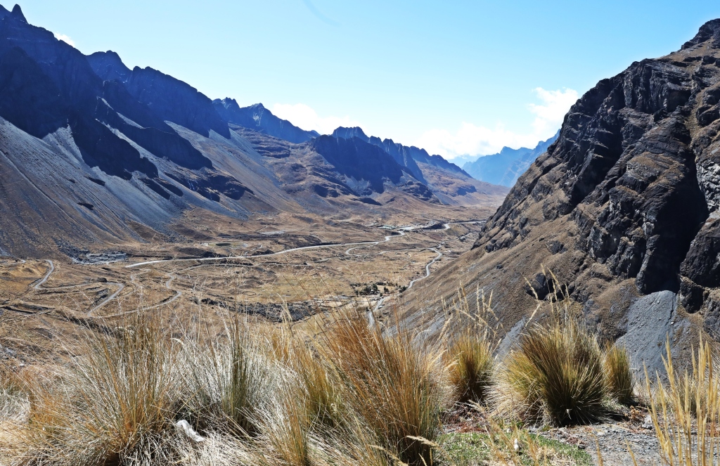
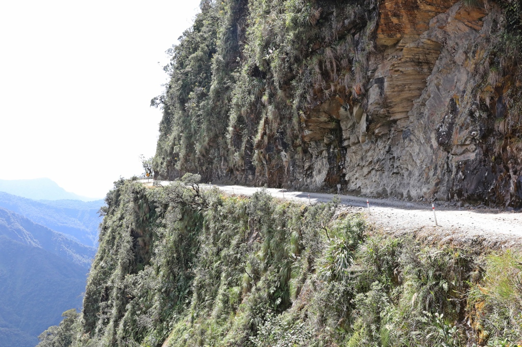
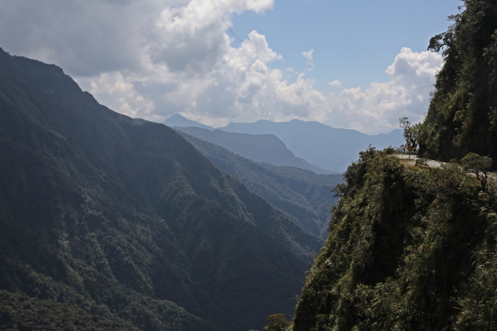
Dressed in full helmets, elbow and knee pads, we were ready to tackle Camino del Meurte (Death Road). For many years this narrow gravel road was the only way people could get from La Paz to regions in the northeast. The road descends from the “La Cumbre” (summit) at 4,650 meters all the way down to the Yungas region at 1,200 m (3,900 ft). That’s a loss of 3,450 m in less than 70 km. This curvy, gravel road has a mountain wall on one side and an unprotected 1,000 m shear cliff on the other. In many places the road is barely wide enough for one vehicle and yet it is a two-way road. When it was used as a major thoroughfare 200 – 300 people died in motor vehicle accidents on it every year.
Finally in 2007 a new paved highway was opened with wider lanes, tunnels and guard rails. Since the new road opened, Camino del Muerte has been used by mountain bikers as a place to go for a fun downhill ride.


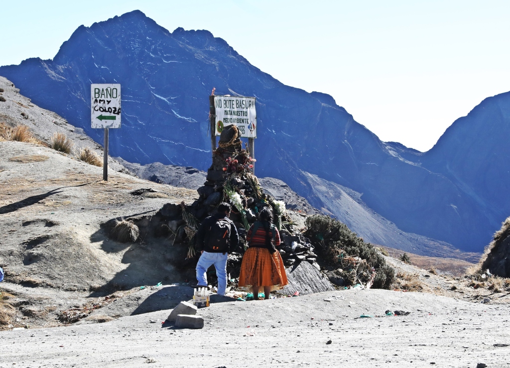
We started biking from La Cumbre. The first 8 km of the bike ride was on asphalt. The guides used this section to assess our riding skills and make sure we were all capable handling the upcoming ride. The disconcerting part was the number of witches we saw at La Cumbre. We tried not to upset them for fear of being cursed before descending Death Road.


After we proved our capabilities on the asphalt, we were ready to bike down the old gravel road. Hunched over on our mountain bikes we quickly gained speed on the initial straightaway section of the road. Just before reaching the first series of sharp corners we slowly applied the brakes as our tires spun out on the lose gravel. Since we do a lot of single track mountain biking at home maneuvering around the next 66 km of tight switchbacks wasn’t difficult, but our hands and shoulders were tired from the constant jarring of the uneven road.
As a bike ride, it’s not actually dangerous. There are still many sharp corners, steep drop-offs and thick gravel, so caution is needed, but what is narrow for a bus is plenty wide for a bicycle.


In total we biked down 3,450 m on a steep 66 km winding, gravel road. On the way we had a few stops so we could both enjoy the view and see the terrain that was coming next. Even though it wasn’t dangerous, it was still a fun and unique way to spend the day.
At the end of the ride we enjoyed a late lunch in the warm climate at 1,200 m (3,900 ft). The temperature in the jungle was much different than in La Paz where we began our day.

Tour Operators – There are many places in La Paz near Calle Sagarnaga that offer these bike trips. We went with the company No Fear and were very happy with their bikes and guides.
Tiwanaku
Not far from Lake Titicaca on the Bolivian Altiplano is a relatively unknown pre-Incan site. In approximately 110 AD the Tiwanaku people established a settlement that survived almost 1,000 years. Covered in sand for centuries, only 20 percent of the ancient ruins have been uncovered today.
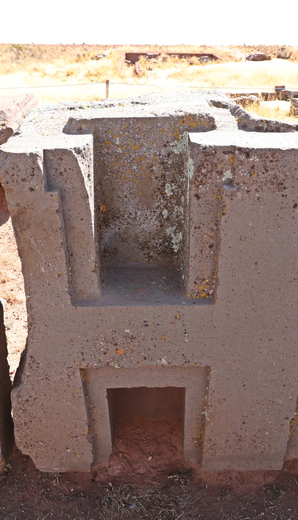
The interesting part of visiting this site was learning about the large boulders and stones used to build the temple walls. Massive volcanic boulders weighing close to 100 tons were brought from the Kapia Volcano in Peru a staggering 65 km away. It is not known for sure, but researchers believe that the boulders were brought on reed rafts that were floated across Lake Titicaca. The rafts would have been similar to the ones used by the indigenous living on Lake Titicaca today. During the Tiwanaku civilization times, the city reached the edges of the lake and from there the boulders would have been floated through the city on canals.
These volcanic rocks were used as pillars in the construction of temple walls. Others were used as standing stone monoliths with important mythological creatures and ceremonial customs carved into them.

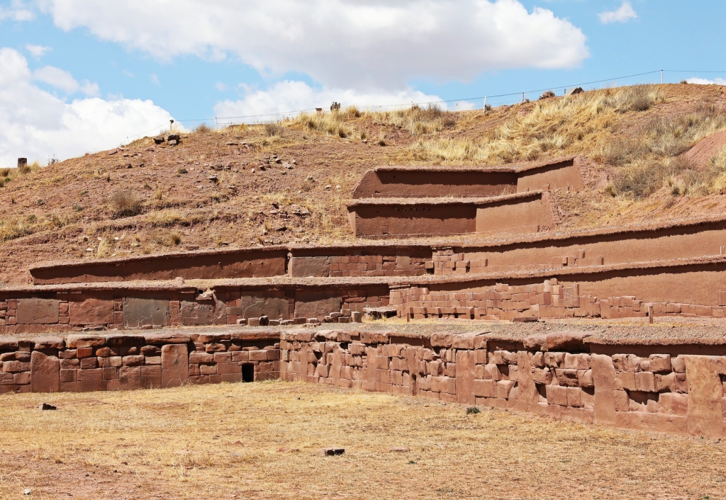
Between the large volcanic boulders were smaller red sandstone rocks cut into bricks. The original volcanic pillars remain standing today, but the red sandstone bricks had to be replaced with new ones. The originals were taken by the Spanish to build churches. We saw one of these churches in the nearby village of Tiwanaku.

Unlike the volcanic rock, the red sandstone was brought from the nearby mountains. Even though the mountains were relatively close, it would have been no easy feat to haul the giant sandstone slabs to the city. The heaviest ones remaining on the site are 130 – 180 tons.

The Tiwanaku carpenters were very skilled at cutting the stones. Exact cuts ensured the joints fit together perfectly. As well, perfect edges were made when engraving the Tiwanaku Cross. Even today, researches don’t know how they were able to make such precise cuts in the hard rock. Equally impressive is their technology to join the stones. They used interlocking patterns and metal keys to make their walls stable. These techniques were later copied and improved upon by the Incas.


An interesting part of the Tiwanaku culture is their shamans. The on-site museum has mummified remains of one of them. It is believed that the shamans were selected because they were breech babies. The hours old infant had a hole drilled in their skull and then their head was wrapped in tight bandages. This would cause their skull to elongate as they grew. There were always 14 active shamans at a time, divided equally between men and women.
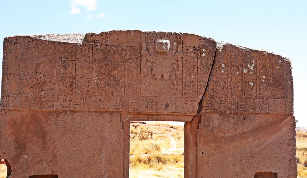
Inside the museum a 24 foot tall monolith of a male shaman is the largest known Tiwanaku statue. It has been carved to have the physical features of a shaman dressed in ceremonial dress with images of important mythological creatures. Pictures weren’t allowed in the museum, but there were other, smaller monoliths in the outdoor temples.


There are three temples at the Tiwanku site. The first is a raised temple for the shamans (Akapana). Beside it is a submerged temple (Kantatallita) with 270 head carvings coming out of the walls. The third is a large temple (Kalasasaya) with a stone Sun Gate. Unfortunately not much of these temples remain.


Admittedly the remains that are left are a little underwhelming. Much of the ruins are still buried and those that have been uncovered were looted; first by the Incas and then the Spanish. If you do visit, it’s worth it to take a guide. Without one, you wouldn’t understand most of the site.
Finding a tour – It is quite difficult to get information about this tour in La Paz. Some hotels and hostels offer tours, or there is a kiosk at the Terminal de Buses that sells tickets for the tour. You are picked up at the bus station between 8 and 9 am.
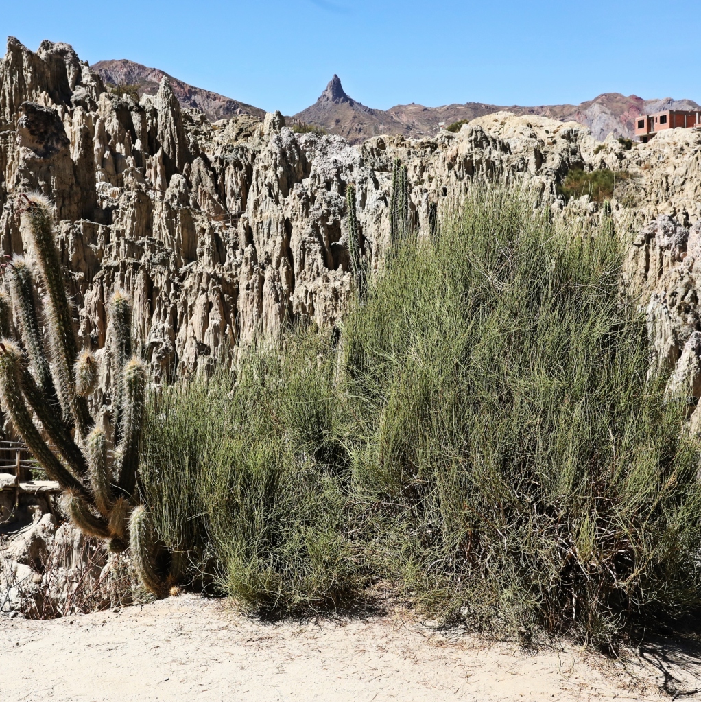
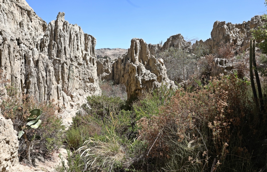
Valle de la Luna (Valley of the Moon)
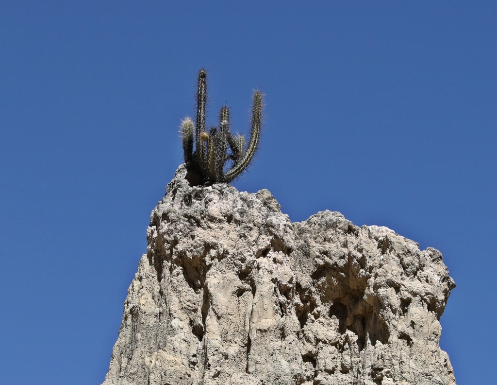
On the edge of La Paz is a small park with an interesting landscape. Looking as if it were a part of the moon, tall cliffs of clay have been eroded by wind and water making unusual looking pillars, craters, gullies and caves.


You’ll find all sorts of cacti in many shapes and thorny bushes growing in the harshest settings.
There are 2 walking routes in the park; a 15 minute trail and a 45 minute trail. We suggest taking the longer trail because you wouldn’t see much on the 15 minute trail. It is a small park and we recommend seeing it only if you’re not visiting other parts of Bolivia. There are similar landscapes in larger settings in other parts of the country.

Getting to Valle de la Luna – Take the Green Teleferico to its end and walk to Calle 8 where you can catch a shared minibus.
To read about our other adventures in Bolivia click here.
Coming Next – A Bolivian Safari
For pictures from other blogs go to Gallery at monkeystale.ca
To read about more of our adventures go to Destinations.
If you like what you read, please comment or share (with credit) using the links below

Ok, if I believed in reincarnation, I would want to come back braver and fitter so I could live and travel like you. What an amazing place. So many things to see and so many stories. That breech birth and drilling a hole in the baby’s skull is one that I won’t forget soon.
LikeLiked by 4 people
Yes it’s a horrifying story. And that’s what they do to the revered, imagine what happened to the less favoured!! Maggie
LikeLiked by 1 person
grandioso!
LikeLiked by 2 people
Grazie!!!
LikeLike
I have heard of Camino del Meurte and often thought it would be an exciting ride. I fear it is too late for me, but was glad to ride down Haleakala in Maui after seeing the sunrise. Always good when pedalling is at a minimum. Glad you survived Maggie. Allan
LikeLiked by 2 people
Especially at that altitude, peddaling up hilll would have been awful! 😊 Thanks for your comments Allan! Maggie
LikeLiked by 1 person
Wow! That road looks intense. I can’t believe you guys biked all the way down it. How did you get back up? Did you have to ride?
LikeLiked by 1 person
It’s not bad because it’s wide for a bike, but you still have to pay attention the entire time. The tour rents you the bikes , gives a ride to the start and then gives you lunch and a ride back to La Paz. We did have a few sections where we had to bike up hill and at that elevation it was really tough, but thankfully very short.
LikeLiked by 1 person
Fabulous, but not for those without a head for heights, I think!
Thank you for sharing!
LikeLiked by 2 people
Haha yes you’re probably right!
LikeLiked by 2 people
I had never heard of the Camino del Meurte and I think it is really fascinating and a bit difficult
Thanks a lot for this interesting post, Maggie 🙏
LikeLiked by 1 person
Thanks Luisa! Maggie
LikeLiked by 1 person
You’re more than welcome!
LikeLike
Thank you as always for another fabulous travellog photo-essay. The weather and bright sunshine is fabulous. Great photos. You mentioned that the bike ride in Camino del Muerte was not dangerous…the photo with the bike atop a rocky outcrop ooh…that looks pretty steep to me. Yikes!
LikeLiked by 2 people
Haha well that was just me posing for effect 😊 Maggie
LikeLike
Oh, LOL. It worked 🚲 🙄
LikeLiked by 1 person
I felt like I was on the road with you! Also, that cactus on the top of the rock looks like it’s giving tourists the finger
LikeLiked by 2 people
That’s what we thought too 🤣
LikeLiked by 1 person
I remember this meme going around of a cactus photoshopped as giving the middle finger and the caption was, “The environment saying goodbye to Scott Pruit”
LikeLiked by 1 person
What incredible scenery! Biking on the death road must be such a great experience! The ancient statues were amazing too. When we next visit Peru I’ll have to hop over to La Paz!
LikeLiked by 1 person
It’s worth a couple of days to explore. The bad thing is that it’s expensive to fly into but you can bus from Puno in a few hours.
LikeLiked by 1 person
Great stuff. I’m a bit concerned by your ‘even though it wasn’t dangerous, it was still a fun… day’. What must you do to celebrate birthdays?
LikeLiked by 1 person
🤣🤣
LikeLike
What an amazing place/trip! That bike ride took my breath away and my (somewhat under control) fear of height kicked in 🙂
LikeLiked by 1 person
It might be tricky with a fear if heights, but you can stick to the mountain side 😊
LikeLiked by 1 person
Oh my goodness! That bike ride is something else…good thing you have some experience back home with mountain biking. I can’t imagine being in a vehicle on that narrow road!! I’m beginning to think there isn’t much that the two of you won’t try 🙂
LikeLiked by 2 people
Haha, it was more scary being in a bus on similar road than being on a bike 🙂
LikeLiked by 1 person
No doubt!!
LikeLike
Great photos as ever! Thanks for the photographs of Tiwanaku. The ancient peoples in what is not South America had cement making technology. Forgive me for leaving a link to an article I wrote: https://fakeflamenco.com/2022/04/19/did-aliens-build-bolivian-monuments/
LikeLiked by 2 people
Oh, I hadn’t heard that. Thanks for the article. I’ll look at it in the morning.
LikeLiked by 1 person
They didn’t talk about cement in Tiwanaku, but the guide did talk about the organic matter. He said researchers explained that the stones were most likely covered in water, I think from Titicaca, from time to time. But he say they didn’t know how the stones were cut so maybe they are cement! They don’t really know much about the site or the people since there was no written language. It’s remarkable which ever way they built it! Maggie
LikeLiked by 1 person
Thanks for reading. The stones in your pictures look similar to the site with the organic concrete. Amazing structures.
LikeLiked by 1 person
Yes I think some of your pictures are from Tiwanaku.
LikeLiked by 1 person
“now” instead of not : )
LikeLiked by 1 person
Camino del Meurte reminds me of the Hogback in Utah, a narrow stretch of road with cliffs on each side and NO guardrails! Once was enough! You are quite brave. Great post and photos as usual.
LikeLiked by 2 people
Well navigating the narrow road on a bicycle is easier than a car. I hate traveling thse roads on bus!
LikeLiked by 1 person
This feels like proper South American Wild West stuff, from the name to all its dramatic viewpoints. That shot of you wheeling your bike near the cliff’s edge (posing or not) is a keeper and representative of everything this exciting trail has to offer. Love the monoliths too, a wonderful article Maggie as always.
LikeLiked by 1 person
Thanks Leighton. Posed! I was planning on jumping the cliff 🤣. Thanks for adding your thoughts. Maggie
LikeLiked by 1 person
I would have done the bike trek in my younger years, not so much now. However, the archaeological exploration remains appealing. A trip to Bolivia would be worthwhile just for the ancient sites alone.
LikeLiked by 1 person
Bolivia has a lot more to see than we had imagined. It’s definitely worth a visit , Maggie
LikeLiked by 1 person
The bike ride through the gravel path is so interesting and that too with these amazing views. The Tiwanaku site in itself is so great with such incredible ancient architectures.
LikeLiked by 2 people
It always amazes me what people could build in ancient times. Tiwanaku’s engineers and architects must have been very clever. Thanks for sharing your thoughts! Maggie
LikeLiked by 1 person
You’re a very brave soul to bike down that. No question as to why it’s named the death road with all those sharp turns and tall drop offs. But man, what a thrill that must have been!
LikeLiked by 1 person
It was so much fun!!
LikeLiked by 1 person
Kudos to you for taking that bike hike! I’m getting dizzy just looking at the photos… 🙃
LikeLiked by 1 person
Haha, it’s not for everyone but wedrather bike it than drive it!! Maggie
LikeLiked by 1 person
Wow, just look at all the amazing adventures you have been on! Hats off to you for braving the infamous North Yungas Road, aka Bolivia’s Death Road, as it snakes around a mountain. I’ve seen a good few documentaries about this stretch of a dirt road in the mountains west of La Paz where dozens of people have lost their lives in traffic accidents on the extremely narrow and curvy road. I would love to explore the otherworldly landscapes found at Valley of the Moon to take in the jagged, steep, hillsides that have been dramatically eroded by wind and water. Thanks for sharing and have a good day 🙂 Aiva xx
LikeLiked by 1 person
Thanks Aiva, there are so many remarkable places to visit in Bolivia. I love how they take a bad story, Death Road, and then it into a tourist attraction. Thanks for adding your thoughts. Maggie
LikeLiked by 1 person
Amazing stuff, each of these are excursions we would want to take…though possibly not on the Death Road by car. Love picking up stories of shaman and the “magic” they performed. What a terrific city and area La Paz sounds.
LikeLiked by 1 person
The city has many unique and unusual parts. From deadly roads to llama fetuses. We’re not in Canada anymore😊
LikeLiked by 1 person
You’ve certainly been to some interesting places. The scenery is quite staggering but I doubt I could cope with that road.
LikeLiked by 1 person
Thanks Jo, the ride isn6as bad as it looks, but I guess it’s not for everyone 😊 Maggie
LikeLiked by 1 person
This is a good selection of activities. I found many good reasons not to do the Camino del Muerte, but looking back I don’t think I was right. I liked the visit to Tiwanaku, one of the civilizations that served as a base for the Incas, with their own mysteries. The Valle de la Luna is easy to visit, to avoid wasting time searching for transportation, a taxi ride is not expensive. I would recommend the Golden Hour where the earth takes on an even stronger colour.
LikeLiked by 1 person
We probably should have gone to valle later in the day, but it didn’t work in our schedule. Thanks for your thoughts!! Maggie
LikeLiked by 1 person
I love the hiking photos. I haven’t come across any naked mountains or roads when hiking in Japan yet. The mountains here are pretty lush, so seeing somewhere like Death Road is exciting. I’ve never been to Bolivia, but now I can see why it’s an attractive place for adventurers 😊 I’ll keep coming back for your other adventures!
LikeLiked by 1 person
Thank you, yes the mountains in Bolivia are very high, often high above tree line making it a great place to hike. Thanks for reading and adding your comments. Maggie
LikeLiked by 1 person
We visited there in Boliva ..such an incredible site we visited and so much hiking around. Great images.
Anita
LikeLike
Wow – something for everyone in this post!! I loved the photos from the Death Road but these carved rocks and the way they were assembled is fascinating! Great post Maggie!!
LikeLiked by 1 person
Thank you! Yes I hadn’t thought about it but they are very different days, but both worth doing 😊😊 Maggie
LikeLiked by 1 person
The contrast works very well!! You guys are certainly having a great time!! Keep well! 🙂
LikeLiked by 1 person
Having a name like Death Road does not sound the most comforting or inviting!! Of course you guys would check it out! Glad to hear it wasn’t super sketchy or terrifying. Your pictures along the way look gorgeous. The landscape in Valle de la Luna looks so cool with all those interesting formations. And I love the cacti growing amongst the rocks.
LikeLiked by 1 person
This sounds and looks like fascinating experiences. I’m glad you made it safely down the Camino del Muerte (an ominous name). My carpal tunnels would prevent me from 66 km of gripping handle bars.
The Herculean feat of transporting all the heavy boulders to Tiwanaku reminds me of similar efforts used to build the Egyptian pyramids, or the Ancestral Puebloan buildings at Chaco Canyon in New Mexico. It’s amazing how they all did it.
LikeLiked by 1 person
I just find it incredible to learn about the knowledge and skills these ancient civilizations had. And we think we’re so smart 😊 Maggie
LikeLiked by 1 person
That’s how I feel, too!
LikeLike
Wow, your photos are beautiful. I will never understand how all these ancient places were built without modern technology! Incredible.
LikeLiked by 1 person
I know, I am always stunned at what the could accomplish!! Maggie
LikeLike
You mountain bike! What is it that both of you don’t do? 😃 Truly inspiring. And you visited Tiwanaku. The first time I learned about this place it immediately evoked my imagination, especially that one image of the Sun Gate I saw many years ago.
LikeLiked by 1 person
The history of Tiwanku is fascinating. They were amazing architects and engineers, but sadly the site doesn’t have much to it. I wouldn’t say you should travel to Bolivia to see it but if you’re in Bolivia it’s worth a visit. Maggie
LikeLiked by 1 person
You guys really see and do some cool stuff. The husband would live to do Death Road on a bike. Frankly, I’d rather do it on a bike than in a car. The stone masonry of the pre-Incans is amazing. Whenever I read about ancient civilizations moving huge stones (Stonehenge, this, etc.), I wonder if they thought, mischievously, “Heh, heh, future civilizations will be totally stymied by our stone-moving methods.”
LikeLiked by 1 person
Haha good point, maybe it was all to confuse us!! Death Road is much more enjoyable on a bike than a bus an perfect for you two!
LikeLiked by 1 person
loved Bolivia it offers so much to the visitor. the road of death looks pretty special, have heard of it but I elected not to stay in La Paz when i visited. hopefully one day I will get back!
LikeLiked by 1 person
Absolutely stunning images!
LikeLiked by 1 person
Thank you!!
LikeLike
I love the look of the Camino del Muerte but as a non-cyclist it would sadly be off-limits for me. I find myself wishing it were still possible to drive it – or rather, to be driven! As for those shamen monoliths, how stunning are they?! That’s definitely a must-see for me if I make it to La Paz – and if you keep posting sights like these, I will have to try to do just that 😀
LikeLiked by 1 person
Ha ha! The monoliths and all of the construction techniques at Tiwanaku were very interesting. Maggie
LikeLiked by 1 person
Such a unique landscape. Some pictures are similar to the landscape here in Ladakh.
LikeLiked by 1 person
Yes because it’s so high and so dry the landscapes are quite similar. We even saw similarities between the aymara/quechua women and the Tibetan. Same size, hair etc.
LikeLiked by 1 person
Great! Thanks for sharing, Maggie
LikeLike
hi…Bolivia is an amazing country, full of mysteries, culture, history and adventure. I was in Chacaltaya, on a quick stop in La Paz going to Machu Picchu. the roads were narrow, unmarked, mostly unpaved, and one car passed at a time. at every turn, the horn sounded to know if another vehicle was coming from the other side. not to mention the altitude. it was a magnificent life experience as was your wonderful and sensitive post. thank you so much.
LikeLiked by 1 person
Bolivia is indeed an amazing country. There is so much to see with its diverse landscape and rich culture. Thanks so much for taking the time to comment. Maggie
LikeLike
Ok, my hands are sweating and my heart is in my throat right now! The Camino del Muerte looks absolutely breathtaking (scary)! You are adrenaline junkies in overdrive!!
LikeLiked by 1 person
Haha, it’s actually more scary to be on a bus than a bike!! 🙂
LikeLiked by 1 person
This is so amazing and educational. We have Bolivia on our list for next year. Thank you so much for this. These are areas we have not read about! You guys rock! Cheers!
LikeLiked by 1 person
Oh great! We spent 45 days in Bolivia so we traveled throughout. Let me know if you have questions about anything. I’m not sure your budget but we stayed in an awesome hotel in La Paz that I’d recommend, Qantu. It’s a budget hotel but very nice and good location and breakfast.
LikeLiked by 1 person
Thanks so much. I sent you a message on IG. Will check out the hotel. Con mucho gusto!
LikeLiked by 1 person
De nada 🙂
LikeLike