
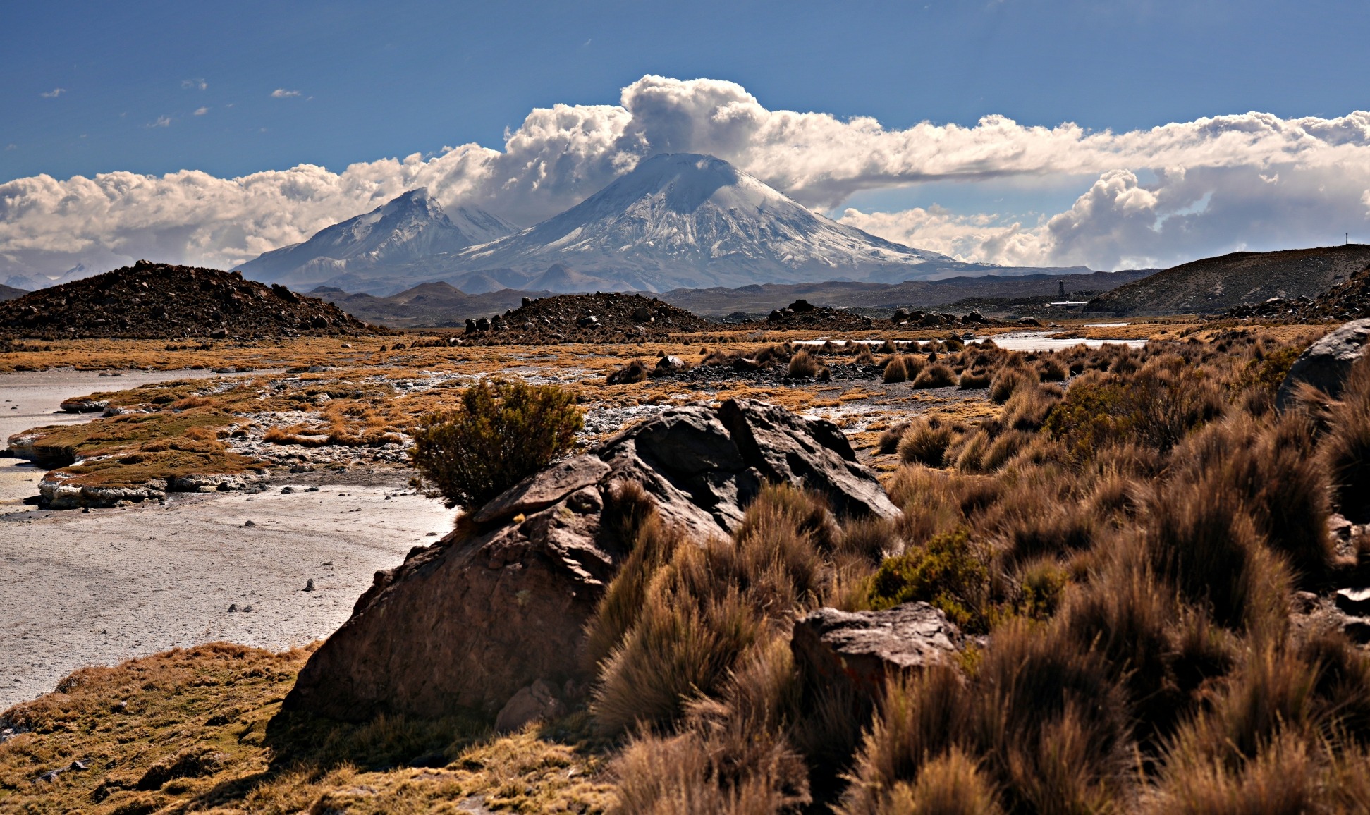
Ruta de las Flores (The Flower Route) connects a series of cute towns set on a high plateau between the peaks of El Salvador’s volcanoes. Blooms of wildflowers coat the area’s hills and valleys in a multitude of colours between November and February. Although the flowers are how this area got people’s attention, it is the small, artisan towns with vibrant markets and frequent festivals that keep people coming throughout the year.
Ruta de las Flores is located in the blue box in the map of El Salvador below.

Click on the link to go directly to Travel Tips For El Salvador.
The five towns that make up Ruta de las Flores are Ataco, Apaneca, Salcoatitán, Juayúa and Nahuizalco. The larger cities of Ahuachapan and Sonsonate are located at either end of the route and provide access to the area. Unfortunately, we were there in April when the blooms were mostly finished but we did get to enjoy the atmosphere of the towns. We visited all of them except Nahuizalco and Ahuachapan and are excited to show you what to expect when you visit Ruta de las Flores.
Town of Ataco
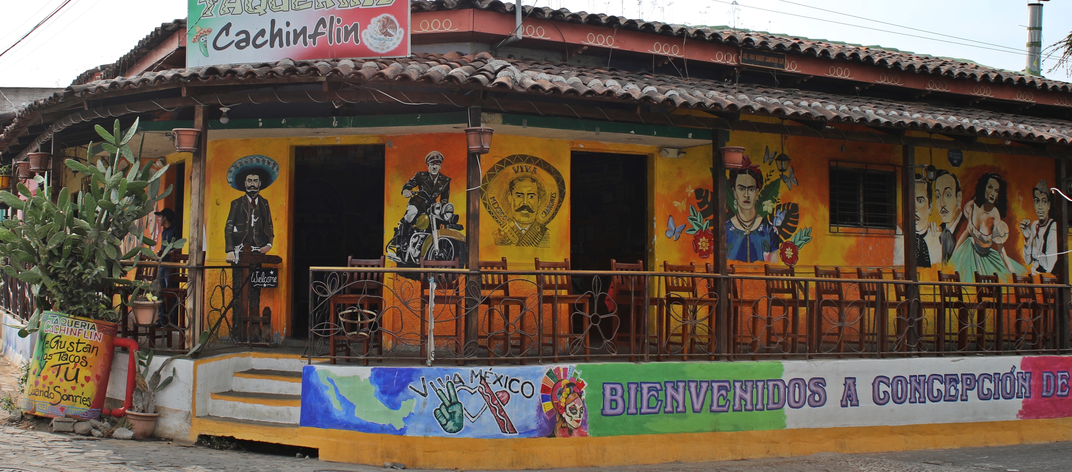
The small, colourful town of Ataco (1,225 m/4,020 ft) has a unique location inside the crater of an extinct volcano. Many artists live in Ataco and their paintings, weavings and crafts are for sale at the many small shops in town. Colour comes from the painted homes and also from the street art that decorates many of the buildings in town. Of the five towns on Ruta de las Flores, we think Ataco is the prettiest.


Ataco was originally settled by the indigenous Pipils people. They migrated from central Mexico to El Salvador in the 11th century and some decided to make Ruta de las Flores their home. Pipils speak Nahuat and in this language Ataco means ‘Place of High Water Springs’. Nahuat likely originated from Nahuatl, spoken by indigenous Mexicans such as Mexicas (Aztecs). Like the rest of the region, Ataco was colonized by the Spanish in 1543 and the name was formally changed to Concepción de Ataco.
One of the nicest features in the small town is the garden-filled main square, Fray Rafael Fernandez Park. Providing shade to much of the park are two large ceiba trees. They are unlike any trees we’ve ever seen. Their huge limbs seem to grow into each other. It may be an example of inoculation where two trees growing close to one another morphological join. Whatever it’s called, these trees are a work of art


On the edge of the park is the large Immaculate Conception of Maria Church. The wooden ceiling inside the sanctuary reminded us of the mission churches in the jungles of Bolivia.


Surrounding the square are low roofed buildings with verandahs in front. Cafés and restaurants fill the verandahs with tables and chairs and make great places to stop for a coffee. Farmers have been growing coffee beans on the slopes of the volcanoes since the mid 1800s and it is now one of the main economies in the region. The coffee here is very good. It’s dark with a hint of chocolate flavouring and is not as bitter as other coffee we’ve had in Central and South America.


On the streets surrounding the main square some of the heritage buildings house crafts and artisan shops. At night, there’s more action in the town as busy markets spill out onto the streets and the parks are filled with families. There is an energetic buzz in the town at night.


For a bird’s eye view of Ataco, head up an easy trail to Mirador del Cruz de Cielito Lindo (Cross From Sweet Heaven Lookout) located just above Iglesia el Calvario. From there you have a panoramic view of the town and the jungle covered volcano walls surrounding it.


Apaneca
The next town east of Ataco is Apaneca (1,400m/4,699 ft). The town’s name is also a Nahuat word that means ‘River of the Wind” in English. We think it is the second nicest town on the route.
In 1577 a Franciscan monk built a church in the already established indigenous village. Today the very large San Andrés Church seems a little out of place in the centre of this humble town. Beside the church is a cute plaza surrounded by craft shops and restaurants.


The main reason we visited Apaneca was to see Laguna Verde (Green Lagoon) (1,540 m/5,052 ft). Its located 5 km (3.1 miles) from town and involves a 170 m (560 ft) elevation gain. We walked to the lake, but if you don’t want to walk you can also take Uber, or rent an ATV. El Salvadorians seem to love the ‘adventure’ of driving an ATV up the partially paved road to the lake. Many were wearing ski goggles although the road was rather smooth and not very dusty.
We’re not sure it was worth it though. Instead of being a picturesque volcanic crater lake, it is a very small lagoon.


Salcoatitán
The next town on Ruta de las Flores is Salcoatitán. The main feature in town is Parque la Ceiba where we found a massive, ceiba tree that is over 350 years old. This one has long branches extending out to provide a lot of shade underneath.
The town is very small, though so there is not much to see other than a few colourful homes and of course a Catholic church or two.


Juayúa
The pre-Columbian city of Juayúa (1,060 m/3,480 ft) is the largest of the five in Ruta de las Flores. It is a very busy city without the charm of the smaller Ataco or Apaneca. Its Nahuat name translates to ‘River of Purple Orchids’. We’d rather call it this since it took us forever to learn how to correctly say Juayúa. It is pronounced Hoo-A-Yu-A (or as we remembered it, ‘Who-a You-a’).
The city hosts a food festival every weekend which is very popular with El Salvadorian tourists. We arrived mid week so missed out on the festivities.
Juayúa’s Central Park is the city’s nicest spot with large trees and several park benches. The main feature is Santa Lucia Church that is sometimes referred to as Cristo Negro. When the Spanish were attempting to convert the local indigenous people to Catholicism, they often modified indigenous’ beliefs to align with Catholic stories. One of those involved their important black warrior god Ek Chuah. He was so important to the people that they went on pilgrimages to Esquipulas, Guatemala to see it. The Spanish morphed this god into their Christian stories and eventually it became Cristo Negro (Black Christ) rather than Ek Chuah. In the late 16th century, priests brought an icon of the Cristo Negro of Esquipulas to Juayúa and established a hermitage. Eventually that building was replaced by today’s Church of Santa Lucía Church which is why it has the nickname Cristo Negro.


Seven Waterfalls Hike
Backpackers flock to Juayúa because it is the starting point for the Seven Waterfalls Hike. Unfortunately, most of these backpackers don’t even bother to explore the other towns on the route. They don’t know what they missed.
Since there is so much hype about this hike, we thought we should do it too. We joined a guided tour and went with them into the jungle.

Once on site we realized that the ‘trail’ travels through the river, literally. So, wearing our shoes and socks, we stepped into the shin deep water and made our way up river. Waterfalls 1 (La Toma/The Taking), 3 (Cascada Arcoirus/Rainbow Waterfall) and 5 (Novena Ocho/Ninth Eight), are quite similar. These wide waterfalls are quite pretty as they drop straight down over sheer cliffs.


Waterfall 4 (Cascada Escalata/Rock Climbing Waterfall) is the reason there is so much excitement about this hike. True to the name, the route climbs straight up the waterfall. Our guide set up a rope for everyone to use, but the climb is not difficult. The rope seemed to more of a gimmick than anything, but it was still fun to climb up a waterfall.


We then walked across the middle of waterfall 6 (Borbollan/ Bubble) so that any remaining dry parts to our clothes were now completely drenched. Waterfalls 2 (Cascada Seca /Dry Waterfall) and 7 (Cascalita/Little Waterfall) were so small we almost didn’t notice them.

After walking up and through these seven waterfalls our guide had a little more in store for us. We walked in our soaking wet shoes up and down the dusty hiking trail and passed two small waterfalls until we reached the prettiest of them all, Los Chorros de la Calera (The Limestone Jets). At this one, the water drops straight down over a wide cliff forming a nice swimming pool below. The thick vegetation adds to the pretty scene. This waterfall can be reached on its own without talking the Seven Waterfalls Trek and is a very popular trip.

It was fun, but not as much as we had hoped or been told it would be.
How to do the Seven Waterfalls Hike
Even though the walking is not difficult, you will never find all of these waterfalls on your own. There are a few guides in Juayúa offering group or private hikes. In spring 2024 the cost for a group hike was $15 USD per person and $150 USD for a private hike.
You can’t swim in any of the seven waterfalls, but you can swim in Los Chorros de la Calera.
Sonsonate
Ruta de Flores ends in the busy city of Sonsonate. We walked around its downtown area stopping at the market. The busiest vendors were the cobblers’ and tailors’ stalls who were set up on the side of the road.


We didn’t have to take the local colectivos (share-taxis), but we did in other parts of El Salvador.

You will likely need to take a bus from Sonsonate to your next destination, but there really is no other reason to spend time in the city.
Best time to visit Ruta de las Flores
If you want to see the flowers, the best time to visit is between November and February. Rainy season runs between May and October and is not a very good time to visit. We were there in April when there weren’t many flowers but there also wasn’t much rain.
Getting to Ruta de Las Flores
To reach the towns of Ruta de las Flores you could rent a car in San Salvador, Santa Ana or a scooter in one of the beach towns.
The other options are to take a chicken bus from San Salvador to either Ahuachapan or Sonsonate. From Sonsonate bus 205 runs frequently, but it is better us to take the Select Bus. For only $1.30 you have an air-conditioned bus and your luggage can go underneath as opposed to the chicken bus where you need to bring it on-board. Select Bus leaves from across the street from the Chicken Bus Station in Sonsonate. Both buses arrive at Terminal de Occidente (westside bus terminal) in San Salvador.
If you’re in Santa Ana, you can take a chicken bus directly to Juayúa. From El Tunco, you need to first get to La Libertad where you can take a chicken bus to Sonsonate.

Getting Around Ruta de las Flores
Getting between the towns on the Ruta de las Flores is also easy because chicken buses run between them all day long. For each town, the bus stop is on the highway on the edge of the town. Some chicken buses run only between Ahuachapan and Apaneca, or between Sonsonate and Juayúa. Check with the driver if you’re not sure. They leave every 30 minutes, from 4:30 am until 6:00pm.
These buses are a fun way to see El Salvadorian life. People use these buses regularly whether travelling to work, home from shopping or to visit family. There’s always a lot of action on board between the vendors selling all types of food to the flashing lights and loud music played by the driver.

Safety in Ruta de las Flores
Ruta de las Flores is one of the safest parts of El Salvador. In fact, recent changes in government crackdowns on gang violence has made the entire country a lot safer. Even with this decrease in crime, always use safe practices such as not carrying a lot of cash or expensive jewelry or walking alone at night when travelling in El Salvador.

To read more of our adventures in El Salvador, click here.
Coming Next – Visit Colonial Suchitoto, El Salvador
For pictures from other blogs go to Gallery at monkeystale.ca
To read about more of our adventures go to Destinations.
If you like what you read, please comment or share (with credit) using the links below.


We'd love to hear from you, please leave a comment.