
Tucked away, in Argentina’s remote north, is a quaint mountain village sheltered by dramatic cliffs, giving it a spectacular setting. Due to its remoteness, Iruya is not often visited by foreigners. Those who do make the trip to Iruya are rewarded with a quiet, easy-going town and phenomenal scenery.
Driving to Iruya
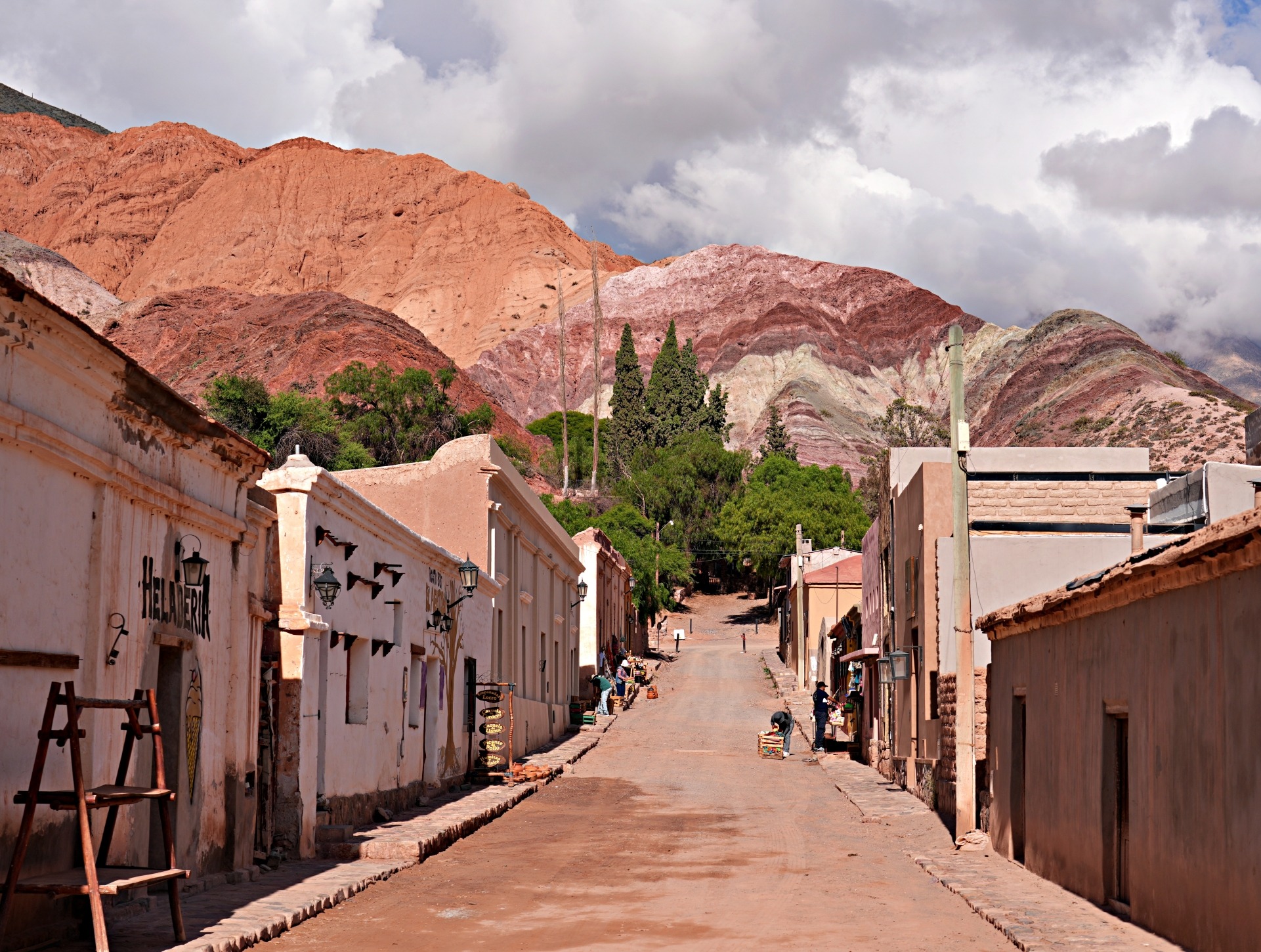
Even though Iruya is in Salta Province, the town can only be reached from Jujuy Province. Most make the trip by beginning in Humahuaca, which is what we did. In fact, a large part of the adventure in visiting Iruya is the drive from Humahuaca.
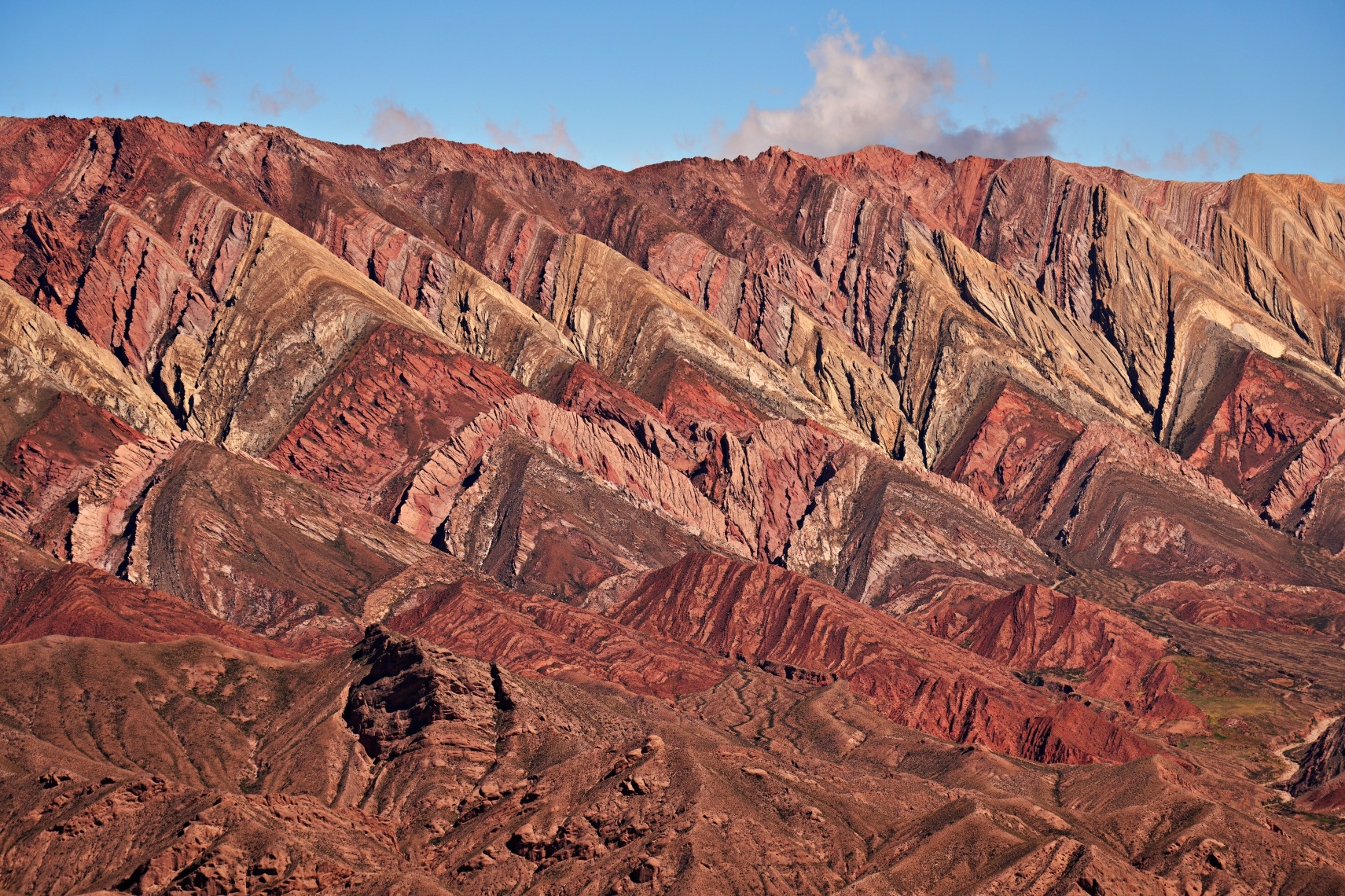
On the journey, you’ll leave the colourful Quebrada de Humahuaca and head north, where the colourful mountains are replaced by dry, rolling hills covered in cacti and shrubs. The final 40km of the 75 km drive is on a rough, gravel road that climbs up through the barren rolling hills to a high mountain pass. You will pass a few small hamlets, but there is no large population in this arid land.
On the Jujuy side of the pass, the gravel road seems to take its time, slowly climbing 600 metres (2,000 ft). At the top, Abra del Cóndor (Condor Pass) at 4,000 m (13,123 ft) not only delineates the border between the two provinces, but it also draws a line between the rolling hills of Jujuy and the dramatic canyons in Salta.


On the other side of the pass, the landscape changes yet again. What was a leisurely ride on the way up is a steady stream of steep, hairpin switchbacks that continue all the way down to the canyon bottom, around 1,000 m (3,289 ft) below. Because of the open landscape, you can see most of the winding route as it travels down the mountain slope. It’s a great view, but seeing how far there still is to go makes the drive seem much longer.


Iruya
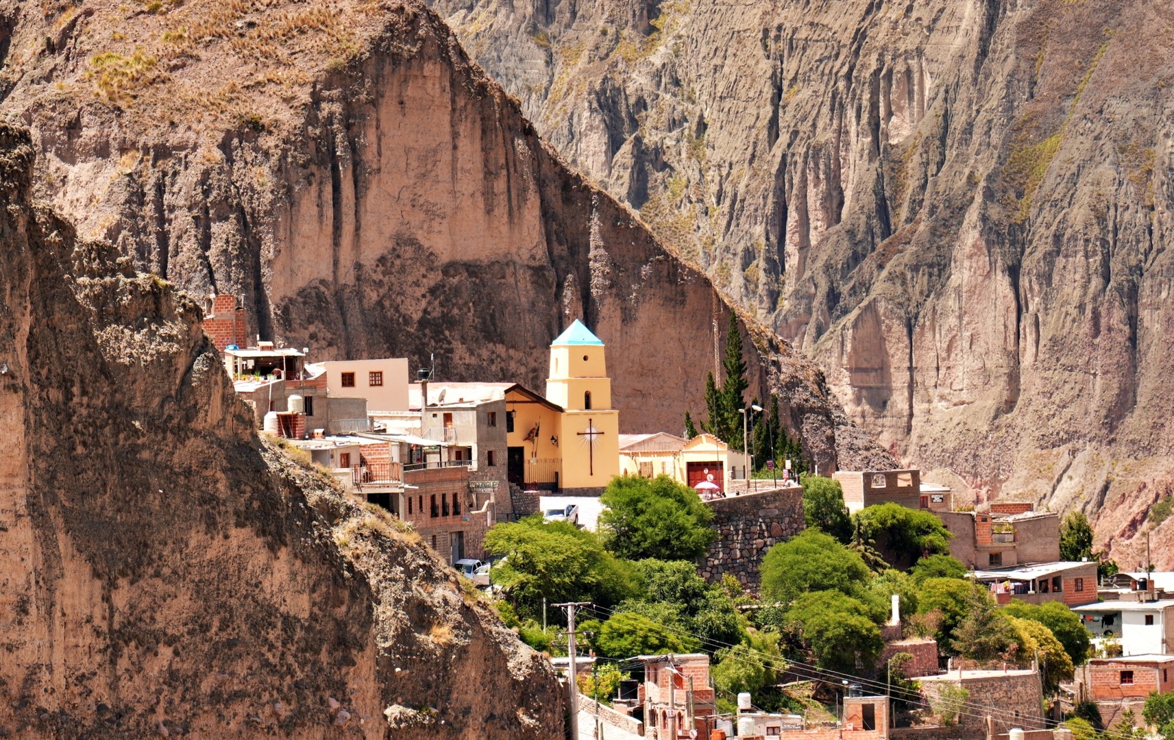
Eventually, you reach the Iruya River and follow it up to the picturesque village of Iruya. Located on the Altiplano at 2,780 metres (9,120 ft), the mountain town has a personality as unique as its setting. Tall canyon walls not only provide natural protection but also lend a dramatic appearance to the village. This location is a big part of its allure.


Records of the town’s origins are not clear, but the Spanish likely established it around 1750. Before their arrival, the pre-Hipanic Kolla people lived in this region as early as the mid 1600s. Kolla (also spelled qulla) are a pre-Incan indigenous population living in northern Argentina, Chile and southern Bolivia. Today, they are considered a blend of Quechua from Peru and Aymara from Bolivia. Most speak Quechua and follow some ancestral beliefs, such as Pachamama (Mother Earth) as the creator.
The town’s uncommon name comes from a Quechua word meaning ‘place of high pastures’ or ‘abundance of straw’. Making it even more unusual is the pronunciation. In northern Argentina, y is pronounced sh, so Iruya is pronounced ee-roo-sha.
Church of the Rosary
The iconic image of Iruya is the Church of the Rosary, backed by a sheer mountain wall. While it is cute up close, we wanted to see the yellow adobe building in its postcard setting. A viewpoint at the entrance to the village, near the Iruya sign, provided us with that view.


The church’s interior blends Kolla and Spanish designs, which suits the town, since residents celebrate both Christian and Pachamama traditions.

The town of Iruya is split in two by the Iruya River. From the church, you have a wonderful view of the homes that climb the slopes on the other side of the river. Above those slopes is Condor Viewpoint, which we planned to visit later in the day.

Plaza la Tablada
Instead of a typical Spanish colonial square, Plaza la Tablada is more of a recreation centre. Located in the centre of town, shops and hotels wrap around its edge. The cement yard in its middle is used for everything from soccer games to festivals and, as we saw, sometimes church services.

Away from the plaza, the cobblestone streets quickly climb the steep hills above. Many are still old adobe buildings, but you’ll find a lot of newer, brick ones mixed in too.


Hike to Mirador Cruces
Distance – 1.5 km (0.9 mi) return from plaza; Elevation Gain – 85 m (280 ft), Max elevation 2,812 m (9,225 ft)
You are granted a startlingly impressive 360° panorama from this short hike. Located right above the houses, the mirador gives you a wonderful bird’s eye view of the village, which includes both the buildings immediately below and the neighbourhood across the river. As well, this hilltop spot lets you look up and down this beautiful valley.


Tip – Since Iruya is at 2,780 meters (9,120ft) elevation, hiking may be more difficult if you are not acclimated. Spending a few days in Humahuaca at 3,012 m (9,882 ft) will help with this. The views are best in the afternoon.
Mirador de los Condores Hike
Distance – 5km (3 ¼ mi) round-trip from the plaza; Elevation Gain – 386m (1,270ft), Max elevation – 3,086m (10,125ft)
After seeing the homes on the other side of the river and the bright red peak above, it was time to get a closer look. At the top of the red cliff, high above the homes, is the Mirador de los Condores (Condor Lookout).
A steep trail begins at the top of the village, taking you by the impressive cliffs and offering better and better views of the valley below.


As if to prove it was properly named, we were excited to watch five condors soar above us for most of the hike.
Tip – It is best to see the birds in the afternoon. We were at the mirador at 4 pm, which seemed perfect timing.


Finally, we reached the viewpoint, and although the clouds were low, we looked down upon the two sides of Iruya, far below.


You can find the trail on Alltrails and Maps.me. If you don’t have those apps, it’s easy to follow once you get out of town. Cross the bridge and take the road beside Capilla Immaculado Corazón de María. Once you reach the kiosco, continue to follow the road instead of the shortcut suggested by the apps. At the top of the road, the trail begins and is easy to follow, but it is steep and has loose gravel. In places, it is exposed, so the hike is not for everyone.
Do not attempt this hike on a rainy day because it is prone to flash floods. As we descended, we could see black clouds forming in the distance, so we had to hurry our pace to outrun the rain.
Tip – There is not very good mobile coverage in Iruya. Our mobile provider, Claro, didn’t work at all, but most hotels have Wi-Fi. If you plan to use your hiking apps, download them before your trip.
San Isidro de Iruya
Distance -14 km (8½ mi) return; Elevation Gain – 605m (1,985 ft), Max elevation 2,971m (9,750ft).
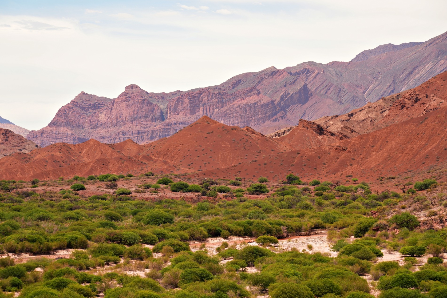
A great half-day trip from Iruya is to the village of San Isidro de Iruya. It’s only seven kilometres away, and you can find several tours in town that include San Isidro in their offerings. Instead of taking a tour, we decided to walk so we could enjoy the mountain scenery at a slower pace.
From Iruya, walk up the Iruya River Valley to reach its confluence with the San Isidro River. We enjoyed seeing how the soft morning light seemed to cast a spell on the red cliffs.


From the confluence, follow the San Isidro Valley beside its steep, crumbling mountains. At the time, we said that it’s not an overly picturesque canyon compared to others we’ve seen in this region. Maybe we’ve just been spoiled, because it actually is quite pretty.


Keep in mind that the route crosses the Isidro River at least 14 times. When we visited in December, the water level was very low, and steppingstones make it easy to cross. Locals use this route every day, so most crossings are easy and well-maintained. During or after the rainy season, though, it may not be passable on foot. Another option is to travel on horseback or take a 4×4.


We could see the homes of San Isidro perched on an outcrop high above the river valley. The tall cliffs protect the village from three sides, and when we first saw it, we wondered how we’d reach it. In the end, we found the long staircase that takes you from the river up to the top of the cliffs.


Unfortunately, many of its traditional adobe homes have been replaced, so it is not as charming as we had hoped. As we explored the small village, though, we were able to find a few old stone and adobe homes not far from the cute 17th century San Isidro Church.


If you look up, you can see the village cemetery, on the top of the hill, high above the village. There is a walking path to reach it, but it takes you all the way around the hill to climb it from the other side.

The 7 km walk from Iruya follows the gravel road for most of its way, but it’s not busy. We only saw 2 motorcycles on the road.
Other things to do in Iruya
If you have more time, you can take a trip to Laguna Verde, Las Capillas or San Juan. There are a couple of tour agencies in town that offer hiking, horseback or jeep tours.
Getting to Iruya
Even if you have a car, this will not be an enjoyable drive on an exposed, gravel mountain road. It is prone to washouts and landslides; therefore, do not drive this road if it rains or there is a forecast for heavy rain. If you don’t have a car, Transporte Iruya buses travel to/from Humahuaca three times a day, and once daily to/from Tilcara. You can find their schedule and current rates on their website here. The 75 km drive takes 3 hours.
Iruya is located in the top left corner of the map below. It is an interactive map, so you can zoom-in, or click on a marker for a link to our post from that region.
Where to stay in Iruya
While it is possible to visit on a day trip, we recommend you stay at least one night in town. If you arrive on an early bus and leave on a late bus the next day, you will be able to see quite a lot. Don’t expect luxury accommodations; all are basic hotels.
Plaza la Tablada is just above the main church, Our Lady of the Rosary, and this is where you will find most restaurants and shops, so it is the most convenient part of the town to stay. From the plaza, the streets go almost straight up the hills, so if you book too far away, prepare to climb. The opposite side of the river also has a few hostels, but it is even steeper and has less infrastructure.
What to eat in Iruya
As in Purmamarca and Humahuaca, most restaurants serve local favourites like tortillas rellenas, humita, tamales and empanadas, but pasta and grilled meat are also on most menus.
Best time to visit Iruya
For the best weather, visit in spring and fall (March to May and September to November). During this time, you’ll have the best chance for pleasant weather. The rainy season typically runs between December and February, when it often brings heavy rain.

To read more of our adventures in Argentina, click here.
Coming Next – Bariloche in Argentina’s Lake District
For pictures from other blogs go to Gallery at monkeystale.ca.
To read about more of our adventures go to Destinations.
If you like what you read, please comment or share (with credit) using the links below.


We'd love to hear from you, please leave a comment.