

I had been dreaming of climbing Everest since I was a young boy. I distinctly remember the time the idea was placed in my mind. My dad asked me to read a story about Sir Edmond Hillary and Tenzing Norgay’s summit of Mt. Everest. After reading, he had me recount it to him in my own words. I was captivated by the adventure. Now, here I was, no longer that child, and on my way to achieve that life-long dream. I wonder if my dad realized how much he inspired this adventure.
To skip ahead in the story here are the links to Part II – Khumbu Icefall and Part III – The Summit Push.
I arrived in Kathmandu on March 22nd. Dawa, from Arun Treks & Expedition, picked me up at the airport. This is where I learned that I didn’t have a permit to climb Everest. In fact, no one did. It was the year of the 2008 Beijing Olympics. China had decided that they would put the Olympic Torch on the summit. They made a deal with Nepal that climbers weren’t allowed on the mountain until after China had summited. This would prove stressful for much of my trip. I had two options; either postpone the climb by a year or take my chances and proceed with the climb. I opted for the latter.
I met my high altitude Sherpa, Ngima (pronounced Nima) Nuru Sherpa. He was quite young but had already summited Everest 9 times. In the evening I went for dinner with Ngima and Dawa to the Rum Doodle, a famous Kathmandu restaurant, often used by climbing and trekking companies.
The following day Ngima checked my expedition equipment and then took me for a tour of Kathmandu. It was great to get to know him before we went climbing and to have a tour from a local. One site we visited was Boudhanath. It is an important Buddhist site in Kathmandu. Even though it’s pretty busy with tourists and Buddhist pilgrims, it retains a sense of calm. Ngima told me that when he is in Kathmadu he goes to Boudhanath at 6 am every morning and circumambulates the large white stupa three times. It’s his way of praying.
After Boudhanath we visited the Hindu cremation site of Pashtupatinath and then Monkey Temple formally called Swayambhunath. You can read more of these sites on our post Kathmandu.


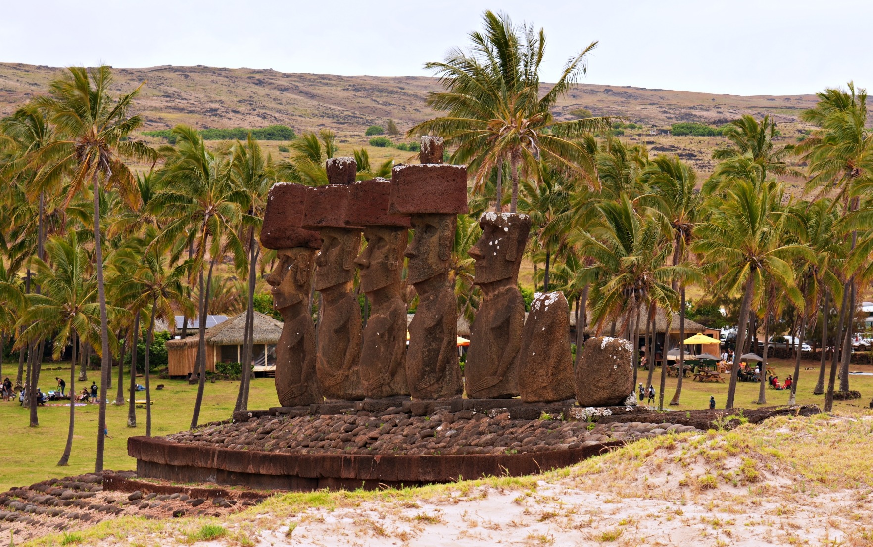
We also visited the historical buildings and temples in Durbar Square. It’s a fascinating place filled with beautiful old Hindu temples. This was my first time in Kathmandu and it was a few years before the 2015 earthquake. Maggie and I visited Durbar Square in 2018, 3 years after the earthquake. It was very depressing to see so much damage to these beautiful structures and the slow progress that had been made in their repairs.
Ngima took me to a Buddhist temple to get a blessing from a Buddhist lama. The lama performed a puja, gave us each a blessing, along with a khata (scarf) and a medallion on a string. The lama told me to wear the medallion for my entire climb to ensure my safety. I complied with his wishes and wore the medallion until I got home.

While in Kathmandu I met with a representative from Elizabeth Hawley’s Himalayan Database. They record the names and details of all people attempting Everest. My expedition was starting to feel more real.
I had hoped to be able to sleep in order to get over the time change, but the hotel that the expedition company put me in was above an Indian music disco. From late in the evening until early in the morning, I was kept awake by the beat of loud Bollywood music.
Days 1 and 2 – Kathmadu to Lukla, Phakding and Namche Bazaar
Day 1 – Elevation loss – 300 m; Hiking time 3 hrs. Day 2 – Elevation gain – 930 m; Hiking time 6 ½ hrs with lunch

In March there aren’t may trekkers on the Everest Base Camp trail. This also meant that the flights were filled mostly with climbers, supplies and gear. Half of the 15-seat propeller plane was filled with climbing gear. Flying into Lukla’s runway is a stressful experience. After flying between the foothills of the Himalayas, the mountains started to get larger and larger with our little plane flying in between. Then we begin the approach to Lukla. The 527 m (1,700 ft) runway is slightly up hill at a 12% grade. It begins at a shear drop off and ends at a solid rock wall. I was impressed when the pilots calmly managed to land, slow down and then stop the plane just before crashing into this wall. It’s supposedly one of the most dangerous runways in the world.


I had brought a lot gear for the expedition. I had 2 duffle bags filled with cold weather clothes and climbing equipment. One duffle bag went ahead to Namche Bazaar on a mule and the other was carried by a porter who hiked with us. I also had a large backpack weighing 20 kg that contained my hiking clothes, my – 40° C sleeping bag and personal items. Even before I left home I had decided to carry this backpack myself all the way to the Everest Base Camp. I did this because I wanted to continue to work on my fitness. Maggie and I made a deal before I started my bid for the Seven Summits. Since the expeditions were all self-funded, we agreed that I would only get one chance at each peak. If I failed at any on the first try, the Seven Summits would be over. I knew that I must be in good shape for this climb. People looked at me on the trail and thought I was either crazy or cheap because most people use porters. In total my bags weighed at least 60 kg.
After getting all of our luggage we were on our way to Phakding. This is a common first night for trekkers on the EBC or Everest 3 Passes Trek, but today it was mostly climbers, guides and porters on the trail.
Most of the locals in the Khumbu region belong to the Sherpa ethnic group. Sherpa is their last name rather than their profession. The trails we were walking on have been used as the main transportation routes by these Sherpas for generations. They are originally from Tibet and follow Tiebtan Buddhism and most have a kind, gentle nature. Not long after Lukla we started passing Buddhist mani stones, chortens, prayer flags and prayer wheels. Ngima explained that everything must be passed or spun in a clockwise direction. ‘Om Mani Pad Me Hum’ is written on most of the structures and the clockwise rotation equates to saying the mantra.


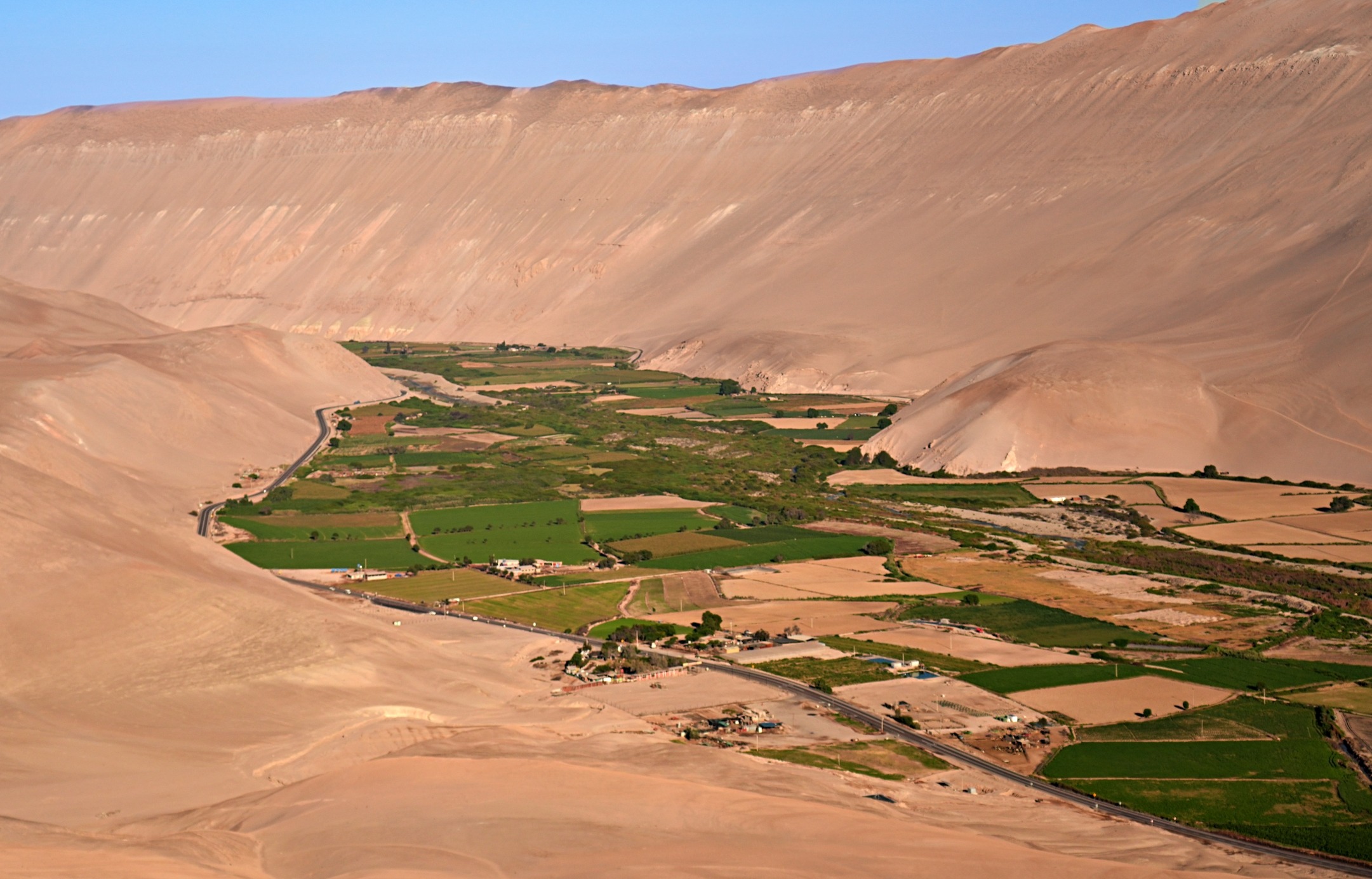
The trail follows the Dudh Kosi River Valley through forests of rhododendrons, birch, pine and fir. The trail was very busy with mules carrying gear and supplies. Before approaching Namche Bazzar we started seeing Yaks on the trail. Ngima taught me to always go on the high side of a mule or yak, not the cliff side, in case they accidently bump you. Ngima’s dad owns many of the yaks that carry supplies on this trail.


Ngima knows a lot of people and stopped to talk to most of them so the trekking was quite slow. We had all day so I suppose there was no need to rush. It gave me time to enjoy the amazing views in the Khumbu region.

The route crossed the river several times on suspension bridges strung between the sides of the deep valley. The bridges were adorned with Buddhist prayer flags that waved in the light wind. As we climbed up and down the mountain trails we passed through small villages whose homes seemed to cling to the sides of the mountains.


Phakding is a small village spread across both sides of the river. In Phakding I started monitoring my oxygen saturation. Normal O₂ saturation is between 94 and 99%. In Phakding mine was 90%, much lower than usual, but not bad for my first day at 2, 500 m (8,202 ft) elevation. Calgary, my home, is 1,045 m (3,430 ft).

As with most Everest climbers I had spent a year specifically training for this climb. I have enjoyed mountain sports most of my life, but fitness was a side benefit. The mountains were my gym. Living in Calgary I was able to go to the mountains every weekend; hiking and climbing in the summer and ski touring in the winter. In the 5 months leading up to my departure, I would ski longer and longer days, gaining more and more elevation. I had to do most of this on my own since Maggie was awaiting ACL surgery and couldn’t ski. Instead, she wrote my weekly exercise plan which involved 3-4 days lifting weights and doing cardio in the gym and ski touring every weekend. The ski routes began short, 10 km, with a 500 m elevation gain. This would be a normal ski tour for us on a Saturday in Kananaskis. By the end of my training season I would ski close to 50 km (30 miles) and gain 2,500 m (8,000 ft) in elevation in one day. I was the fittest that I had ever been.
Namche Bazaar is an interesting town built along the walls of a mountain cirque. There is a long steep climb before reaching it and when you get to the top you have a great view of the buildings strung up and down the steep walls. From the bottom of the village I still had to climb up to my hotel which was at the elevation of 3,430 m (11,253 ft).
In the 2015 earthquake Namche was flattened. Many locals were killed and almost all of the buildings were destroyed. Returning in 2018 with Maggie, I saw how the city had been rebuilt and even improved.

Day 3 – Namche Bazaar – Acclimatization hike
Elevation gain – 380 m (1,246 ft); Hiking time – 4 hrs
Ngima’s family lives a half hour walk from Namche so he spent the night at his mom’s house. He met me after breakfast and we went for an acclimatization hike to visit the villages of Khunde and Khumjung located above Namche Bazaar.
It’s a steep walk up to get to Khunde and Khumjung. First you climb an endless series of stone steps to reach the top of Namche. Then you hike to the top of the hill where the villages are located. From these remote villages I had my first look at one of the most beautiful mountains in the world, Ama Dablam. Beyond it I could see Lhotse and for the first time, I saw Everest. What an incredible site.


During our tour of Khumjung we visted the gompa (monastery) where they have an old Yeti scalp. Ngima found the caretaker who unlocked the temple and showed us the scalp. It is a fascinating part of their folklore, but I’m not convinced it’s from a Yeti. The scalp is covered in a blackish skin and has long, brown hair. Pictures weren’t allowed. It’s one of three Yeti remains in the Khumbu region.

I was able to speak with the expedition company today and they still haven’t received climbing permits for Everest, but a new set of rules was announced. Climbers would be allowed to hike up to Camp II, but not higher until after the Chinese summited. It was very stressful because there is only a small window when it is safe to climb Mt. Everest. The spring cimbing season is only a couple of weeks long between the cold winter weather and the start of the monsoon rains. Summit attempts are timed based on when the rains will start and if the Chinese take too long, it may be too late for me.
Day 4 – Namche Bazaar to Pangboche
Elevation gain – 555 m (1,820 ft); Hiking time – 6 ½ hrs with lunch
The trail leaves Namche Bazaar and begins climbing almost immediately. Near the top I was startled to see a Tahr in the bushes. These hairy goat-like animals are very shy and rarely seen. I took it as a good omen.


On the trail we passed a young couple who were riding mules. They didn’t look very proud as we walked by them carrying our 20 kg backpacks.
The first major village we passed after Namche was Tengboche. The town sits on a small col. Its position allows unimpeded mountain views. In the middle of the village is a lovely Budhhist monastery. Many people spend the night in Tengboche, but our destination for the day was a little further. From the trail above Tengboche we turned back to see the village perched on its small col.


Before reaching Pangboche we arrived at one of my favourite views so far. A rustic white chorten was perfectly situated in front of the spectacular Ama Dablam. When Maggie and I returned to this site in 2018, this chorten was no longer standing. Unfortunately it and the ground it was standing on were demolished during the earthquake.

Pangboche (3,985 m/13,074 ft) is a cute village beneath the beautiful Ama Dablam. We stayed in Ngima’s sister’s guesthouse. The village used to be the highest permanent settlement in the Khumbu but tourism has resulted in more near-permanent settlements higher up the valley.


Day 5 – Pangboche to Dingboche
Elevation gain – 425 m (1,394ft); Hiking time – 2 hrs
Before we left Pangboche we stopped at the gompa. Ngima lit two candles for us to have good luck on Everest, and gave his khata (scarf) from the lama in Kathmandu as an offering. This monastery also has a Yeti scalp as well as a hand, but I didn’t see them on this trip.

After the monastery we climbed to a lookout above Pangboche with an incredible 360° view of the Himalayan giants, Everest, Lhotse, Ama Dablam, Thamserku and others


When planning this expedition, I decided that I also wanted to do an acclimitization climb on Island Peak. At 6,189 m (20,305 ft), Island Peak is the perfect height to aid in my acclimitiztion. The village of Dingboche is off the normal trekking route to basecamp, but is on the way to Island Peak. While in Dingboche Ngima received a phone call from Dawa telling us we finally received permits to climb Everest! What a relief.
In Dingboche (4,410 m/14,468 ft) I met two climbers from Quebec, Canada who were also climbing Island Peak. They planned to climb Lobuche Peak as well, later that week.
Since my Seven Summits expeditions were self funded I needed to find the most cost effective, but safe way to climb. I met Spanish climber Rosa on Denali. She recommended Arun Treks & Expedition. They are a Nepalese company that provides kitchen services, Sherpas and arrange climbing permits. I didn’t have a famous western guide, but Ngima was as experienced on this mountain and as good a climber as any of them. Arun arranged for us to share the Quebec climbers’ cook for our Island Peak climb.
Day 6 – Acclimatization hike to Dingboche Ri
Elevation gain / loss – 695 m (2,280 ft)
I had an awful sleep last night with bad dreams. In the middle of the night I woke suddenly and was gasping for air. I checked my O₂ saturation and it was down to 80%. The last few days it had been around 90%. I took multiple deep breaths and started to feel better. Eventually I fell asleep. By the morning it was up to high eighties and I was feeling a little better.
From Dingboche we did another acclimatization hike to the top of Dingboche Ri (5055 m/16,584 ft). On the way up Dingboche Ri I could see Island Peak in the distance. Its elevation is 6,189 m which is the same height as Mt. Denali, the highest mountain in North America. Here though, the peak looks tiny, as it is dwarfed by Lhotse and other tall Himalayan giants. Island Peak is the small mountain in the middle in third picture below.


Day 7 – Dingboche to Chukkhung
Elevation gain – 370 m (1,230 ft); Hiking time – 2 hrs
I finally had a good sleep last night, and my oxygen saturation was up to 89%, so it appears that I’m acclimatizing well. Above 3,000 m, the general rule is to slowly acclimatize by not gaining more than 300 m per day and to have a rest day every 3 – 4 days. We try to follow that rule so that my body has the best chance for success.
On the way out of Dingobche we walked by a few small farms. At one a family was planting potatoes. It seemed like a harsh envronment to grow anything, but these farmers are remarkably resilient.

Chukkhung (4,730 m/1,5518 ft) is not a village, but rather a small collection of guesthouses located at the base of Lhotse’s south face. It was hard to imagine but on the other side of Mt. Lhotse is Everest basecamp. It’s so close, but it would still be a few days until I would be there. From our guesthouse in Chukkung we had a spectacular view of Ama Dablam and the ice couloirs coming downs its steep ridges.


Day 8 – Chukkhung to Island Peak basecamp
Elevation gain – 385 m
We woke to about 3 cm of fresh snow but it melted quickly once the strong sun came out. It was a short but steady climb to reach basecamp. My backpack was a little heavier because I had to bring climbing gear such as a harness, climbing boots and crampons.
There were a few other expeditions already at Island Peak Basecamp (5,115 m/16,780 ft). We set up our tents near the Quebec climbers. I was very glad that we shared kitchen services with the Quebec climbers because their cook, Pasang, was very good.


Day 9 – Island Peak Base Camp to High Camp
Elevation gain 355 m, Hiking time – 1 hr
High Camp is only an hour hike away from basecamp, so we rested in the morning and left for High Camp in the afternoon. High Camp’s elevation is 5,470 m (17,946 ft), which is 110 m (360 ft) above Everest Basecamp.
My O₂ saturation at High Camp was in the low 80s. I took Ngima’s and it was only 86%. I was really surprised that it’s so low and yet he’s able to work so hard at high elevations. Later I learned that Sherpas are born with exceptionally large lungs, a very fast breathing rate and increased capillarization in their brain. These natural changes allow them to be successful at high altitudes even though many, like Ngima, live in Kathmadu during the off-season. Everyone else needs to slowly accimitize allowing the body to produce more hemoglobin so the blood can transport more oxygen.

Day 10 – Island Peak Summit Day
Elevation gain – 719 m, Elevation loss to basecamp 1,074 m; Total time -approx. 8 hrs
We left High Camp around 2:30 in the morning so it was still dark. With headlights on we began our ascent. The route heads straight up a gully on loose scree. At the top of the gully we reached the glacier where we put on crampons. The first section is a flat snow névé that takes about 30 minutes to cross. We passed large bergschrunds and crevasses. Since it was dark, I didn’t know they were there until I saw them on the way down.


It was good to have this easy section because from the the névé to the summit it is a relentless two hour climb. First we climbed a very steep headwall that was covered in uneven snow formations. At first I thought it was avalanche debris, but later realized they are similar to small penitente-like formations I had seen on Aconcagua. These formations made an already difficult ascent more tricky as we had to navigate around these bulges.


The headwall took us to a very steep ridge. Both sides had shear 70 – 80° drop-offs. I could see straight down to a huge berghshrund, hundreds of feet below me. I had never climbed on such a razor sharp edge before.


The last section of the ridge to reach the summit is very steep. There was a fixed rope, but in places it was badly frayed with only a few threads left. I was worried that if I fell it may not hold me. I was careful not to put too much pressure on the rope. Denali’s headwall is touted as being very difficult, but this peak is much more serious. In Nepal, Island Peak is called a ‘trekking peak’, but this is not for trekkers. It’s much more technical than I had envisioned.
Finally we arrived at the summit (6,189 m/20,305 ft). I enjoyed the breathtaking view of Ama Dablam, Lhotse, Mera and the other Himalayan peaks. The summit is very small with just enough room for four of us. I summited with Ngima, one of the Quebec climbers and his Sherpa.


When we started our descent we could see other climbers on the névé below. They were slowly making their way up the mountain. When we arrived back at High Camp it was still early, so Ngima and I descended all the way to Island Peak Basecamp.

Day 11 – Island Peak Basecamp to Dingboche
Elevation loss – 755 m
I was glad we could have one more meal made by Pasang. He made us a delicious breakfast. It was very tasty compared to the bland meals in the guesthouses.
We arrived in Dingboche in the afternoon. It’s much lower than where we were for the past few days and the air felt so good. Sitting in the dining area of the guesthouse in Dingboche I realized why my stomache gets upset from time to time. The dining rooms are heated with yak-dung stoves. I watched as the cook picked up pieces of yak dung with her hands and put them in the stove. She then returned to cooking our meals without washing her hands. My stomach was used to a more hygenic kitchen.
Day 12 – Dingboche
We found out that our Everest Basecamp cooks are a day late, so we would have a rest a day in Dingboche. It was snowing again with poor visiblity. It has snowed almost every night since we arrived in Pangboche a week ago. We were very lucky to have good weather on Island Peak.
I finally had my first ‘shower’ since leaving Kathmandu. It wasn’t luxurious. I had 2 buckets of hot water to pour over myself but it’s better than not showering I guess.
I met an interesting Englishman in Dingboche. He’s 65 but looks much younger. He’s planning to climb the trekking peak Lobuche. The Quebecois are also in Dingboche and are resting before they attempt Lobuche Peak.
Day 13 – Dingboche to Lobuche
Elevation gain – 560 m; Hiking time – 3 hrs
The ground was covered in a layer of snow in the morning. On our way to Lobuche we stopped at a guesthouse in Dughla for a tea break. Arriving in Dughla we were back on the Everest Basecamp trail. Here I met the Englishman again. He told me that the weather is not supposed to improve for the next few days. It had been snowing all day and continued to snow all the way to Lobuche (4930 m/16,175 ft). I remember thinking to myself how I’d love to be able to see the mountains that surround me.
As luck would have it at sunset, the clouds over Nuptse cleared and we were treated to an incredible alpenglow on Nuptse (7,861 m). Maybe it’s a good omen and everything will work out for my climb to Everest’s summit.

Coming Next – My Seven Summits – Climbing Mt. Everest – Part II, Everest Basecamp
Here are links to stories from Richard’s other summits. Everest Parts II, III (Nepal), Aconcagua (Argentina), Vinson Massif (Antarctica), Kilimanjaro (Tanzania), Denali (Alaska), Elbrus (Russia), Carstensz Pyramid (Indonesia).
If you’re interested in hiking to Everest Base Camp you can read our posts from our trek over Everest Three Passes. Part I (Kongma La), Part 2 (Cho La), Part 3 (Renjo La).
For extra pictures from Nepal click here. For pictures from other blogs go to Gallery at monkeystale.ca
To read about more of our adventures go to Destinations.
If you like what you read, please comment or share (with credit) using the links below.


We'd love to hear from you, please leave a comment.