
Florianópolis is one of the most popular vacation destinations in southern Brazil. Most people who visit spend their days lazing on one of the beaches, but the hiking trails on this hilly island are what was calling us. Some trails led us to beaches, others took us up to beautiful viewpoints. For us, it was the perfect way to explore the beautiful landscapes of this large island.
The island is formally named Santa Catarina but it is usually referred to by the name of its main city Florianópolis, called Floripa for short. At 424 km²(164 square miles) it is the largest island in Brazil and therefore has a very long coastline. Hiking trails climb up and down the mountains that follow the island’s edge allowing you to see a lot of this coastline from high above. Even though it rained for much of out time on the island we were able to do a couple of hikes to a few of the lookouts and beaches.
Trilha Lagoinha do Leste (Trail to East Pond)
At the far southern end of the island is the very pretty Lagoinha do Leste beach. It’s a hike-in only beach set in a secluded cove. Knowing the weather forecast for the upcoming days called for a lot of rain, we did this hike on our fist day, when the skies were clear.
The hike follows a good trail as it climbs up the hills through the rainforest. After about 1.5 km we reached a pass (240 m) where the trail splits. The good trail continues straight and goes down from the pass to the beach. The other trail takes you to a lookout on Morro da Coroa. We followed the trail to the lookout that took us deeper into the dense rainforest. It was quite a bit more rugged with many exposed roots and large rocks. The trail eventually opened up at a long, open ridge.


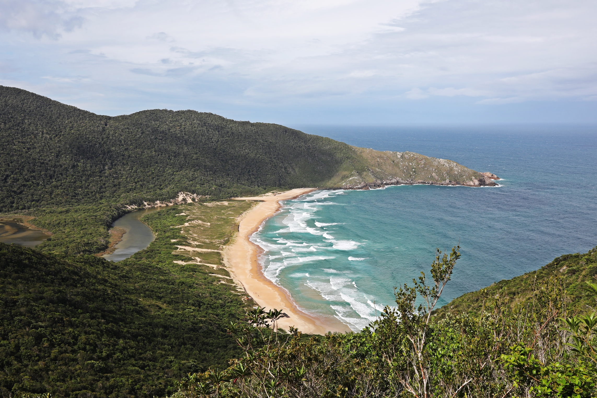
From here the trail follows the ridge and allows lovely views of the ocean. From a lookout on the edge of Morro da Corao we looked down on the most beautiful cove. Blue water laps up on the edge of a perfect sandy beach. On the other side of the beach is a mirror image to the hilly point that we were on. A small pond behind the beach gives it the name, Lagoinha do Leste. The view from this lookout is one of the nicest on the island. Storm clouds rolling in over the ocean let us know we shouldn’t linger for long.

The trail leaves the hilltop in a series of sharp switchback all the way down to the beach. It was on this trail that we saw our first of two tarantulas on the island. The beach is quiet, with fine sand but we knew we wanted to hike out before the storm came so we kept walking. From the beach, a good trail climbs back up to the pass where we branched off earlier and continues all the way back to the trailhead.


Hike details -The trail leaves from Rua Manoel Pedro Oliveira in Pântano do Sul neighbourhood. A large sign makes the trailhead easy to find. The route we did is 8.4 km and gains 464 m elevation. If you don’t go to the lookout, the elevation gain and loss is only 240m. The return trip has to regain 240 m to reach the pass. You could do the trail in either direction.
Trilha da Boa Vista (Good View Trail)
The name of the trail was a good indication that there would be something nice to see. It’s a rough trail that is not well maintained and has many slippery roots, rocks and even boulders that require scramble moves using your hands and feet to scale. There were several points on this trail that took us out of the forest and gave panoramic views of the long coastline. We could also look behind to see the community of Barra de Lagoa on the land between Lagoa da Conceição and the ocean.


When we finally reached the main lookout point, we were treated to a view that was much better than “good” as advertised in the trail name. We looked down to the side by side beaches, Praia Mole and Praia Galheta.

Trilha da Boa Vista eventually joins a good trail for an easy walk down to Galheta beach. Another easy trail allows you to walk between it and Mole Beach. We didn’t realize it at the time bus Galheta is known to be a nudist beach, so again people gave Richard strange looks when he pulled out his camera. It wasn’t until we got further down the beach that we saw a few naked bums in the distance.


Hike details – The trail starts at Barra da Lagoa just beyond the channel. It is relatively short at only 2.8 km with 177 m elevation, but the rough conditions means it will take you longer than you expect. The trail ends on Praia Mole which is beside the main road.
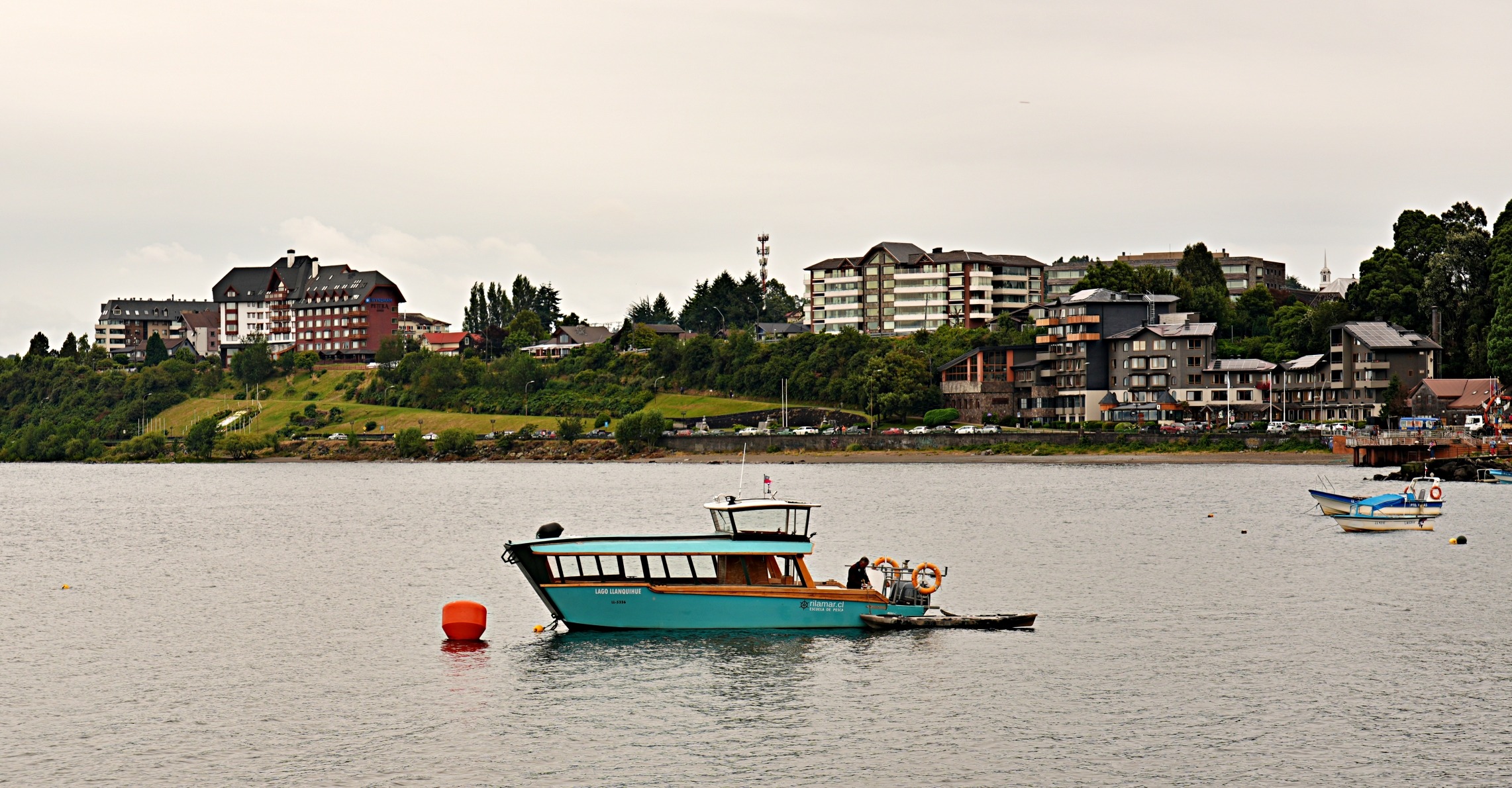
Florianópolis is a large city with a population over 1.1 million. It begins on the mainland and extends across the island. Three large bridges connect the two so it’s easy to forget you’re on an island. Tall skyscrapers line the shores on both sides of the bridges, which lead you to busy downtown streets. The opposite side of the island is more quiet and is where we spent most of out time. Although much less busy than downtown, it is not the idyllic escape we had hoped to find. Busy roads run along the length of the island connecting the many small communities. A destination this popular need services so we shouldn’t have been surprised, but we didn’t expect to find so many large communities that surround most of the beaches.
In the centre of the island is the large Lagoa da Conceição. It’s surrounded by communities that offer shopping, restaruants and bars and is a popular place to stay in town.


Between the lagoon and the island’s eastern shore is the quiet community Barra da Lagoa. On its edge is a beach of the same name. It’s very long and is made even longer with its connection to Praia do Moçambique. The inclement weather wasn’t great for us, but it made the surfers happy. We watched for a while as several surfers played on the strong waves at this beach.


On the other side of a rocky point at the end of Barra da Lagoa beach is the much smaller Prainha da Lagoa. With large boulders on the water’s edge, it is wilder looking than the larger beach. A walking trail from the beach allows you to reach natural pools We were there at high tide so the pools were covered by the ocean, and not very easy to see.


Between the two beaches is a quaint channel with colourful fishing boats. Canal Da Barra was so peaceful and turned out to be one of our favourite places on the island.


It rains a lot in Florianópolis; in fact it has no dry season. The rainiest months are between October and May where it rains, on average, 17 days each month. The least amount of rain falls in the colder months of June and August, but it still rains on an average of 9 days each month.
Maybe it was the rain, maybe it was the traffic, but we didn’t fall in love with Florianópolis. It wasn’t our idea of paradise.
How to get to Florianópolis
A good highway connects Florianópolis with São Paulo in the north, but it is over 650 km away. Flying is an easier option into the international airport on the island. Overnight buses travel from Rita Maria Bus Terminal in Florianópolis to Rodoviário Tietê in São Paulo or Rodoviária Novo Rio in Rio. Day time buses travel to many other destinations such as Curitiba.
Getting Around Florianópolis
This island is almost 54 km long so having a car would make the trip that much easier. If you don’t, Uber or taxis are available everywhere. There is also a good transit system that can take you to many locations, but it does take time. If you want to use the city buses, the system is integrated into Google Maps. When you zoom in on the map you can see bus stops. Click on a bus stop and it will list the buses that use that stop as well as their routes and timetable. It’s a really slick system. We realized that it works in a few cities around the world so will likely look for it more.
Where to stay on Florianópolis
If you have a car you can stay in almost any community of the island. The most popular areas are Campeche, Lagoa da Conceição and Canasvieiras. We stayed in the quiet community of Barra da Lagoa. There are a few good restaurants and hotels in the area, but we found it a little too far away from everything.
Coming Next – A Tour of São Paulo
For pictures from other blogs go to Gallery at monkeystale.ca
To read about more of our adventures go to Destinations.
If you like what you read, please comment or share (with credit) using the links below


We'd love to hear from you, please leave a comment.