
After visiting the Fergana Valley in Uzbekistan, and Kyrgyzstan we were interested to see Tajikistan’s version of this divided land. Like Kyrgyzstan, the Fergana Valley is physically separated from the rest of the country by a high mountain pass giving it a unique flavour that is not only different from the rest of the country, but also different from the rest of the Fergana Valley.
To go directly to Travel Tips For Tajikistan click here.
Fergana Valley has been known as a fertile garden in arid Central Asia since the days of the Silk Road. The name is a bit misleading as it is not a valley at all, but rather a depression between the tall Tian Shan Mountains in the north and the Alay Mountains in the south. Historically it was ruled by as many different Khans as the rest of Central Asia. During Soviet occupation, haphazard borders were created dividing the valley between Uzbekistan, Kyrgyzstan and Tajikistan. At that time the borders didn’t really affect the people because they could come and go as they pleased. When the countries gained independence however, the borders and the wealth that was contained in the land mattered a lot more. Looking at the map below, you can see how willy-nilly the borders are. The cities we visited in the three countries, Kokand in Uzbekistan, Khujand in Tajikistan and Osh in Kyrgyzstan, used to be one region but now are separated by an arbitrary border.

A large part of the problem is that the people’s ethnicities do not follow these lines. Families found themselves living on opposite sides of the borders from each other. Jealousy and hatred developed between people who were once family and neighbours because of the feeling of inequity in the distribution of land. Many say that this was done by the Soviets to ensure that there were minorities in each Soviet state. This unequal division would create internal fighting and keep the heat off the Soviet rulers.
Today that animosity continues between Kyrgyzstan and Tajikistan and as a result the borders between the two countries are closed. We had intended on travelling on the Pamir Highway from Osh, Kyrgyzstan to Dushanbe, Tajikistan but with the border closure, we had to find another way. Instead, when we were in Bishkek, Kyrgyzstan we travelled to Almaty, Kazakhstan by bus. From there we flew to Tashkent, Uzbekistan. The last leg of this long journey was a road trip from Tashkent to Khujand, Tajikistan.
Uzbekistan – Tajikistan Border Crossing
The closest border town to Tashkent is Oybek, 100 km away. We took a Yandex ride to the border making it a quick and painless journey. On the way we saw dozens of large crane nests on the tops of the electrical towers. In a few we could see the heads of baby birds poking over the top. If we had known this sooner, we may have made a special trip to this region. Unfortunately we didn’t and also weren’t able to take any pictures on this drive.
Once we arrived at the border it was a pretty easy crossing. There was a little pushing and shoving to get through the line ups, but it was nothing like we experienced between Uzbekistan and Kyrgyzstan. In fact, we met the friendliest border guard we’ve ever encountered. He likely wanted to practice English, but spoke to us for a while about what we should see during our time in Tajikistan and wished us a great trip as we left. We easily found a taxi on the Tajik side to take us to the city of Khujand.
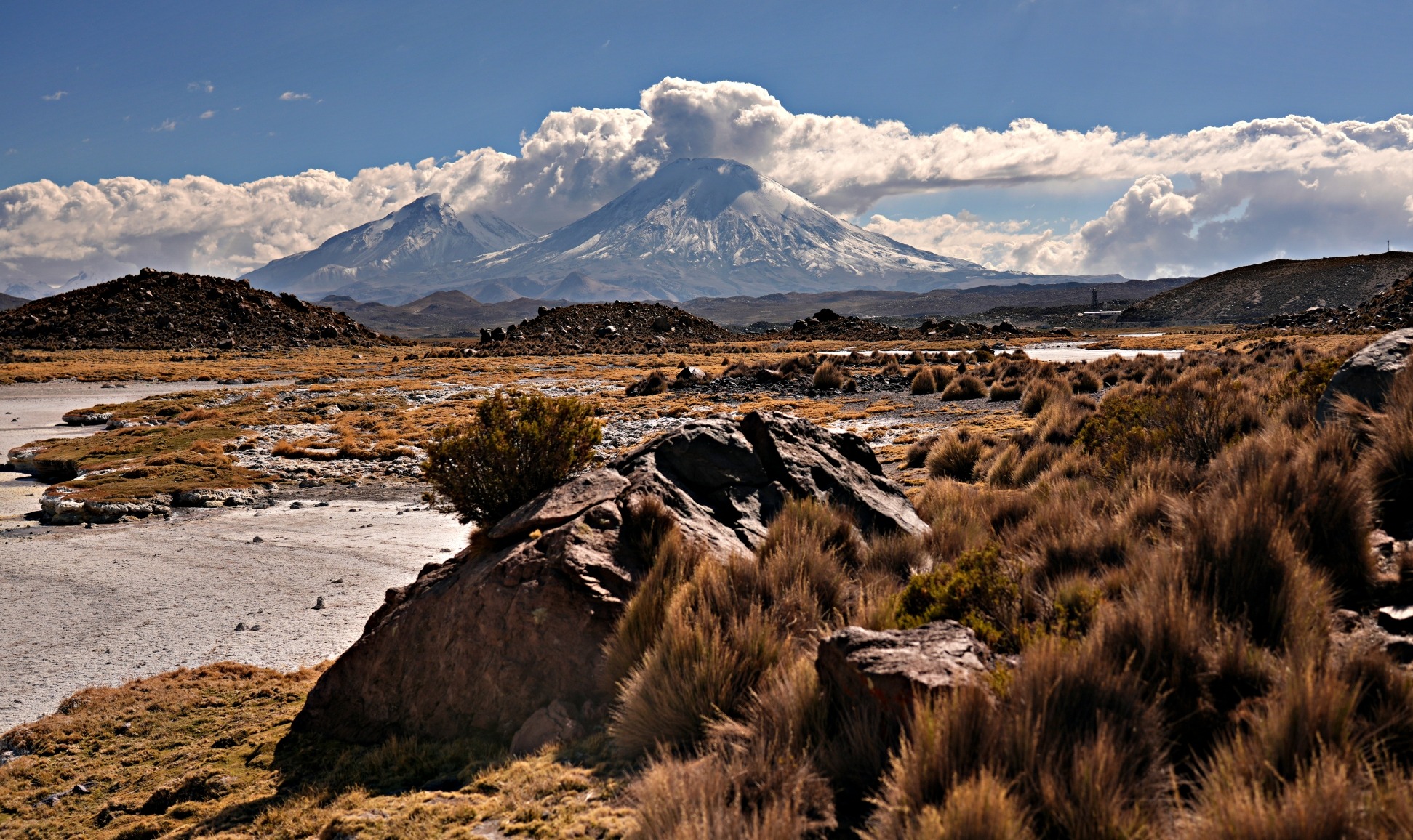
It seemed as if the landscape changed as soon as we crossed the border where desert-like hills lead up to the arid mountains of the Fann Range. The Fergana Valley is isolated in its location in northern Tajikistan. It’s cut off from the rest of the country by high mountain passes. In addition to the physical separation it is culturally different as well. There are more ethnic Uzbeks living in Tajikistan’s Fergana Valley than Tajiks.
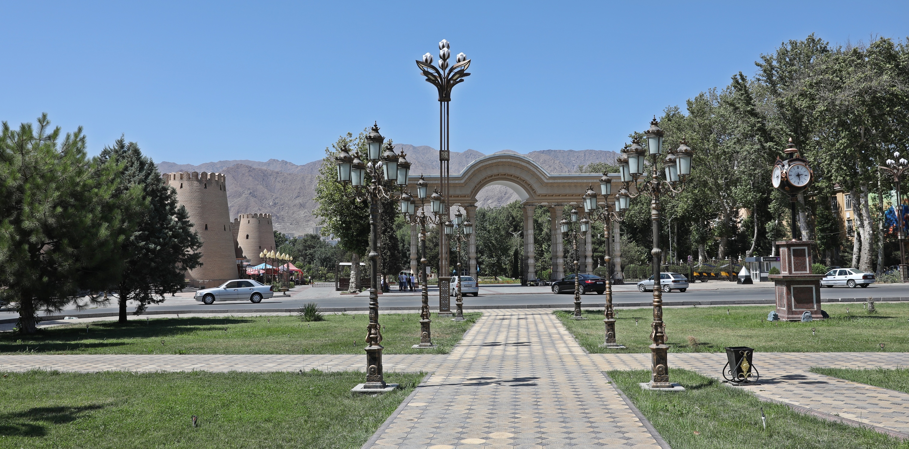
Khujand
With tree lined streets and large parks, Khujand is a nice, clean city. There’s not a lot for the visitor to do though, so don’t plan to spend too long; one day is enough.
After seeing great fortresses in Uzbekistan, we were excited to visit Khujand Fortress. The original castle was built in the 5th century BCE but was demolished and rebuilt several times. The current one is said to be from the 13th century but is currently being rebuilt yet again. We had expected to be awed by the castle but instead, the restoration work made it look like it was brand new and we were horribly disappointed. Inside is a museum but we were told it doesn’t have much on display. Since we were already feeling dejected about its outer appearance, we didn’t bother going in.

Surrounding the fortress is a lovely treed park. We enjoyed walking through Kamoli Khujand Park where we found a few nice heritage buildings and monuments. The park is named after 14th century Tajik writer, Kamal Khujandi, and the park surrounds his mausoleum.


Surrounded by the arid Fann Mountains, Khujand is bisected by the Syr Darya River. Across the large river from Kamoli Khujand Park is a large statue of Ismoil Somoni. In the 10th century he reigned over Tajikistan and much of Central Asia and is now considered the founder of Tajikistan. Every city has at least one Somoni statue where he is wearing a crown and holding a golden scepter. The Tajik currency is called Somoni, named after him.


We didn’t visit the large bazaar in Khujand, but we did pass many fruit sellers on the street. It must have been watermelon season because the sidewalks were lined with large watermelons.

Getting to Khujand
There are many shared-minivans, called marshrutka, that travel between Khujand and other large Tajikistan cities such as Dushanbe or Panjakent.
If you’re travelling from Uzbekistan there are fewer options. We had intended on taking the bus that travels between Tashkent, Uzbekistan and Khujand. Once in Tashkent we discovered that the bus arrives in Tashkent late in the afternoon but only leaves when it is full. We didn’t feel like waiting around so instead we ordered a Yandex to take us to the border. It was a pretty cheap for the hour and a half drive at only 205,000 UZS ($18 USD). On the Tajik side of the border there is a money exchange shop and a few taxis. Wait until you get all the way across the border to take a taxi as there are a few within no-man’s land that will charge a lot more. The taxi from the border to Khujand was 110 TJS ($10 USD) for the 60 km drive.
Where to stay in Khujand
Most of the restaurants are located near Kamoli Khujand Park. This is probably the best part of the city to stay in too.
Panjakent
After leaving Khujand and the Fergana Valley, we drove through the arid Fann Mountains toward the city of Panjakent. Even though the mountains are barren, we saw many places with small green oases. The green came from columnar Aspens and gardens that surrounded the mountain villages. Tajiks are very good at building irrigation channels allowing them to build villages in the most inhospitable locations.


The drive took us to the top of a mountain pass at 2,600 m. As we drove down the other side of the pass, the lower we got, the more vegetation we saw. At 1,700 m we started to see orchards. Along the side of the road, farmers were selling buckets of apricots. We had just discovered that Panjakent is the apricot capital of Tajikistan.
Our marshrutka stopped at a roadside market with a unique way to cool their drinks. The shelves are set up in a waterfall.


The city of Panjakent is set beside the Zeravshan River, in the middle of the arid Fann Mountains . It’s a bit of a wild town that’s a little rough around the edges. The city felt different than other parts of Central Asia. There was more litter on the streets and it felt less organized. The people look less Asian and more Persian, which is their ethnic heritage.

Panjakent is located in a much more conservative part of the country. We saw a few men were wearing long robes and traditional head coverings. Women were dressed in kurtas; long tunics over wide pants and most covered their hair.

Panjakent Bazaar is located in an old Madrasa (school of Islamic studies). Tables were filled with ripe apricots and cherries.


There aren’t a lot of historical buildings in Tajikistan, but in addition to the madrassa, there is a 17th century mosque and minaret.


Panjakent’s Ismoil Somoni statue is found outside one of they city’s government buildings. Behind it is a large dictator-style poster of president Emomali Rahmom. He has been Tajikistan’s president since 1994 and still leads the government today. In fact, the constitution was recently changed so that he would be president for life. We would see these posters across the country.

There isn’t a lot for the traveller to do in town, but it is the jumping off point to explore the scenic Fann Mountains, which is exactly what we did. Our reason for travelling to Panjakent was to hike around the spectacular Haft Kul (Seven Lakes) (Coming Soon).
Getting to Panjakent
Panjakent is connected to the long M34 highway that connects Khujand and Dushanbe. Several minibuses, called marshrutkas, travel between Panjakent and other Tajikistan cities like Dushanbe and Khujand. If travelling from Uzbekistan, you can easily cross the border between Panjakent and Samarkand. It is one of the most common land border crossing between the two countries.
Where to stay in Panjakent
There aren’t many hotel options in Panjakent. We stayed in SUGD Hotel. It has a good location, nice rooms and very helpful, friendly staff.
Travel Tips for Tajikistan
• When to travel – Most of Tajikistan’s best sites are in the mountains at higher elevations. That means that they best time to travel is between mid-June and mid-September. It will be hot in Dushanbe and Khujand, but the mountains are where you want to be in this country.
• SIM Cards – We purchased a SIM card from TCell mobile. SIM cards can only be purchased in their stores. You can only buy 10 days at a time, but it can be topped up. Ours actually worked for about 14 days even though we were told 10. We purchased 25 GB for 180 TJS ($16 USD). It worked reasonably well for the phone it was loaded in, but the hotspot didn’t work for our second phone.
• Internet in Tajikistan is quite slow. You will need to use a VPN to open many websites including Monkey’s Tale and many of the WordPress blogs that we follow.
• ATM – Getting Tajik Somani from ATMs can be a bit challenging. Not all ATMs accepts international debit cards and many don’t accept pin codes with more than 4 digits. The machines don’t always have money especially on Sunday nights or during holidays. At other times they are often out of order. When you do find an ATM that is working, take enough money to last a few days, especially if you’re going to remote villages or if it is a weekend. At most ATMs we could take up to 2,000 Somoni (TJS) ($180 USD) at a time. Sometimes we could take multiple withdrawals, but at others the limit was only 1,000 TJS ($90 USD) a day. The difficulty is that it is a cash-based economy. We didn’t find any hotels or restaurants that accepted credit cards. We found Bank Eskata to work most often and offered the lowest fees.
• Getting around – There are no large buses and very few flights within the country. That doesn’t mean you don’t have options. You can hire a private taxi, but they are usually over-priced for tourists. Another option is to take a marshrutka (shared minibus). On these you pay a lower fee but it’s not comfortable and you usually wait for it to be full. You could take a share-taxi, which are a bit more pricey than marshrutkas but more comfortable and often easier to find other people to share. A common option is to hitchhike which is actually very easy. It’s not typical hitchhiking though because you will almost always be expected to pay. It helps to ask in advance what fee the driver expects. The final option is to bike which is becoming much more popular. Make sure you are comfortable biking on a busy, dusty road where traffic may or may not give you a comfortable amount of space.
• What to wear – Even though it’s a Muslim country it is not as conservative as the other Central Asian countries (except Panjakent, which is very conservative). In most cities and towns, local women wear short sleeve top with long pants and only half cover their hair. I dressed the same in short sleeve t-shirts and long pants. The cities will be quite hot during the summer months (high 30s to low 40s C°), but it will be cooler (mid 20s C°) in the mountains. Since most of the activities are in the mountains, bring hiking or running shoes and layer your tops.
• Language – The main languages are Tajik or Pamiri depending on where you are. Most people also speak Russian, and there are a few English speakers. Almost all signs use the Russian alphabet so it helps to have a screenshot of the place you are looking for.
• Accommodation – Many of the mountain guesthouses have very basic rooms and only offer shared bathrooms. There are not many luxurious hotels outside of Dushanbe.
• GABO Permit – If you will be entering Pamirs, you need to have a GABO Permit. It’s easy to apply for one when you apply for your e-visa on-line before arriving. If you have an e-visa make a couple of photocopies of it to bring along. If you’re getting a visa on arrival, permits can be obtained at the Migration Police offices in Dushanbe or Khujand. They may take a few days though so give yourself enough time.
To read more of our posts from Tajikistan, click here.
Coming Next – Seven Lakes Trek In Tajikistan
For pictures from other blogs go to Gallery at monkeystale.ca
To read about more of our adventures go to Destinations.
If you like what you read, please comment or share (with credit) using the links below.


We'd love to hear from you, please leave a comment.