
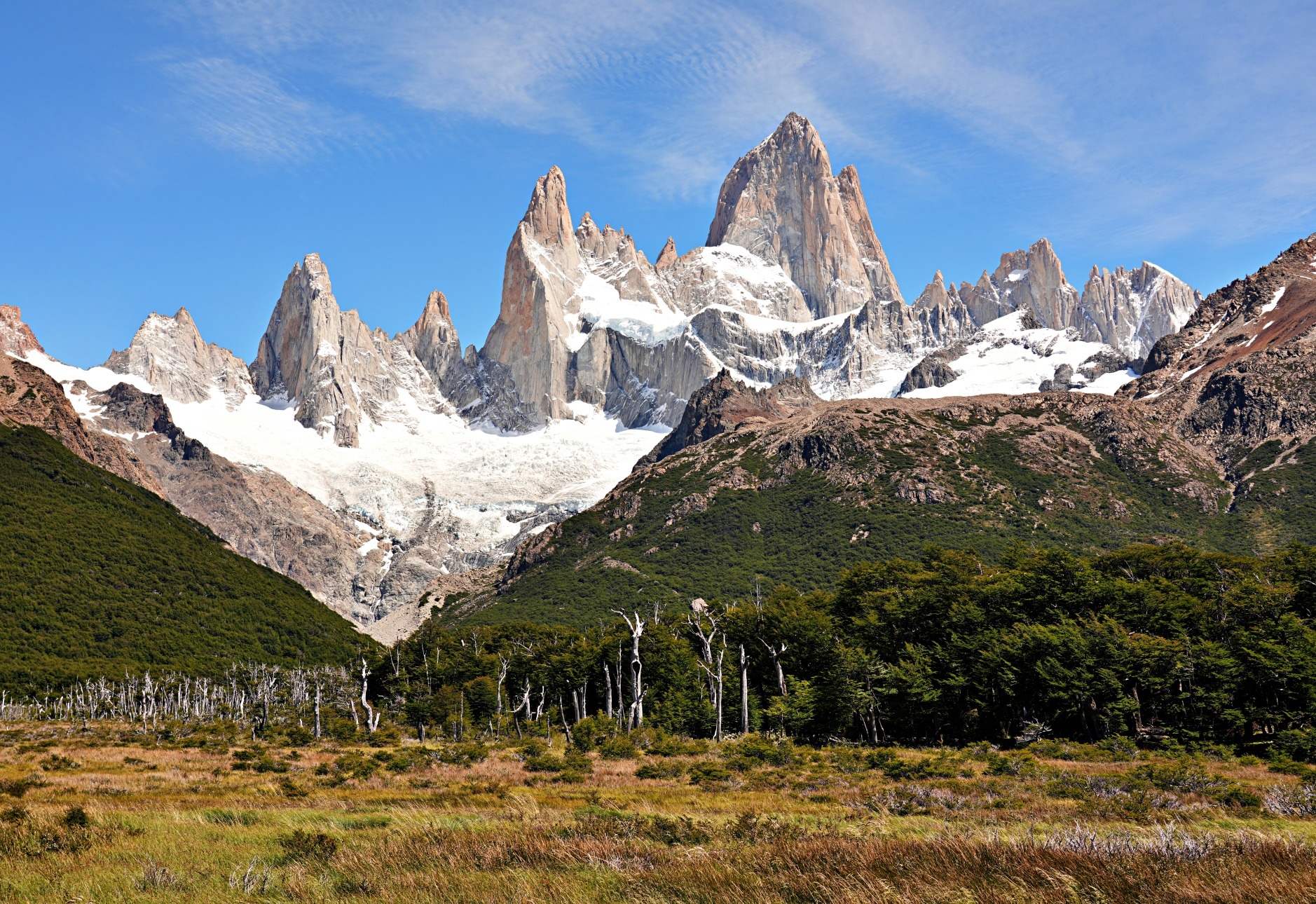
Looking up at the majestic Monte Fitz Roy, left us in awe. Its sheer granite towers rise straight up from its glacier, commanding all of your attention. With this view, it is no wonder that hiking to the base of this mountain is the main draw in Argentina’s Glacier National Park, but deciding which trail to use can be confusing. We’ve created this Monte Fitz Roy hiking guide to help you pick the best trail for you.
The most famous peak in Glacier National Park, Monte Fitz Roy, is also known as Cerro Chaltén. These two names come from very different histories. The indigenous name Chaltén means ‘smoking mountain’ in Tehuelche, and was inspired by the clouds that frequently boil around its summit. The other comes from Robert FitzRoy, who was the captain of the Beagle on its second voyage. It was on this expedition that he mapped much of Patagonia’s watershed. Today, the mountain is typically called Monte Fitz Roy, or even just Fitz Roy.
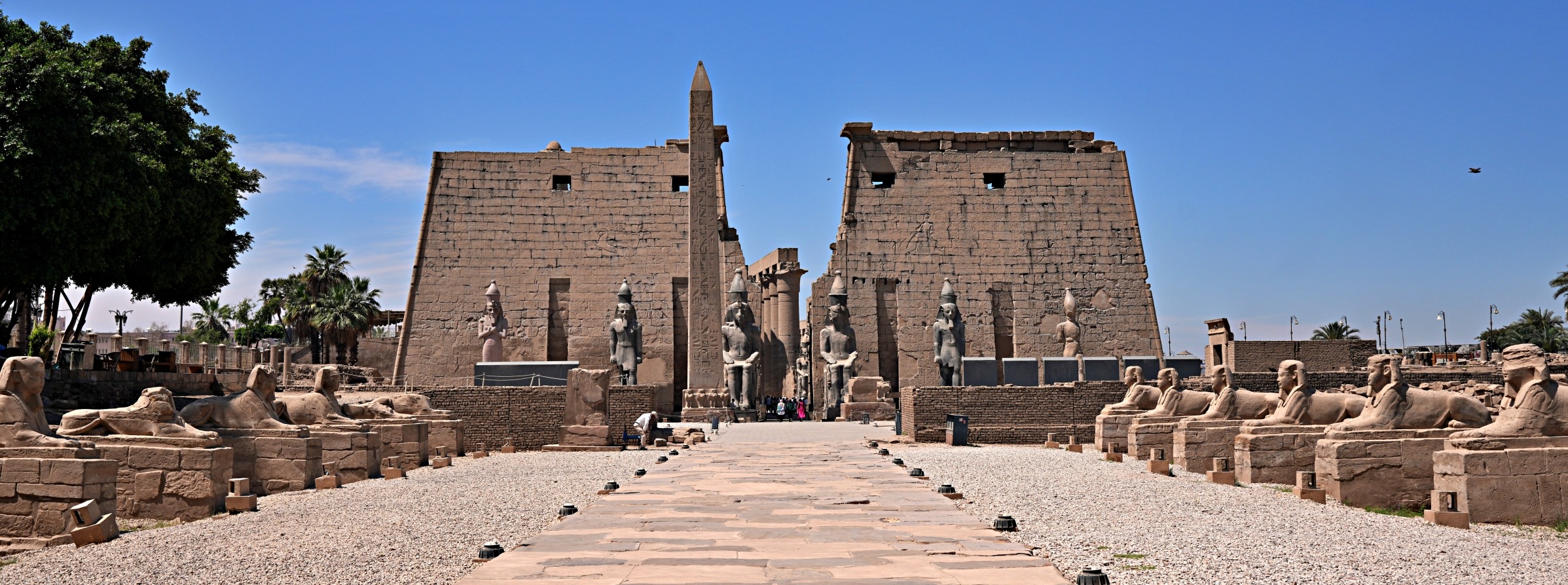
The other famous peak is Cerro Torre. For more information on this mountain, read our Cerro Torre Hiking Guide.
We first visited Glacier National Park 20 years ago. On that trip, we had awful weather and could barely see the massif. This time, we hoped it would be different.
Laguna de los Tres Trail to Monte Fitz Roy
We’ll begin by showing you the Traditional Route, Sendero Laguna de los Tres.
Return Distance – 20 km (12½ mi); Elevation Gain – 750 m (2,460 ft); Elevation – 1,200 m (3,940 ft)
Access – The trailhead for the classic route, Sendero de las Tres Lagunas, is from the north end of Santa Marta Avenue in El Chaltén.

Not far from the Sendero Laguna de los Tres trailhead is your first viewpoint, offering a nice look down the Rio de las Vueltas Valley. As you walk up to it, don’t forget to look back for a great view of the sheer cliffs behind El Chaltén.


After 3.5 km (2¼ mi), you’ll pass the side trail to Laguna Capri. We think it’s best to take this trail on your way back down so you don’t tire your legs too much for the climb to Laguna de los Tres. We’ll describe this trail later in this post.
Not far from this turn-off, you emerge from the trees to one of the best views in the park. An open wetland allows an amazing panorama of the Fitz Roy Massif above. From this vantage point, you can see the many spires that make up this gorgeous feature. The tallest three, from left to right, are named Aguja Saint Exupery, Aguja Poincenot and Mont Fitz Roy. Aguja translates in English to Needle, which seems appropriate.
A mountaineering objective is to climb all of these peaks in one trip. If you’re interested, watch this excellent documentary about Alex Honnold and Tommy Caldwell climbing the Fitz Traverse. You can watch a preview of it on Patagonia’s website here.


A little further on, you will reach the Poincenot Campground. We stayed in this campground on our first visit, many years ago. At that time, there were only a few other tents. On this trip, however, it was packed full and didn’t look like a place you would get much sleep. If you plan to stay here, or any other campground in the park, be sure to book early.

Rio Electrico Trail Option
An alternative way to reach Poincenot Campground is the 8 km (5 mi) Rio Electrico Trail (Sendero Río Eléctrico). The trailhead is 16 km outside of town, but there are a few different one-way shuttles in El Chaltén that will take you there.
This trail wasn’t built when we first visited, so we were excited to hike it and see another part of the park. We’re happy we did because it offers so many amazing views, and they begin before you even reach the trailhead. After being dropped off at the Rio Electrico Bridge, the trail follows a small creek, where the open landscape lets you see all around. High above, the red, snow-topped Cerro Electrico keeps a watchful eye on the land.
Tip – The hike begins outside the park, but there is a ranger station just inside the boundary, so be sure to bring your park pass. This was the only place we had to show ours, but you should bring your pass on all of the trails inside the park.


Once inside the park, the long valleys lead your eyes to the mighty peaks in the distance. After seeing these valleys, we realized that it would be worth exploring the other trails in the area if you have time.


Eventually, the trail leaves the river valley to climb through the forested hill. Occasional breaks in the trees offer glimpses of Fitz Roy’s jagged peaks and the Piedras Blancas Glacier. Since we didn’t see this glacier on our last trip, it was a wonderful surprise on this hike.


From the official Mirador Piedra Blancas, the glacier, its lake and the stunning granite spires come together for a phenomenal scene. We had no idea that seeing Fitz Roy from this side would be as impressive as the classic Laguna de los Tres view.


After 8 km, the trail meets the main trail (Sendero Laguna de los Tres) from El Chaltén, just before Poincenot Campground. Since the distance and elevation gain are almost the same as the Traditional Route, we highly recommend this taking the Rio Electrico Trail. A great option would be to go up on Rio Electrico and down the Sendero Laguna de los Tres.
Continue on Laguna de los Tres Trail
Signs and literature claim that it is a 2 km (1.2mi) hike with 400 m (1,312 ft) elevation gain to reach Laguna de los Tres from the campground. In reality, it is 2.5 km (1.5mi) and 475m (1,560ft) gain. On paper, those don’t sound like much of a difference, but it is a very steep slog, and you feel every one of those extra steps.
As you climb the moraine, don’t forget to look over your shoulder for views of Madre, Hija and Capri Lakes far below.


Finally, after 1,200 m (4,000ft) of gain, you will reach the top of the moraine, where the reward is the famous view of Fitz Roy towering over Laguna de los Tres. The scene of the majestic peak and green lagoon below a blue sky was more than we had hoped for. On our previous visit, Laguna de los Tres was covered in ice, and clouds covered the mountain’s face.


Making it even better, these amazing views aren’t over yet. To see it from another angle, climb down to the lake and then scale up the next moraine hill for a view of another glacier lake, Laguna Sucia. If you include Laguna Piedras Blancas on the other side, we saw three beautiful glacier lakes positioned under Fitz Roy.


The most common option is to descend Sendero de las Tres Lagunas, to return to town.
Laguna Capri Trail – Sidetrip
Distance – 4.5 km from El Chaltén and Camp Poincenot; Elevation Gain from El Chaltén – 400 m.
When walking down Sendero de las Tres Lagunas, we highly recommend making this side trip to Laguna Capri. Some people only complete the trek to this lake and don’t continue up to Laguna de los Tres. That’s a great idea too, because it also offers amazing views of Fitz Roy. When we visited, we shared the scenery with some of the local wildlife.


Beyond the lake is a rough, unofficial trail to two lagunas, which give you more picture-postcard views of this land.

Lagunas Madre and Hija Trail Option
Distance – 7 km (4.3mi); Elevation Gain 248m (815 ft)
An alternative trail out is the Mother and Daughter Lakes Trail (Lagunas Madre and Hija) that connects Laguna Torre and Laguna de los Tres trails. The trailhead is in the wetlands area, on the Laguna de los Tres side. It’s a nice walk because the terrain is mostly flat, and it takes you beside the two lakes, where you are treated to more spectacular views of Fitz Roy.

We took a picture of a wind-blown lenga tree on the side of Laguna Hija 20 years ago and hoped we would see the same or a similar one again. Luckily, we were able to find the same tree, but new ones have grown around it, so we weren’t able to re-create it exactly. You can see the comparisons below.
Legna trees are common in Patagonia. and often have a peculiar appearance with garled and twisted trunks caused by the strong Patagonian winds. Their varying shapes make them quite photogenic.


After leaving the lakes, we could hear the distinct sound of woodpeckers knocking on the trees. After seeing them in Llao Llao Park near Bariloche, we didn’t think we would be lucky again. This time, we were thrilled to see two male Magellan Woodpeckers on a coihue tree, not far from the trail. It was fun to watch them hop around the tree and drill holes in its trunk with their beaks.


The Lagunas Madre and Hija Trail ends at the Laguna Torre Trail, and can be done in either direction. When you arrive at the intersection with Laguna Torre Trail, you can either go left to follow it to El Chaltén, or turn right to visit Cerro Torre. Doing this trail on its own is definitely possible, but remember, you need to walk partway up and then partway down the other two main trails.
Tips for visiting Glacier National Park
• Park Passes – You must purchase a park pass to hike in Glacier National Park (Parque Nacional Los Glaciares). You can purchase day passes at the park office in El Chaltén or El Calafate. Multi-day passes can only be purchased online here. Perito Moreno Glacier is included on the same pass, so buy enough days to include it if you plan to visit. Multi-day passes are valid for 6 months.
• Weather – The weather is very unpredictable in the mountain park. Typically, the best weather is during Austral summer (December to February). It will be warm, but it is usually very windy and cloud-covered. Forecasts are not very accurate, and conditions vary throughout the park; therefore, plan to be flexible with your activities. Having a few extra days to wait out the bad weather will make your visit more enjoyable.
• Clothing – It is very windy, which makes it chilly, even in the middle of the summer, so bring warm, waterproof and windproof clothes. There are many mountain equipment stores in El Chaltén if you didn’t bring enough. Good hiking shoes are recommended, as are trekking poles.
• Money – Many places in El Chaltén only accept cash and, as with most of Argentina, if they take credit cards, there is a very high surcharge. There are only 2 ATMs and one Western Union, and apparently, they often do not have much cash, so bring enough with you.
• Accommodations – The park is very busy and expensive compared to other parts of Argentina, especially during the summer months, so book your accommodations, including campsites, early. There are quite a few apartments for rent that allow you to save money by preparing meals. For hotels, expect to pay more for a lot less luxury.
• Trails – The hiking trails are in excellent condition and are well marked. There are strong reminders everywhere not to stray from the trail.
For information on where to stay in El Chaltén and how to get there, visit our Guide to Cerro Torre Hike.
Read about the other hikes we’ve done in both Argentina and Chile. You can find all our hikes under Trek-Bike-Ski, or go directly to Argentina’s Refugio Frey and Cerro Llao Llao, Cerro Torre, Iruya and Aconcagua. And Chile’s Torres del Paine Base and O Circuit.
You can find Monte Fitz Roy and Cerro Torre Hikes near the southern end of the map below. It is an interactive map, so you can zoom-in, or click on a marker to find a link to our post from that region.

Click on the link to read our Travel Tips For Argentina.
To read more of our adventures in Argentina, click here.
Coming Next – Perito Moreno Glacier: A Must-See in Argentina
For pictures from other blogs go to Gallery at monkeystale.ca.
To read about more of our adventures go to Destinations.
If you like what you read, please comment or share (with credit) using the links below.


We'd love to hear from you, please leave a comment.